·

Enable Location

We need your location to show you interesting places around you

Discover nearby places

Find interesting locations and hidden gems around you

Precise directions

Get accurate directions and distances to places

Your location is never shared with other users. It's only used when you tap the location button.

Nantasket Beach

Log in to your account

Start exploring — it's free

Trusted by 62,668 travelers worldwide

Continue with Google
Continue with Apple
or

We will send you a code to connect

By continuing, you accept our Terms and Conditions and our Privacy Policy

Check your inbox

We've sent a pincode in your inbox. Please enter the code below.

Nantasket Beach

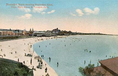
Nantasket Beach, Public beach in Plymouth County, Massachusetts.

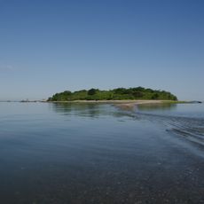
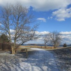
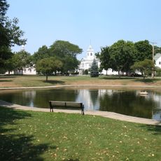
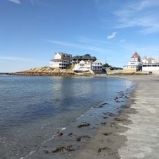
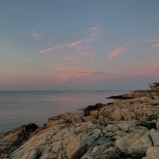
Nantasket Beach is a public beach in Plymouth County, Massachusetts, stretching about three miles along Massachusetts Bay with smooth gray sand and calm water for swimming. The shore is wide and open, backed by dunes and pathways that lead down to the waterline.

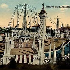
English settlers arrived in the area during the early 1600s and found a coastline long used by the Wampanoag. Over the following decades, the shore developed into a popular destination for residents from Boston and nearby towns.

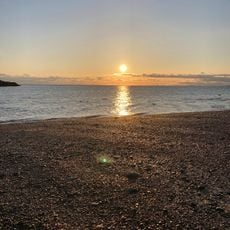
The name Nantasket comes from the Wampanoag people and describes the place where tides meet. Families gather here in summer to sit on the sand, wade in the shallow water, and watch boats crossing the bay.

Parking is available near the shore, with different fees for vehicles registered in Massachusetts and those from other states. The beach is best visited during calm weather, when the water is shallow and safe for swimming.

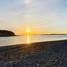
At low tide, the water pulls back hundreds of yards, revealing flat expanses of sand where shallow pools form. Small fish and crabs gather in these pools, and wading birds arrive to feed along the edges.

The community of curious travelers

AroundUs brings together thousands of curated places, local tips, and hidden gems, enriched daily by 60,000 contributors worldwide.

Start exploring
Location
GPS coordinates
42.27030,-70.85470
Latest update
December 5, 2025 22:30
Around this place
Paragon Park
United States of America

Paragon Park

200 m
Fort Revere
United States of America

Fort Revere

5.7 km
Bumpkin Island
United States of America

Bumpkin Island

3.9 km
Webb Memorial State Park
United States of America

Webb Memorial State Park

6 km
Weir River Farm
United States of America

Weir River Farm

3.4 km
Josephine M. Hagerty House
United States of America

Josephine M. Hagerty House

4.5 km
Hingham Naval Ammunition Depot
United States of America

Hingham Naval Ammunition Depot

6.4 km
Fort Revere Park
United States of America

Fort Revere Park

5.7 km
Fort Duvall
United States of America

Fort Duvall

4.7 km
Paragon Park Carousel
United States of America

Paragon Park Carousel

210 m
Coast Guard Station Point Allerton
United States of America

Coast Guard Station Point Allerton

6 km
General Benjamin Lincoln House
United States of America

General Benjamin Lincoln House

4.4 km
Cushing Homestead
United States of America

Cushing Homestead

3.4 km
Hull Shore Drive and Nantasket Avenue
United States of America

Hull Shore Drive and Nantasket Avenue

549 m
Capt. John Wilson House and Bates Ship Chandlery
United States of America

Capt. John Wilson House and Bates Ship Chandlery

5.5 km
Pratt Historic Building
United States of America

Pratt Historic Building

5.7 km
Lincoln Historic District
United States of America

Lincoln Historic District

4.5 km
Cohasset Common Historic District
United States of America

Cohasset Common Historic District

5.3 km
Caleb Lothrop House
United States of America

Caleb Lothrop House

6.1 km
Government Island Historic District
United States of America

Government Island Historic District

6.5 km
Cohasset Central Cemetery
United States of America

Cohasset Central Cemetery

4.7 km
Crescent Beach
United States of America

Crescent Beach

1.7 km
Gun Rock Beach
United States of America

Gun Rock Beach

1.2 km
Telegraph Hill
United States of America

Telegraph Hill

5.6 km
Bassing Beach
United States of America

Bassing Beach

6.5 km
Pemberton Beach
United States of America

Pemberton Beach

6.4 km
Pleasant Beach
United States of America

Pleasant Beach

3.8 km
Black Rock Beach
United States of America

Black Rock Beach

2.6 km
Show the full map
« Nantasket Beach - Public beach in Plymouth County, Massachusetts » is provided by Around Us (aroundus.com). Images and texts are derived from Wikimedia project under a Creative Commons license. You are allowed to copy, distribute, and modify copies of this page, under the conditions set by the license, as long as this note is clearly visible.

Discover hidden gems everywhere you go!

From secret cafés to breathtaking viewpoints, skip the crowded tourist spots and find places that match your style. Our app makes it easy with voice search, smart filtering, route optimization, and insider tips from travelers worldwide. Download now for the complete mobile experience.

Around Us App Screenshot

A unique approach to discovering new places

Le Figaro

All the places worth exploring

France Info

A tailor-made excursion in just a few clicks

20 Minutes

Around Us
Travel Guide & Maps
Download

Send to your phone

QR Code
1

Open the camera app on your mobile.

2

Point at the QR code with your camera. A notification will appear.

3

Tap the notification to open the link.