Enable Location

We need your location to show you interesting places around you

Discover nearby places

Find interesting locations and hidden gems around you

Precise directions

Get accurate directions and distances to places

Your location is never shared with other users. It's only used when you tap the location button.

Pymatuning State Park

Log in to your account

Start exploring — it's free

Trusted by 60,637 travelers worldwide

Continue with Google
Continue with Apple
or

We will send you a code to connect

By continuing, you accept our Terms and Conditions and our Privacy Policy

Check your inbox

We've sent a pincode in your inbox. Please enter the code below.

Pymatuning State Park, Public recreational area in Crawford County, Pennsylvania.

Description

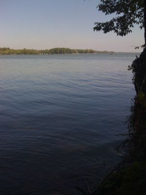
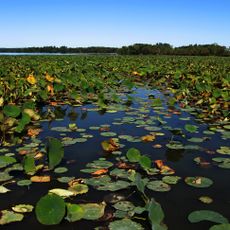
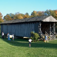
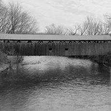
Pymatuning State Park is a large protected area in Pennsylvania with forests, wetlands, and a big reservoir for water activities. The lake is surrounded by trails for walking, camping areas, and fishing spots where people come throughout the year.

History

The park was created in 1934 to manage the lake and provide people with a place to relax and fish. The area had been important for fishing and hunting long before the park was established.

Culture

The park runs a fish hatchery where staff raise young fish for the reservoir and teach visitors about the species that live in the water. You can walk through the facility and learn how the breeding program helps maintain the lake's ecosystem.

Practical

You can camp, fish, boat, and hike, but know that the place gets crowded on weekends and warm months. Good shoes for trails and sun protection matter, since much of the lake area is open and exposed.

Did you know?

The Linesville Spillway draws visitors who feed carp that gather in such dense schools that ducks walk across their backs. This unusual sight has become a strange attraction where people come to witness and photograph this odd animal behavior.

Location
Inception
1934
Operator
Pennsylvania Bureau of State Parks
Shares border with
Pymatuning State Park
GPS coordinates
41.52324,-80.49099
Latest update
December 8, 2025 20:00

AroundUs brings together thousands of curated places, local tips, and hidden gems, enriched daily by 60,000 contributors worldwide. Discover all places nearby (Crawford County).

Around this place
Conneaut Lake Park
United States of America

Conneaut Lake Park

19.3 km
Blue Streak
United States of America

Blue Streak

19 km
Pymatuning State Park
United States of America

Pymatuning State Park

9.9 km
Clarence Darrow Octagon House
United States of America

Clarence Darrow Octagon House

11.3 km
United States of America

Baldwin-Reynolds House

31.5 km
Gibson House
United States of America

Gibson House

6 km
Toboggan
United States of America

Toboggan

19.2 km
Congregational-Presbyterian Church
United States of America

Congregational-Presbyterian Church

11.5 km
Caine Road Covered Bridge
United States of America

Caine Road Covered Bridge

28.8 km
Bentley Hall
United States of America

Bentley Hall

31.8 km
Root Road Covered Bridge
United States of America

Root Road Covered Bridge

36.1 km
Dr. Peter Allen House
United States of America

Dr. Peter Allen House

11.5 km
Independent Congregational Church
United States of America

Independent Congregational Church

31.1 km
Giddings Road Covered Bridge
United States of America

Giddings Road Covered Bridge

33.6 km
Netcher Road Covered Bridge
United States of America

Netcher Road Covered Bridge

31.1 km
Quaker Bridge
United States of America

Quaker Bridge

14.7 km
Meadville Downtown Historic District
United States of America

Meadville Downtown Historic District

31.1 km
South Denmark Road Covered Bridge
United States of America

South Denmark Road Covered Bridge

27.3 km
Graham Road Covered Bridge
United States of America

Graham Road Covered Bridge

30.6 km
Roueche House
United States of America

Roueche House

31.2 km
Bridge in East Fallowfield Township
United States of America

Bridge in East Fallowfield Township

12.9 km
Kidd's Mills Covered Bridge Historic District
United States of America

Kidd's Mills Covered Bridge Historic District

20.4 km
Greenville Commercial Historic District
United States of America

Greenville Commercial Historic District

15.5 km
Ruter Hall
United States of America

Ruter Hall

31.9 km
Alexander P. and James S. Waugh House
United States of America

Alexander P. and James S. Waugh House

19.3 km
Judge Henry Shippen House
United States of America

Judge Henry Shippen House

31.3 km
Bridge over French Creek in West Mead Township
United States of America

Bridge over French Creek in West Mead Township

29.3 km
Darrow Octagon House - Clarence Darrow (1857-1938)
United States of America

Darrow Octagon House - Clarence Darrow (1857-1938)

11.3 km
Show the full map
« Pymatuning State Park - Public recreational area in Crawford County, Pennsylvania » is provided by Around Us (aroundus.com). Images and texts are derived from Wikimedia project under a Creative Commons license. You are allowed to copy, distribute, and modify copies of this page, under the conditions set by the license, as long as this note is clearly visible.

Discover hidden gems everywhere you go!

From secret cafés to breathtaking viewpoints, skip the crowded tourist spots and find places that match your style. Our app makes it easy with voice search, smart filtering, route optimization, and insider tips from travelers worldwide. Download now for the complete mobile experience.

Around Us App Screenshot

A unique approach to discovering new places

Le Figaro

All the places worth exploring

France Info

A tailor-made excursion in just a few clicks

20 Minutes

Around Us
Travel Guide & Maps
Download

Send to your phone

QR Code
1

Open the camera app on your mobile.

2

Point at the QR code with your camera. A notification will appear.

3

Tap the notification to open the link.