Enable Location

We need your location to show you interesting places around you

Discover nearby places

Find interesting locations and hidden gems around you

Precise directions

Get accurate directions and distances to places

Your location is never shared with other users. It's only used when you tap the location button.

Aibonito

Log in to your account

Start exploring — it's free

Trusted by 63,531 travelers worldwide

Continue with Google
Continue with Apple
or

We will send you a code to connect

By continuing, you accept our Terms and Conditions and our Privacy Policy

Check your inbox

We've sent a pincode in your inbox. Please enter the code below.

Discussion Reviews 1 Photos
17.9k Popularity

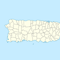
Aibonito, municipality in Puerto Rico

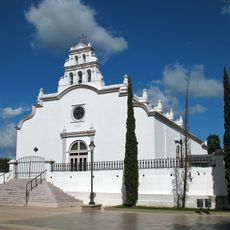
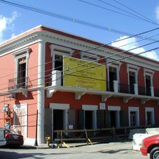
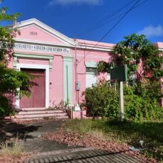
Aibonito is a small mountain town in Puerto Rico known for its cooler climate and lush surroundings. The winding streets pass old houses, flower gardens, and small shops where locals move at a relaxed pace and neighbors greet each other as they go about their day.

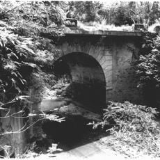
The town was established in the early 1800s and was originally inhabited by the Taíno people, particularly the tribe led by Chief Orocobix. It grew as a center for coffee cultivation and farming, with old mills and terraces still visible as reminders of that agricultural past.

Aibonito takes its name from 'Ay, que bonito' ("How beautiful!"), a phrase that reflects the community's deep connection to nature and its surroundings. The town is known for growing flowers everywhere, and residents tend their gardens year-round, making horticulture a central part of local identity and daily life.

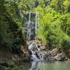
The town is about an hour's drive from San Juan along scenic mountain roads and works well as a day trip. Visitors can walk through the streets on foot or explore nearby trails and parks, with paths leading to viewpoints and waterfalls throughout the area.

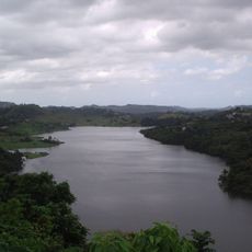
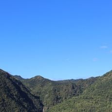
The Taíno name 'Aibonito' may come from the language of the original inhabitants and could mean 'place of the hills'. The San Cristobal Canyon area holds the largest canyon in the Caribbean, with waterfalls that drop over 750 feet (229 meters).

The community of curious travelers

AroundUs brings together thousands of curated places, local tips, and hidden gems, enriched daily by 60,000 contributors worldwide.

Start exploring
Location
Inception
March 13, 1824
Elevation above the sea
604 m
Shares border with
Cidra, Barranquitas, Coamo, Salinas, Cayey
GPS coordinates
18.14000,-66.26611
Latest update
February 17, 2026 00:20
Around this place
Monumento al Jíbaro Puertorriqueño
United States of America

Monumento al Jíbaro Puertorriqueño

9.2 km
Central Aguirre Historic District
United States of America

Central Aguirre Historic District

21 km
United States of America

Carite State Forest

23 km
Casa Cautiño
United States of America

Casa Cautiño

23.6 km
La Plata Lake
United States of America

La Plata Lake

20.8 km
Arenas Bridge
United States of America

Arenas Bridge

13.6 km
San Blas de Illescas Church (Coamo)
United States of America

San Blas de Illescas Church (Coamo)

11.6 km
United States of America

La Robleda Natural Protected Area

13.8 km
Old Plata Bridge
United States of America

Old Plata Bridge

19.3 km
United States of America

Cerro El Bolo

24.5 km
Cayey Bridge
United States of America

Cayey Bridge

22.1 km
Planadas-Yeyesa Nature Reserve
United States of America

Planadas-Yeyesa Nature Reserve

8 km
Punta Petrona
United States of America

Punta Petrona

25.6 km
La Liendre Bridge
United States of America

La Liendre Bridge

14.2 km
Puente de las Calabazas
United States of America

Puente de las Calabazas

7.6 km
Pico Pomar Residence
United States of America

Pico Pomar Residence

11.5 km
Casa Natal de Luis Muñoz Rivera
United States of America

Casa Natal de Luis Muñoz Rivera

7 km
Eleuterio Derkes Grammar School
United States of America

Eleuterio Derkes Grammar School

24 km
General Méndez Vigo Bridge
United States of America

General Méndez Vigo Bridge

14.2 km
Río Hondo Bridge
United States of America

Río Hondo Bridge

8 km
Hacienda Los Maldonado
Puerto Rico

Hacienda Los Maldonado

9.8 km
Cascada Charco Prieto
Puerto Rico

Cascada Charco Prieto

18.1 km
Jesús Izcoa Moure Bridge
United States of America

Jesús Izcoa Moure Bridge

21.4 km
La Casa del Cuento y de la Historia Cayeyana Ramón "Moncho" Gómez
United States of America

La Casa del Cuento y de la Historia Cayeyana Ramón "Moncho" Gómez

11.1 km
Casa y Museo del Poeta Luis Palés Matos
Puerto Rico

Casa y Museo del Poeta Luis Palés Matos

23.8 km
Carretera Central historic district
United States of America

Carretera Central historic district

3.3 km
Lago Toa Vaca
United States of America

Lago Toa Vaca

22.3 km
Lago Guayabal
United States of America

Lago Guayabal

25.6 km
Show the full map
Reviews
Share your experience

No review yet

Discussions
Start a discussion...

No discussion yet

« Aibonito - municipality in Puerto Rico » is provided by Around Us (aroundus.com). Images and texts are derived from Wikimedia project under a Creative Commons license. You are allowed to copy, distribute, and modify copies of this page, under the conditions set by the license, as long as this note is clearly visible.

Discover hidden gems everywhere you go!

From secret cafés to breathtaking viewpoints, skip the crowded tourist spots and find places that match your style. Our app makes it easy with voice search, smart filtering, route optimization, and insider tips from travelers worldwide. Download now for the complete mobile experience.

Around Us App Screenshot

A unique approach to discovering new places

Le Figaro

All the places worth exploring

France Info

A tailor-made excursion in just a few clicks

20 Minutes

Around Us
Travel Guide & Maps
Download

Send to your phone

QR Code
1

Open the camera app on your mobile.

2

Point at the QR code with your camera. A notification will appear.

3

Tap the notification to open the link.