Chest opened
+${chestReward.xp} XP
Explorer
NOUVEAU ×${chestReward.collectible.quantity}
tapez pour fermer
Chest locked

Open chests in the app

Around Us is built for your phone — chests unlock when you walk, explore and capture nearby places.

Enable Location

We need your location to show you interesting places around you

Discover nearby places

Find interesting locations and hidden gems around you

Precise directions

Get accurate directions and distances to places

Your location is never shared with other users. It's only used when you tap the location button.

Tygart Valley River

Log in to your account

Start exploring — it's free

Trusted by 72,957 travelers worldwide

Continue with Google
Continue with Apple
or

We will send you a code to connect

By continuing, you accept our Terms and Conditions and our Privacy Policy

Check your inbox

We've sent a pincode in your inbox. Please enter the code below.

Tygart Valley River
Discussion Reviews 1 Photos
10.9k Popularity

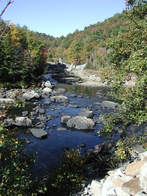
Tygart Valley River, River in Marion County, United States.

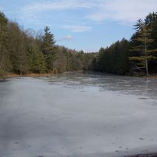
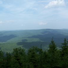
The Tygart Valley River is a waterway flowing north-northwest through eastern West Virginia, passing through multiple counties. It eventually joins the Monongahela River, forming an important water system for the surrounding valleys and communities.

The first European settlers, David Tygart and Robert Files, established themselves near present-day Beverly in 1753. This early settlement marked the beginning of European presence in this region.

The river shaped communities along its course, including Huttonsville, Mill Creek, Beverly, Elkins, Junior, Belington, Philippi, and Grafton. People in these towns still rely on the water for their daily lives and local activities.

The river offers fishing opportunities at multiple access points along its course. Spring and fall are generally the best times to visit, when water conditions are more stable and weather is comfortable for outdoor activities.

The river is home to various fish species, regularly stocked by authorities to maintain healthy populations. These management programs make it a popular destination for anglers throughout the region.

The community of curious travelers

AroundUs brings together thousands of curated places, local tips, and hidden gems, enriched daily by 60,000 contributors worldwide.

Start exploring
Location
Location
Location
Location
GPS coordinates
38.46833,-79.98083
Latest update
December 8, 2025 13:44
Around this place
Green Bank Telescope
United States of America

Green Bank Telescope

12.9 km
Cass Scenic Railroad State Park
United States of America

Cass Scenic Railroad State Park

9.8 km
Durbin and Greenbrier Valley Railroad
United States of America

Durbin and Greenbrier Valley Railroad

15.5 km
Greenbrier River Trail
United States of America

Greenbrier River Trail

29.2 km
Bald Knob
United States of America

Bald Knob

4.9 km
Green Bank Interferometer
United States of America

Green Bank Interferometer

12.9 km
White Top
United States of America

White Top

19.6 km
Gaudineer Scenic Area
United States of America

Gaudineer Scenic Area

21.5 km
Gaudineer Knob
United States of America

Gaudineer Knob

20.2 km
Reber Radio Telescope
United States of America

Reber Radio Telescope

14.8 km
40-foot telescope
United States of America

40-foot telescope

13.5 km
Seneca State Forest
United States of America

Seneca State Forest

16.2 km
Shavers Fork Mountain Complex
United States of America

Shavers Fork Mountain Complex

20.2 km
Camp Bartow Historic District
United States of America

Camp Bartow Historic District

20 km
Pocahontas Times Print Shop
United States of America

Pocahontas Times Print Shop

29 km
Pocahontas County Opera House
United States of America

Pocahontas County Opera House

29.1 km
E. E. Hutton House
United States of America

E. E. Hutton House

27.5 km
Frank and Anna Hunter House
United States of America

Frank and Anna Hunter House

29.5 km
Pocahontas County Courthouse and Jail
United States of America

Pocahontas County Courthouse and Jail

29.4 km
Cass Historic District
United States of America

Cass Historic District

10.1 km
IOOF Lodge Building
United States of America

IOOF Lodge Building

29 km
Green Bank Observatory
United States of America

Green Bank Observatory

13.1 km
Green Bank Observatory Science Center
United States of America

Green Bank Observatory Science Center

14.8 km
300 foot Radio Telescope
United States of America

300 foot Radio Telescope

12.9 km
Green Bank Jansky Antenna
United States of America

Green Bank Jansky Antenna

14.9 km
Howard E. Tatel Radio Telescope
United States of America

Howard E. Tatel Radio Telescope

13.8 km
Green Bank 85-3 telescope
United States of America

Green Bank 85-3 telescope

12.7 km
Green Bank 45ft telescope
United States of America

Green Bank 45ft telescope

14.4 km
Show the full map
Reviews
Share your experience

No review yet

Discussions
Start a discussion...

No discussion yet

« Tygart Valley River - River in Marion County, United States » is provided by Around Us (aroundus.com). Images and texts are derived from Wikimedia project under a Creative Commons license. You are allowed to copy, distribute, and modify copies of this page, under the conditions set by the license, as long as this note is clearly visible.

Discover hidden gems everywhere you go!

From secret cafés to breathtaking viewpoints, skip the crowded tourist spots and find places that match your style. Our app makes it easy with voice search, smart filtering, route optimization, and insider tips from travelers worldwide. Download now for the complete mobile experience.

Around Us App Screenshot

A unique approach to discovering new places

Le Figaro

All the places worth exploring

France Info

A tailor-made excursion in just a few clicks

20 Minutes

Around Us
Travel Guide & Maps
Download

Send to your phone

QR Code
1

Open the camera app on your mobile.

2

Point at the QR code with your camera. A notification will appear.

3

Tap the notification to open the link.