Log in to your account

AroundUs is a community-driven map of interesting places, built by curious explorers like you. It grows with every review, story, and photo you share.
Connect to save your favorite spots, contribute locations, and create personalized routes.
Continue with Google
Continue with Apple
Continue with X
Continue with Facebook
Continue with email
By continuing, you accept our Terms and Conditions and our Privacy Policy
Create an account

Benton MacKaye Trail

Add to collection
Map
Suggest a change
Share

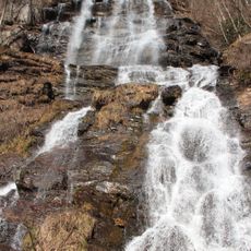
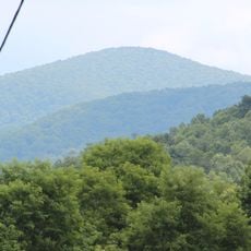
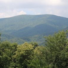
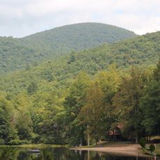
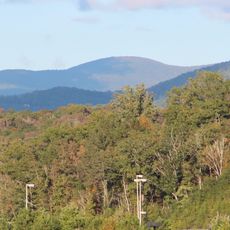
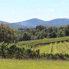
Benton MacKaye Trail, footpath nearly 300 miles (480 km) in length

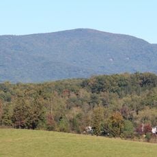
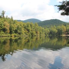
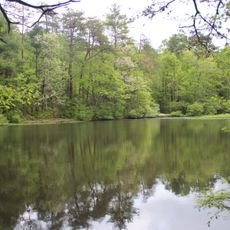
Benton MacKaye Trail is a hiking path that runs roughly 280 kilometers from Georgia to Tennessee through mountain terrain and forest. The trail connects several national forests and offers hikers different difficulty levels with camping and shelter options along the way.

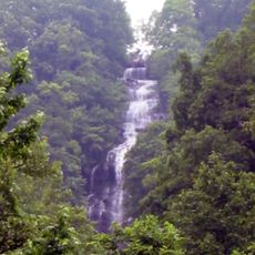
The trail was planned and built in the 1970s to honor Benton MacKaye, a landscape architect who advocated for wilderness preservation. The route reflects the vision of creating a connected hiking system across the southern Appalachian Mountains.

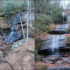
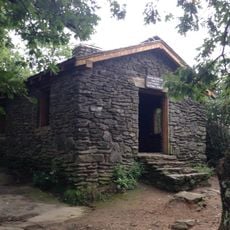
The trail works well for day hikes and longer backpacking trips, with different starting points depending on which section you choose. It helps to check conditions before you go since weather and trail maintenance can vary by season.

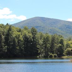
The trail was designed to intentionally differ from the more famous Appalachian Trail, following quieter, less-traveled mountains instead. This design choice gives hikers a different experience with fewer crowds on comparable mountain terrain.

GPS coordinates: 34.63528,-84.17419

Latest update: December 15, 2025 13:27

Photos
Around this place
Amicalola Falls State Park
United States of America

Amicalola Falls State Park

10 km
Blood Mountain
United States of America

Blood Mountain

24.6 km
Springer Mountain
United States of America

Springer Mountain

2 km
Amicalola Falls
United States of America

Amicalola Falls

9.9 km
DeSoto Falls
United States of America

DeSoto Falls

25 km
Mount Oglethorpe
United States of America

Mount Oglethorpe

22 km
Consolidated Gold Mine
United States of America

Consolidated Gold Mine

21.6 km
Lake Winfield Scott
United States of America

Lake Winfield Scott

21.6 km
Blood Mountain Wilderness
United States of America

Blood Mountain Wilderness

24.7 km
Dahlonega Gold Museum Historic Site
United States of America

Dahlonega Gold Museum Historic Site

20.8 km
Black Mountain
United States of America

Black Mountain

3.7 km
Rich Mountain Wilderness
United States of America

Rich Mountain Wilderness

18.5 km
Big Bald Mountain
United States of America

Big Bald Mountain

18.6 km
Slaughter Mountain
United States of America

Slaughter Mountain

24 km
Rich Mountain
United States of America

Rich Mountain

19.6 km
Ed Jenkins National Recreation Area
United States of America

Ed Jenkins National Recreation Area

2.4 km
Three Sisters
United States of America

Three Sisters

21.5 km
United States of America

Shallowford Bridge

18.3 km
Price Memorial Hall
United States of America

Price Memorial Hall

20.8 km
Holly Theatre
United States of America

Holly Theatre

20.8 km
Dockery Lake Recreation Area
United States of America

Dockery Lake Recreation Area

18.7 km
Dawson County Jail
United States of America

Dawson County Jail

24.3 km
Dawsonville Pool Room
United States of America

Dawsonville Pool Room

24.4 km
Dawson County Courthouse
United States of America

Dawson County Courthouse

24.4 km
Boyd and Sallie Gilleland House
United States of America

Boyd and Sallie Gilleland House

24.7 km
Fields Place-Vickery House
United States of America

Fields Place-Vickery House

20.7 km
Chestatee River Diving Bell
United States of America

Chestatee River Diving Bell

20.7 km
Poop Island
United States of America

Poop Island

25.2 km
Show the full map
Reviews

Visited this place? Tap the stars to rate it and share your experience / photos with the community! Try now! You can cancel it anytime.

« Benton MacKaye Trail - footpath nearly 300 miles (480 km) in length » is provided by Around Us (aroundus.com). Images and texts are derived from Wikimedia project under a Creative Commons license. You are allowed to copy, distribute, and modify copies of this page, under the conditions set by the license, as long as this note is clearly visible.

Discover hidden gems everywhere you go!

From secret cafés to breathtaking viewpoints, skip the crowded tourist spots and find places that match your style. Our app makes it easy with voice search, smart filtering, route optimization, and insider tips from travelers worldwide. Download now for the complete mobile experience.

Around Us App Screenshot

A unique approach to discovering new places

Le Figaro

All the places worth exploring

France Info

A tailor-made excursion in just a few clicks

20 Minutes