Enable Location

We need your location to show you interesting places around you

Discover nearby places

Find interesting locations and hidden gems around you

Precise directions

Get accurate directions and distances to places

Your location is never shared with other users. It's only used when you tap the location button.

Superior National Forest

Log in to your account

Start exploring — it's free

Trusted by 65,449 travelers worldwide

Continue with Google
Continue with Apple
or

We will send you a code to connect

By continuing, you accept our Terms and Conditions and our Privacy Policy

Check your inbox

We've sent a pincode in your inbox. Please enter the code below.

Superior National Forest
Discussion Reviews 1 Photos
20.2k Popularity

Superior National Forest, National forest in St. Louis County, Minnesota, United States

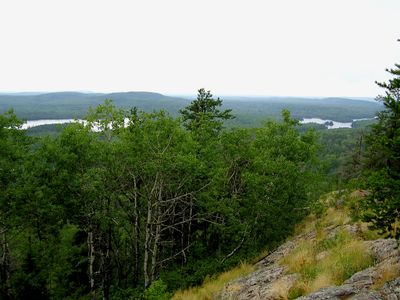
Superior National Forest is a vast forest covering millions of acres across northeastern Minnesota, with thousands of lakes, rivers, and dense woodlands throughout. The Sawtooth Mountains rise across the landscape, creating varied terrain and numerous scenic features.

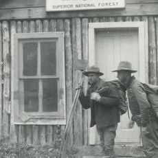
The United States Forest Service established this forest in 1909 to protect natural resources and support sustainable forestry for future generations. This act preserved the landscape at a time when conservation was becoming a national priority.

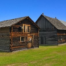
Native American tribes lived here for generations, and their presence is still felt through archaeological remains scattered across the land. Walking through these woods, you can sense the deep connection between the people and this landscape.

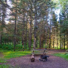
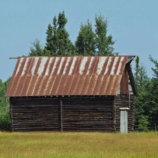
You can find many campgrounds throughout the forest with different levels of comfort, from developed sites with facilities to rustic spots for those seeking solitude. Plan ahead if you want to explore remote areas, as some locations require more preparation and self-sufficiency.

This forest holds the largest population of gray wolves in the contiguous United States, making it a crucial refuge for these animals in their natural habitat. Eagle Mountain, Minnesota's highest point, also stands within these boundaries.

The community of curious travelers

AroundUs brings together thousands of curated places, local tips, and hidden gems, enriched daily by 60,000 contributors worldwide.

Start exploring
Location
GPS coordinates
47.90280,-91.85330
Latest update
December 7, 2025 10:06
Around this place
Boundary Waters Canoe Area Wilderness
United States of America

Boundary Waters Canoe Area Wilderness

49.7 km
Lake Vermilion
United States of America

Lake Vermilion

33.7 km
Quetico Provincial Park
Canada

Quetico Provincial Park

59.8 km
Thomas Rukavina Memorial Bridge
United States of America

Thomas Rukavina Memorial Bridge

66.3 km
Lake Vermilion-Soudan Underground Mine State Park
United States of America

Lake Vermilion-Soudan Underground Mine State Park

30 km
Bear Head Lake State Park
United States of America

Bear Head Lake State Park

20.1 km
Hegman Lake Pictograph
United States of America

Hegman Lake Pictograph

17.3 km
Finland State Forest
United States of America

Finland State Forest

54.1 km
Burntside Lodge
United States of America

Burntside Lodge

7.6 km
Listening Point
United States of America

Listening Point

12.2 km
Stuntz Bay Boathouse Historic District
United States of America

Stuntz Bay Boathouse Historic District

29.8 km
Iron Range Historical Society
United States of America

Iron Range Historical Society

65.3 km
Alex Seitaniemi Housebarn
United States of America

Alex Seitaniemi Housebarn

30.4 km
Hartley Building
United States of America

Hartley Building

28.4 km
Finnish Sauna
United States of America

Finnish Sauna

66.1 km
State Theater
United States of America

State Theater

718 m
Longyear Drill Site
United States of America

Longyear Drill Site

43.2 km
Kaleva Hall
United States of America

Kaleva Hall

65.9 km
Isabella Ranger Station
United States of America

Isabella Ranger Station

41 km
Anna and Mikko Pyhala Farm
United States of America

Anna and Mikko Pyhala Farm

36.5 km
Camp Esquagama
United States of America

Camp Esquagama

60.4 km
Lincoln School Building
United States of America

Lincoln School Building

66.2 km
Jukola Boardinghouse
United States of America

Jukola Boardinghouse

66.2 km
First National Bank of Gilbert
United States of America

First National Bank of Gilbert

65.2 km
Erick and Kristina Nelimark Sauna
United States of America

Erick and Kristina Nelimark Sauna

37 km
Waino Tanttari Field Hay Barn
United States of America

Waino Tanttari Field Hay Barn

31.5 km
Dorothy Molter Museum
United States of America

Dorothy Molter Museum

1.5 km
Jasper Peak Fire Tower
United States of America

Jasper Peak Fire Tower

28.8 km
Show the full map
Reviews
Share your experience

No review yet

Discussions
Start a discussion...

No discussion yet

« Superior National Forest - National forest in St. Louis County, Minnesota, United States » is provided by Around Us (aroundus.com). Images and texts are derived from Wikimedia project under a Creative Commons license. You are allowed to copy, distribute, and modify copies of this page, under the conditions set by the license, as long as this note is clearly visible.

Discover hidden gems everywhere you go!

From secret cafés to breathtaking viewpoints, skip the crowded tourist spots and find places that match your style. Our app makes it easy with voice search, smart filtering, route optimization, and insider tips from travelers worldwide. Download now for the complete mobile experience.

Around Us App Screenshot

A unique approach to discovering new places

Le Figaro

All the places worth exploring

France Info

A tailor-made excursion in just a few clicks

20 Minutes

Around Us
Travel Guide & Maps
Download

Send to your phone

QR Code
1

Open the camera app on your mobile.

2

Point at the QR code with your camera. A notification will appear.

3

Tap the notification to open the link.