Boundary Waters Canoe Area Wilderness

Log in to your account

AroundUs is a community-driven map of interesting places, built by curious explorers like you. It grows with every review, story, and photo you share.
Connect to save your favorite spots, contribute locations, and create personalized routes.
By continuing, you accept our Terms and Conditions and our Privacy Policy

Boundary Waters Canoe Area Wilderness

Add to collection
Map
Suggest a change
Share

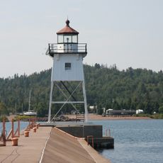
Boundary Waters Canoe Area Wilderness, Nature reserve in Cook County, Minnesota, US

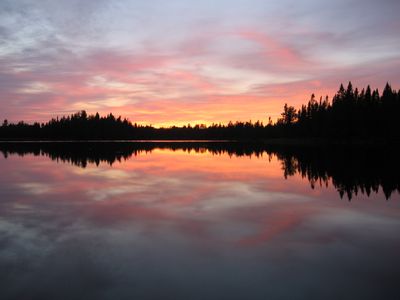
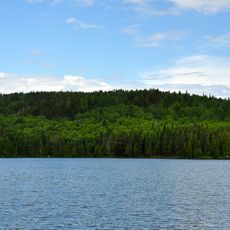
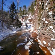
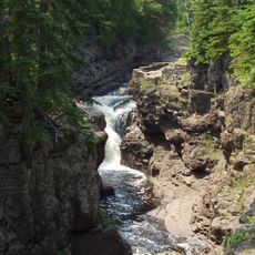
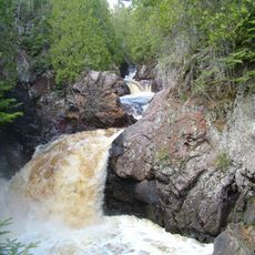
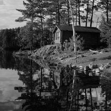
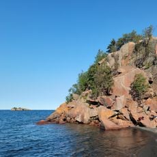
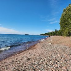
Boundary Waters Canoe Area Wilderness is a protected forest and lake region in northern Minnesota, bordering Canada along the Superior National Forest. More than a thousand lakes connect through rivers and narrow portages, allowing paddlers to travel for days through roadless terrain.

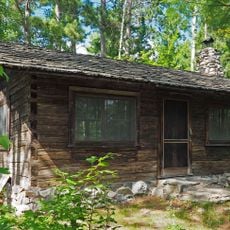
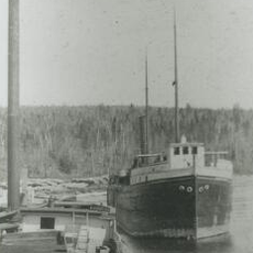
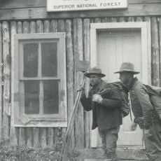
Congress established this territory as protected wilderness in 1978, following decades of debate over logging and motorboat use. Before that, the region served as logging country in the early 20th century before being incorporated into Superior National Forest.

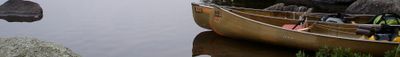
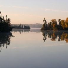
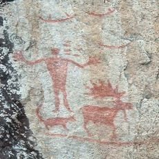
Many lakes carry names from the Ojibwe language, reflecting the communities who fished and traveled these water routes before European contact. Paddlers today follow the same channels that served as vital links between settlements and seasonal camps for centuries.

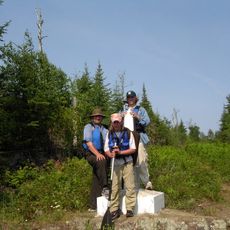
Permits must be obtained throughout the year, with advance reservations required during summer months and self-registration available in colder seasons. Those visiting in autumn or spring often find quieter conditions and fewer travelers on the waterways.

The network of connected lakes allows canoe journeys covering hundreds of miles without repeating the same route or encountering major human settlements. Quiet paddlers may spot moose drinking at shorelines or hear wolves calling across the water at dusk.

Location: Cook County

Operator: United States Forest Service

GPS coordinates: 47.81670,-91.20000

Latest update: December 5, 2025 16:33

Photos
Around this place
Show the full map
Eagle Mountain
United States of America

Eagle Mountain

48.6 km
Superior Hiking Trail
United States of America

Superior Hiking Trail

38.4 km
Tettegouche State Park
United States of America

Tettegouche State Park

53.5 km
Height of Land Portage
Canada

Height of Land Portage

56.8 km
Temperance River State Park
United States of America

Temperance River State Park

38.2 km
Bear Head Lake State Park
United States of America

Bear Head Lake State Park

65.1 km
Cascade River State Park
United States of America

Cascade River State Park

52.1 km
Hegman Lake Pictograph
United States of America

Hegman Lake Pictograph

58.8 km
George H. Crosby Manitou State Park
United States of America

George H. Crosby Manitou State Park

38.2 km
Finland State Forest
United States of America

Finland State Forest

36.6 km
Grand Marais Light
United States of America

Grand Marais Light

65 km
Burntside Lodge
United States of America

Burntside Lodge

57.3 km
Listening Point
United States of America

Listening Point

61.8 km
Amboy and George Spencer Shipwreck Sites
United States of America

Amboy and George Spencer Shipwreck Sites

40.6 km
Black Beach
United States of America

Black Beach

58.3 km
North Shore Commercial Fishing Museum
United States of America

North Shore Commercial Fishing Museum

38.5 km
Hartley Building
United States of America

Hartley Building

66.7 km
State Theater
United States of America

State Theater

50.4 km
Schroeder Lumber Company Bunkhouse
United States of America

Schroeder Lumber Company Bunkhouse

38.1 km
Church of St. Francis Xavier
United States of America

Church of St. Francis Xavier

66.7 km
Cook County Courthouse
United States of America

Cook County Courthouse

65.3 km
Jim Scott Fishhouse
United States of America

Jim Scott Fishhouse

64.8 km
Isabella Ranger Station
United States of America

Isabella Ranger Station

27 km
Dorothy Molter Museum
United States of America

Dorothy Molter Museum

48.3 km
Cascade Lookout Tower
United States of America

Cascade Lookout Tower

46.7 km
Kekekabic Lookout Tower
United States of America

Kekekabic Lookout Tower

28 km
Finland Lookout Tower
United States of America

Finland Lookout Tower

40.2 km
Old Shore Beach
United States of America

Old Shore Beach

66.7 km
Show the full map
Reviews

Visited this place? Tap the stars to rate it and share your experience / photos with the community! Try now! You can cancel it anytime.

« Boundary Waters Canoe Area Wilderness - Nature reserve in Cook County, Minnesota, US » is provided by Around Us (aroundus.com). Images and texts are derived from Wikimedia project under a Creative Commons license. You are allowed to copy, distribute, and modify copies of this page, under the conditions set by the license, as long as this note is clearly visible.

Discover hidden gems everywhere you go!

From secret cafés to breathtaking viewpoints, skip the crowded tourist spots and find places that match your style. Our app makes it easy with voice search, smart filtering, route optimization, and insider tips from travelers worldwide. Download now for the complete mobile experience.

Around Us App Screenshot

A unique approach to discovering new places

Le Figaro

All the places worth exploring

France Info

A tailor-made excursion in just a few clicks

20 Minutes