Enable Location

We need your location to show you interesting places around you

Discover nearby places

Find interesting locations and hidden gems around you

Precise directions

Get accurate directions and distances to places

Your location is never shared with other users. It's only used when you tap the location button.

Cascade River State Park

Log in to your account

Start exploring — it's free

Trusted by 61,410 travelers worldwide

Continue with Google
Continue with Apple
or

We will send you a code to connect

By continuing, you accept our Terms and Conditions and our Privacy Policy

Check your inbox

We've sent a pincode in your inbox. Please enter the code below.

Cascade River State Park

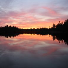
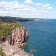
Cascade River State Park, State park in Cook County, Minnesota.

Description

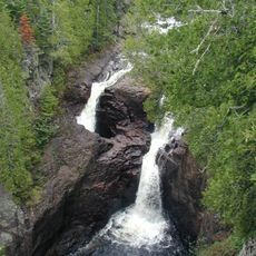
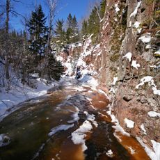
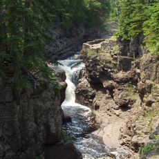
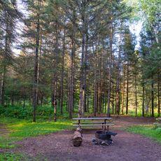
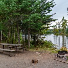
Cascade River State Park is a Minnesota nature reserve where a river descends through a series of waterfalls and rocky canyons on its journey toward Lake Superior. The water cuts deep gorges into the bedrock as it flows downward, creating natural formations that hikers can explore along multiple established trails.

History

The park was developed in the 1930s during the New Deal era when work crews built infrastructure and trails to open the area to visitors. This early development shaped the way people experience the waterfalls and canyons today.

Culture

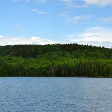
The Superior Hiking Trail connects through the park, offering visitors extended hiking options while linking multiple natural landmarks in northeastern Minnesota.

Practical

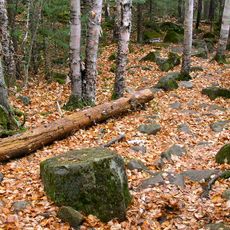
The park offers hiking trails of varying difficulty, from gentle walks to challenging day hikes with overlooks and viewpoints. Visitors should wear sturdy shoes and bring extra clothing since paths can be slippery after rain and water spray from falls is common.

Did you know?

The waterfalls expose rock layers millions of years old, showing how water shapes stone over geological time. These exposed layers are clearly visible from viewing areas and tell the story of how this landscape was carved.

Location
Inception
1957
GPS coordinates
47.70970,-90.52220
Latest update
December 10, 2025 20:08

AroundUs brings together thousands of curated places, local tips, and hidden gems, enriched daily by 60,000 contributors worldwide. Discover all places nearby (Cook County).

Around this place
Judge C. R. Magney State Park
United States of America

Judge C. R. Magney State Park

38.1 km
Boundary Waters Canoe Area Wilderness
United States of America

Boundary Waters Canoe Area Wilderness

52.1 km
Eagle Mountain
United States of America

Eagle Mountain

21.1 km
Superior Hiking Trail
United States of America

Superior Hiking Trail

28 km
Palisade Head
United States of America

Palisade Head

67.9 km
Tettegouche State Park
United States of America

Tettegouche State Park

65.8 km
Witch Tree
United States of America

Witch Tree

71.4 km
Devil's Kettle
United States of America

Devil's Kettle

37.8 km
Temperance River State Park
United States of America

Temperance River State Park

31.4 km
George H. Crosby Manitou State Park
United States of America

George H. Crosby Manitou State Park

51.2 km
Finland State Forest
United States of America

Finland State Forest

69.9 km
Devils Island Light
United States of America

Devils Island Light

71.9 km
Grand Marais Light
United States of America

Grand Marais Light

14.3 km
Grand Portage State Forest
United States of America

Grand Portage State Forest

50 km
Outer Island Light
United States of America

Outer Island Light

70.9 km
Amboy and George Spencer Shipwreck Sites
United States of America

Amboy and George Spencer Shipwreck Sites

44.2 km
North Shore Commercial Fishing Museum
United States of America

North Shore Commercial Fishing Museum

27.6 km
Schroeder Lumber Company Bunkhouse
United States of America

Schroeder Lumber Company Bunkhouse

33.5 km
Church of St. Francis Xavier
United States of America

Church of St. Francis Xavier

16.6 km
Cook County Courthouse
United States of America

Cook County Courthouse

15 km
Jim Scott Fishhouse
United States of America

Jim Scott Fishhouse

14.3 km
Isabella Ranger Station
United States of America

Isabella Ranger Station

70.5 km
Heritage Visitors Center - Grand Portage National Monument
United States of America

Heritage Visitors Center - Grand Portage National Monument

68.4 km
Cascade Lookout Tower
United States of America

Cascade Lookout Tower

5.5 km
Hovland Lookout Tower
United States of America

Hovland Lookout Tower

43.4 km
Kekekabic Lookout Tower
United States of America

Kekekabic Lookout Tower

61.1 km
Finland Lookout Tower
United States of America

Finland Lookout Tower

60.3 km
Devilfish Lookout Tower
United States of America

Devilfish Lookout Tower

43.4 km
Show the full map
« Cascade River State Park - State park in Cook County, Minnesota » is provided by Around Us (aroundus.com). Images and texts are derived from Wikimedia project under a Creative Commons license. You are allowed to copy, distribute, and modify copies of this page, under the conditions set by the license, as long as this note is clearly visible.

Discover hidden gems everywhere you go!

From secret cafés to breathtaking viewpoints, skip the crowded tourist spots and find places that match your style. Our app makes it easy with voice search, smart filtering, route optimization, and insider tips from travelers worldwide. Download now for the complete mobile experience.

Around Us App Screenshot

A unique approach to discovering new places

Le Figaro

All the places worth exploring

France Info

A tailor-made excursion in just a few clicks

20 Minutes

Around Us
Travel Guide & Maps
Download

Send to your phone

QR Code
1

Open the camera app on your mobile.

2

Point at the QR code with your camera. A notification will appear.

3

Tap the notification to open the link.