Height of Land Portage

Log in to your account

AroundUs is a community-driven map of interesting places, built by curious explorers like you. It grows with every review, story, and photo you share.
Connect to save your favorite spots, contribute locations, and create personalized routes.
Continue with Google
Continue with Apple
Continue with X
Continue with Facebook
Continue with email
By continuing, you accept our Terms and Conditions and our Privacy Policy
Create an account
Add to collection
Map
Suggest a change
Share

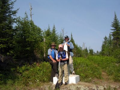
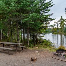
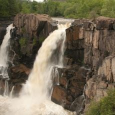
Height of Land Portage, portage along the historic Boundary Waters route between Canada and the United States

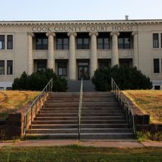
Height of Land Portage is a portage trail in Cook County that connects two water bodies for canoeists and paddlers. The route crosses elevated terrain and serves as a passage between different waterways in the region.

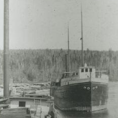
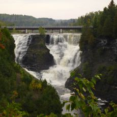
The trail served as an important route for fur trading expeditions in the 18th century. It remains a historical record of early commercial networks in North America.

Access is available on foot for visitors of varying fitness levels. You should prepare for uneven ground and changing weather conditions.

The trail crosses the watershed divide between two major river systems and marks a geographically significant point. This made it an essential passage for traders moving between different trade zones.

Location: Cook County

Location: Thunder Bay District

GPS coordinates: 48.10167,-90.56722

Latest update: December 15, 2025 13:27

Photos
Around this place
Judge C. R. Magney State Park
United States of America

Judge C. R. Magney State Park

47.1 km
Boundary Waters Canoe Area Wilderness
United States of America

Boundary Waters Canoe Area Wilderness

56.8 km
Eagle Mountain
United States of America

Eagle Mountain

22.7 km
Superior Hiking Trail
United States of America

Superior Hiking Trail

62.1 km
Kakabeka Falls
Canada

Kakabeka Falls

77.4 km
Quetico Provincial Park
Canada

Quetico Provincial Park

78.9 km
Witch Tree
United States of America

Witch Tree

70.7 km
Naniboujou Club Lodge
United States of America

Naniboujou Club Lodge

50 km
Devil's Kettle
United States of America

Devil's Kettle

49.1 km
Grand Portage State Park
United States of America

Grand Portage State Park

71.8 km
Temperance River State Park
United States of America

Temperance River State Park

65.1 km
Cascade River State Park
United States of America

Cascade River State Park

43.8 km
Grand Marais Light
United States of America

Grand Marais Light

43.2 km
Grand Portage State Forest
United States of America

Grand Portage State Forest

50 km
Amboy and George Spencer Shipwreck Sites
United States of America

Amboy and George Spencer Shipwreck Sites

76.6 km
North Shore Commercial Fishing Museum
United States of America

North Shore Commercial Fishing Museum

61.7 km
Schroeder Lumber Company Bunkhouse
United States of America

Schroeder Lumber Company Bunkhouse

66.8 km
Church of St. Francis Xavier
United States of America

Church of St. Francis Xavier

42.7 km
Cook County Courthouse
United States of America

Cook County Courthouse

42.5 km
Jim Scott Fishhouse
United States of America

Jim Scott Fishhouse

42.8 km
Pigeon River Provincial Park
Canada

Pigeon River Provincial Park

73.5 km
Kakabeka Falls Provincial Park
Canada

Kakabeka Falls Provincial Park

77.2 km
Heritage Visitors Center - Grand Portage National Monument
United States of America

Heritage Visitors Center - Grand Portage National Monument

67.4 km
Cascade Lookout Tower
United States of America

Cascade Lookout Tower

41.6 km
Hovland Lookout Tower
United States of America

Hovland Lookout Tower

49 km
Paradise Beach
United States of America

Paradise Beach

49 km
Kekekabic Lookout Tower
United States of America

Kekekabic Lookout Tower

43.1 km
Devilfish Lookout Tower
United States of America

Devilfish Lookout Tower

37 km
Show the full map
Reviews

Visited this place? Tap the stars to rate it and share your experience / photos with the community! Try now! You can cancel it anytime.

« Height of Land Portage - portage along the historic Boundary Waters route between Canada and the United States » is provided by Around Us (aroundus.com). Images and texts are derived from Wikimedia project under a Creative Commons license. You are allowed to copy, distribute, and modify copies of this page, under the conditions set by the license, as long as this note is clearly visible.

Discover hidden gems everywhere you go!

From secret cafés to breathtaking viewpoints, skip the crowded tourist spots and find places that match your style. Our app makes it easy with voice search, smart filtering, route optimization, and insider tips from travelers worldwide. Download now for the complete mobile experience.

Around Us App Screenshot

A unique approach to discovering new places

Le Figaro

All the places worth exploring

France Info

A tailor-made excursion in just a few clicks

20 Minutes