Enable Location

We need your location to show you interesting places around you

Discover nearby places

Find interesting locations and hidden gems around you

Precise directions

Get accurate directions and distances to places

Your location is never shared with other users. It's only used when you tap the location button.

Belle Mead

Log in to your account

Start exploring — it's free

Trusted by 65,462 travelers worldwide

Continue with Google
Continue with Apple
or

We will send you a code to connect

By continuing, you accept our Terms and Conditions and our Privacy Policy

Check your inbox

We've sent a pincode in your inbox. Please enter the code below.

Discussion Reviews 1 Photos
16.3k Popularity

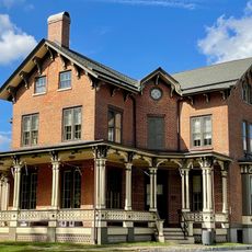
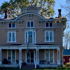
Belle Mead, Census-designated place in Montgomery Township, New Jersey, United States

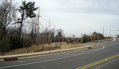
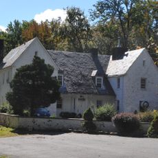
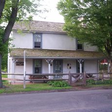
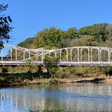
Belle Mead is a census-designated place in Montgomery Township, situated in Somerset County, New Jersey. The community contains residential neighborhoods and small local businesses spread throughout the area.

The community was originally called Plainville before receiving its current name in 1875. This change reflected the evolving development of the area during that period.

The population of Belle Mead experienced a demographic transformation, growing from 216 residents in 2010 to 5,569 residents in 2020 with a strong Asian presence.

The area is accessed via Route 206, which makes navigation straightforward for visitors. The ZIP code 08502 helps with mail delivery and local identification purposes.

During World War II, the Belle Mead Army Depot operated as the largest military supply facility in the United States until its closure in 1991.

The community of curious travelers

AroundUs brings together thousands of curated places, local tips, and hidden gems, enriched daily by 60,000 contributors worldwide.

Start exploring
Elevation above the sea
30 m
GPS coordinates
40.46240,-74.67440
Latest update
December 7, 2025 19:27
Around this place
Delaware and Raritan Canal
United States of America

Delaware and Raritan Canal

7.2 km
Highfields
United States of America

Highfields

9 km
Bachman-Wilson House
United States of America

Bachman-Wilson House

8.5 km
Sourland Mountain
United States of America

Sourland Mountain

4.4 km
Sourland Mountain Preserve
United States of America

Sourland Mountain Preserve

2.6 km
D&R Canal Trail
United States of America

D&R Canal Trail

8.8 km
Donald Grant Herring Estate
United States of America

Donald Grant Herring Estate

9 km
Blackwells Mills Canal House
United States of America

Blackwells Mills Canal House

8.8 km
Franklin Inn
United States of America

Franklin Inn

9.1 km
Neshanic Mills
United States of America

Neshanic Mills

6.7 km
Joseph Stout House
United States of America

Joseph Stout House

8.4 km
Neshanic Station Lenticular Truss Bridge
United States of America

Neshanic Station Lenticular Truss Bridge

6.9 km
Millstone Historic District
United States of America

Millstone Historic District

8.3 km
Rocky Hill Historic District
United States of America

Rocky Hill Historic District

7.6 km
Dirck Gulick House
United States of America

Dirck Gulick House

2 km
Mount Zion African Methodist Episcopal Church
United States of America

Mount Zion African Methodist Episcopal Church

6.4 km
Reformed Dutch Church of Blawenburg
United States of America

Reformed Dutch Church of Blawenburg

6.4 km
River Road Historic Rural District
United States of America

River Road Historic Rural District

5.4 km
Huff House and Farmstead
United States of America

Huff House and Farmstead

7.3 km
Bridgepoint Historic District
United States of America

Bridgepoint Historic District

4.3 km
Maplewood
United States of America

Maplewood

5.5 km
Millstone Valley Agricultural District
United States of America

Millstone Valley Agricultural District

8.2 km
Neshanic Reformed Church
United States of America

Neshanic Reformed Church

5.5 km
Millstone School House
United States of America

Millstone School House

8.7 km
Old Millstone Forge
United States of America

Old Millstone Forge

8.7 km
Blawenburg Historic District
United States of America

Blawenburg Historic District

6.5 km
Neshanic Historic District
United States of America

Neshanic Historic District

5.6 km
Neshanic Station Historic District
United States of America

Neshanic Station Historic District

7.1 km
Show the full map
Reviews
Share your experience

No review yet

Discussions
Start a discussion...

No discussion yet

« Belle Mead - Census-designated place in Montgomery Township, New Jersey, United States » is provided by Around Us (aroundus.com). Images and texts are derived from Wikimedia project under a Creative Commons license. You are allowed to copy, distribute, and modify copies of this page, under the conditions set by the license, as long as this note is clearly visible.

Discover hidden gems everywhere you go!

From secret cafés to breathtaking viewpoints, skip the crowded tourist spots and find places that match your style. Our app makes it easy with voice search, smart filtering, route optimization, and insider tips from travelers worldwide. Download now for the complete mobile experience.

Around Us App Screenshot

A unique approach to discovering new places

Le Figaro

All the places worth exploring

France Info

A tailor-made excursion in just a few clicks

20 Minutes

Around Us
Travel Guide & Maps
Download

Send to your phone

QR Code
1

Open the camera app on your mobile.

2

Point at the QR code with your camera. A notification will appear.

3

Tap the notification to open the link.