Enable Location

We need your location to show you interesting places around you

Discover nearby places

Find interesting locations and hidden gems around you

Precise directions

Get accurate directions and distances to places

Your location is never shared with other users. It's only used when you tap the location button.

Ashtabula

Log in to your account

Start exploring — it's free

Trusted by 63,190 travelers worldwide

Continue with Google
Continue with Apple
or

We will send you a code to connect

By continuing, you accept our Terms and Conditions and our Privacy Policy

Check your inbox

We've sent a pincode in your inbox. Please enter the code below.

Discussion Reviews 1 Photos
2.3k Popularity

Ashtabula, human settlement in South Carolina, United States of America

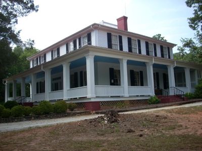
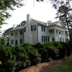
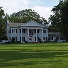
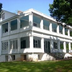
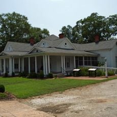
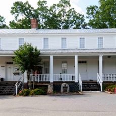
Ashtabula is a house built in 1828 located near Pendleton in South Carolina and listed on the National Register of Historic Places. The two-story white building features porches on three sides with square columns, a central staircase, and tall windows with six-pane sashes.

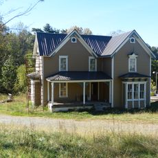
The house was built in 1828 and originally served as the center of a plantation focused on rice cultivation. Throughout the 19th century, it was home to notable figures such as Dr. O.R. Broyles, who introduced innovative farming methods, and later Francis Pelzer, an industrial leader who founded the Pelzer Manufacturing Company.

The main house reflects the architecture typical of plantations from that era, with its wide porches and classical columns. This design shows how families organized community and social gatherings into their daily lives.

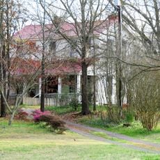
The house was added to the National Register of Historic Places in 1972 and is not open to public tours since it remains in private ownership. Information about the property can be accessed through historical records and official photographs.

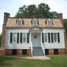
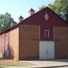
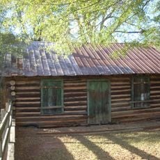
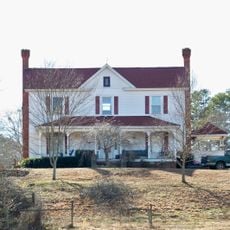
The brick outbuilding constructed around 1790 is older than the main house and originally served as a kitchen and work area for servants. Its horizontal wall planks covered with wallpaper preserve the building styles of that early period.

The community of curious travelers

AroundUs brings together thousands of curated places, local tips, and hidden gems, enriched daily by 60,000 contributors worldwide.

Start exploring
Location
GPS coordinates
34.67889,-82.75694
Latest update
February 9, 2026 08:21
Around this place
Memorial Stadium, Clemson
United States of America

Memorial Stadium, Clemson

7.9 km
Littlejohn Coliseum
United States of America

Littlejohn Coliseum

8.2 km
Fort Hill
United States of America

Fort Hill

7.5 km
Clemson Experimental Forest
United States of America

Clemson Experimental Forest

5.3 km
South Carolina Botanical Garden
United States of America

South Carolina Botanical Garden

6.1 km
Hanover House
United States of America

Hanover House

5.6 km
Old Stone Church and Cemetery
United States of America

Old Stone Church and Cemetery

5.6 km
Clemson College Sheep Barn
United States of America

Clemson College Sheep Barn

6.7 km
President's House
United States of America

President's House

6.8 km
Clemson University Historic District I
United States of America

Clemson University Historic District I

7.1 km
Denver Downs Farmstead
United States of America

Denver Downs Farmstead

11.4 km
Woodburn
United States of America

Woodburn

5.6 km
Pendleton Historic District
United States of America

Pendleton Historic District

3.9 km
Lee and Lowry Hall
United States of America

Lee and Lowry Hall

7.5 km
Ram Cat Alley Historic District
United States of America

Ram Cat Alley Historic District

17.9 km
Clemson Area African American Museum
United States of America

Clemson Area African American Museum

6 km
Faith Cabin Library at Seneca Junior College
United States of America

Faith Cabin Library at Seneca Junior College

18.6 km
Central High School
United States of America

Central High School

5.4 km
Seneca Historic District (Seneca, South Carolina)
United States of America

Seneca Historic District (Seneca, South Carolina)

18.3 km
Morgan House
United States of America

Morgan House

5.3 km
Zebulon H. Baird House
United States of America

Zebulon H. Baird House

19.9 km
Boone-Douthit House
United States of America

Boone-Douthit House

8.5 km
Faith Cabin Library at Anderson County Training School
United States of America

Faith Cabin Library at Anderson County Training School

4.1 km
Alexander-Hill House
United States of America

Alexander-Hill House

20.4 km
North Anderson Historic District
United States of America

North Anderson Historic District

19.8 km
Sheriff Mill Complex
United States of America

Sheriff Mill Complex

21.1 km
Liberty Colored High School
United States of America

Liberty Colored High School

13.8 km
J. Warren Smith House
United States of America

J. Warren Smith House

13.4 km
Show the full map
Reviews
Share your experience

No review yet

Discussions
Start a discussion...

No discussion yet

« Ashtabula - human settlement in South Carolina, United States of America » is provided by Around Us (aroundus.com). Images and texts are derived from Wikimedia project under a Creative Commons license. You are allowed to copy, distribute, and modify copies of this page, under the conditions set by the license, as long as this note is clearly visible.

Discover hidden gems everywhere you go!

From secret cafés to breathtaking viewpoints, skip the crowded tourist spots and find places that match your style. Our app makes it easy with voice search, smart filtering, route optimization, and insider tips from travelers worldwide. Download now for the complete mobile experience.

Around Us App Screenshot

A unique approach to discovering new places

Le Figaro

All the places worth exploring

France Info

A tailor-made excursion in just a few clicks

20 Minutes

Around Us
Travel Guide & Maps
Download

Send to your phone

QR Code
1

Open the camera app on your mobile.

2

Point at the QR code with your camera. A notification will appear.

3

Tap the notification to open the link.