Log in to your account

AroundUs is a community-driven map of interesting places, built by curious explorers like you. It grows with every review, story, and photo you share.
Connect to save your favorite spots, contribute locations, and create personalized routes.
Continue with Google
Continue with Apple
Continue with X
Continue with Facebook
Continue with email
By continuing, you accept our Terms and Conditions and our Privacy Policy
Create an account
Add to collection
Map
Suggest a change
Share

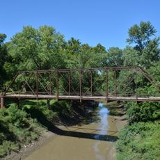
Big Eddy Site, Archaeological site in Cedar County, Missouri, US.

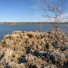
The Big Eddy Site is an archaeological location along the Sac River bank in Missouri where layers of earth contain artifacts and evidence of human settlement. The exposed layers show how different materials accumulated over time, preserving stone tools, hunting weapons, and other objects from multiple periods.

Archaeological work from 1997 to 2005 revealed that people occupied this location continuously for 14,000 years, beginning with early hunter cultures and continuing through later agricultural societies. This extended period of human presence shows how appealing this river valley was to successive groups across millennia.

The site reveals how different groups lived off the river and forest resources over many centuries, adapting their tools and ways to changing conditions. Stone implements and hunting weapons found here show the practical knowledge these people developed to survive in this landscape.

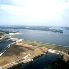
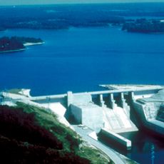
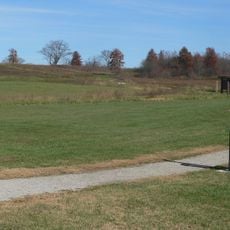
The location sits along a river where water management from a nearby dam affects the site regularly, so plan your visit to observe the exposed layers and landscape. The terrain can be uneven, and you should expect to see ongoing research and protective work being done at the location.

The site features an exposed earth wall rising several meters high that displays clear geological layers comparable to formations found elsewhere in the region. These visible bands of different soils and materials create a natural record that helps explain the long sequence of human occupation at this location.

Location: Cedar County

GPS coordinates: 37.72050,-93.71610

Latest update: December 11, 2025 11:07

Photos
Around this place
Truman Reservoir
United States of America

Truman Reservoir

66.3 km
Stockton Lake
United States of America

Stockton Lake

9.9 km
Fantastic Caverns
United States of America

Fantastic Caverns

57.6 km
Weaubleau structure
United States of America

Weaubleau structure

30.1 km
Harry S Truman Birthplace State Historic Site
United States of America

Harry S Truman Birthplace State Historic Site

55 km
Dickerson Park Zoo
United States of America

Dickerson Park Zoo

63.2 km
Pomme de Terre State Park
United States of America

Pomme de Terre State Park

38.9 km
Osage Village State Historic Site
United States of America

Osage Village State Historic Site

52.2 km
United States of America

Fort Carondelet

56 km
Commercial Street Historic District
United States of America

Commercial Street Historic District

66.4 km
Upper Bridge
United States of America

Upper Bridge

65 km
Caplinger Mills Historic District
United States of America

Caplinger Mills Historic District

11.7 km
Golden Prairie
United States of America

Golden Prairie

55.3 km
George Dimmitt Memorial Hospital
United States of America

George Dimmitt Memorial Hospital

14.8 km
Gilmore Barn
United States of America

Gilmore Barn

47.7 km
Bolivar Public Library
United States of America

Bolivar Public Library

29.5 km
Vernon County Courthouse
United States of America

Vernon County Courthouse

57.9 km
Greenfield Opera House
United States of America

Greenfield Opera House

35.8 km
Infirmary Building, Missouri State Hospital Number 3
United States of America

Infirmary Building, Missouri State Hospital Number 3

58.8 km
Papinville Marais des Cygnes River Bridge
United States of America

Papinville Marais des Cygnes River Bridge

59.6 km
Stockton Community Building
United States of America

Stockton Community Building

7.4 km
Vernon County Jail, Sheriff's House and Office
United States of America

Vernon County Jail, Sheriff's House and Office

57.7 km
Boegel and Hine Flour Mill-Wommack Mill
United States of America

Boegel and Hine Flour Mill-Wommack Mill

62.5 km
Glasgow Commercial Historic District
United States of America

Glasgow Commercial Historic District

57.5 km
South Main Street Historic District
United States of America

South Main Street Historic District

47.2 km
Willard Swimming Center
United States of America

Willard Swimming Center

52.1 km
Jefferson Avenue Footbridge
United States of America

Jefferson Avenue Footbridge

66.1 km
SLSF Sac River Bridge
United States of America

SLSF Sac River Bridge

32.4 km
Show the full map
Reviews

Visited this place? Tap the stars to rate it and share your experience / photos with the community! Try now! You can cancel it anytime.

« Big Eddy Site - Archaeological site in Cedar County, Missouri, US » is provided by Around Us (aroundus.com). Images and texts are derived from Wikimedia project under a Creative Commons license. You are allowed to copy, distribute, and modify copies of this page, under the conditions set by the license, as long as this note is clearly visible.

Discover hidden gems everywhere you go!

From secret cafés to breathtaking viewpoints, skip the crowded tourist spots and find places that match your style. Our app makes it easy with voice search, smart filtering, route optimization, and insider tips from travelers worldwide. Download now for the complete mobile experience.

Around Us App Screenshot

A unique approach to discovering new places

Le Figaro

All the places worth exploring

France Info

A tailor-made excursion in just a few clicks

20 Minutes