Enable Location

We need your location to show you interesting places around you

Discover nearby places

Find interesting locations and hidden gems around you

Precise directions

Get accurate directions and distances to places

Your location is never shared with other users. It's only used when you tap the location button.

Billerica Town Common District

Log in to your account

Start exploring — it's free

Trusted by 62,492 travelers worldwide

Continue with Google
Continue with Apple
or

We will send you a code to connect

By continuing, you accept our Terms and Conditions and our Privacy Policy

Check your inbox

We've sent a pincode in your inbox. Please enter the code below.

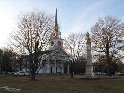
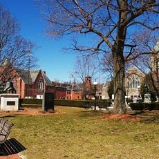
Billerica Town Common District, historic district in Massachusetts, United States

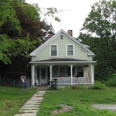
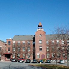
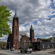
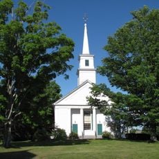
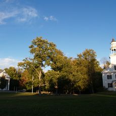
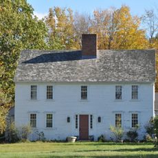
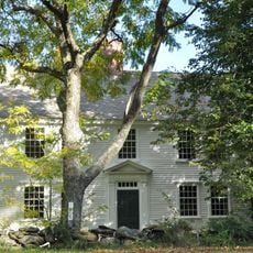
Billerica Town Common District is a historic area centered on a grassy common surrounded by buildings dating mostly to the 1800s, organized around streets such as Cummings Street, Concord Road, and Boston Road. The structures display various architectural styles including Federal, Greek Revival, Italianate, and Second Empire, reflecting different periods of construction and community growth.

The land was originally set aside in 1655 as a shared space for town meetings and gatherings, later becoming a hub for markets and community activities. After the American Revolution, the area transformed into a public park, and residents built a new town hall nearby in 1798 to serve as a center for local government and civic events.

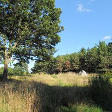
The name Town Common comes from the tradition of communities sharing central land for the public good. Today, you can see how residents and visitors use the grassy space for informal gatherings and quiet moments, continuing a practice that has defined community life here for centuries.

The district is easy to reach and located near Billerica's town center with parking available nearby. The best way to experience the area is to walk slowly through the streets, taking time to notice the building details, old trees, benches, and how the different structures are arranged around the central green space.

The original common was assigned to Captain Daniel Gookin in 1655 but he never claimed it, allowing the community to use it as public land instead. In 1694, part of the land became a militia training ground, and by 1775 it served as a muster point for troops during the American Revolution.

The community of curious travelers

AroundUs brings together thousands of curated places, local tips, and hidden gems, enriched daily by 60,000 contributors worldwide.

Start exploring
Location
GPS coordinates
42.55861,-71.77139
Latest update
February 9, 2026 07:42
Around this place
Whalom Park
United States of America

Whalom Park

2.8 km
United States of America

North County

9.8 km
Leominster State Forest
United States of America

Leominster State Forest

6.9 km
Pearl Hill State Park
United States of America

Pearl Hill State Park

10.6 km
Flyer Comet
United States of America

Flyer Comet

2.9 km
Fay Club
United States of America

Fay Club

3.7 km
Doyle Community Park & Center
United States of America

Doyle Community Park & Center

1.2 km
Fitchburg Art Museum
United States of America

Fitchburg Art Museum

4.1 km
Shirley Shaker Village
United States of America

Shirley Shaker Village

10.5 km
Doyle Community Park & Center
United States of America

Doyle Community Park & Center

1.2 km
Frances H. and Jonathan Drake House
United States of America

Frances H. and Jonathan Drake House

4.2 km
Duck Mill
United States of America

Duck Mill

1.3 km
Faith United Parish
United States of America

Faith United Parish

4 km
Monument Square Historic District
United States of America

Monument Square Historic District

3.6 km
5th street bridge
United States of America

5th street bridge

2.3 km
F. A. Whitney Carriage Company Complex Historic District
United States of America

F. A. Whitney Carriage Company Complex Historic District

3.5 km
James Parker House
United States of America

James Parker House

9.2 km
St. Bernard Cemetery
United States of America

St. Bernard Cemetery

2.2 km
Whitney & Company
United States of America

Whitney & Company

3.7 km
Shirley Village Historic District
United States of America

Shirley Village Historic District

10 km
Fitchburg Yarn Mill
United States of America

Fitchburg Yarn Mill

4.7 km
United States of America

Leominster High School

2.9 km
Lunenburg Historic District
United States of America

Lunenburg Historic District

5.5 km
Monument Park Historic District
United States of America

Monument Park Historic District

3.7 km
Shirley Center Historic District
United States of America

Shirley Center Historic District

10 km
Ezra Wood-Levi Warner Place
United States of America

Ezra Wood-Levi Warner Place

8.3 km
Moran Square Historic District
United States of America

Moran Square Historic District

3 km
Nathan Wood House
United States of America

Nathan Wood House

10.6 km
Show the full map
« Billerica Town Common District - historic district in Massachusetts, United States » is provided by Around Us (aroundus.com). Images and texts are derived from Wikimedia project under a Creative Commons license. You are allowed to copy, distribute, and modify copies of this page, under the conditions set by the license, as long as this note is clearly visible.

Discover hidden gems everywhere you go!

From secret cafés to breathtaking viewpoints, skip the crowded tourist spots and find places that match your style. Our app makes it easy with voice search, smart filtering, route optimization, and insider tips from travelers worldwide. Download now for the complete mobile experience.

Around Us App Screenshot

A unique approach to discovering new places

Le Figaro

All the places worth exploring

France Info

A tailor-made excursion in just a few clicks

20 Minutes

Around Us
Travel Guide & Maps
Download

Send to your phone

QR Code
1

Open the camera app on your mobile.

2

Point at the QR code with your camera. A notification will appear.

3

Tap the notification to open the link.