Bennington Battlefield State Historic Site

Log in to your account

AroundUs is a community-driven map of interesting places, built by curious explorers like you. It grows with every review, story, and photo you share.
Connect to save your favorite spots, contribute locations, and create personalized routes.
Continue with Google
Continue with Apple
Continue with X
Continue with Facebook
Continue with email
By continuing, you accept our Terms and Conditions and our Privacy Policy
Create an account

Bennington Battlefield State Historic Site

Add to collection
Map
Suggest a change
Share

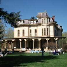
Bennington Battlefield State Historic Site, Revolutionary War battlefield in Walloomsac, New York, United States.

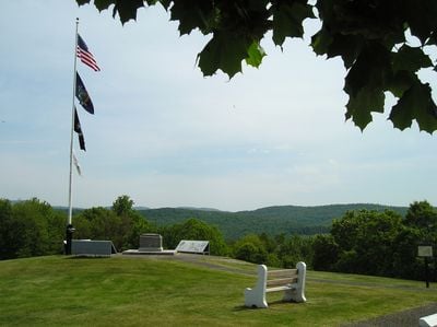
Bennington Battlefield State Historic Site is a Revolutionary War battlefield that spreads across several hundred acres of rolling hills, ridges, and farm fields along the northern bank of the Walloomsac River in eastern New York. The land retains its original mix of cultivated fields and forest areas that characterized the terrain during the battle.

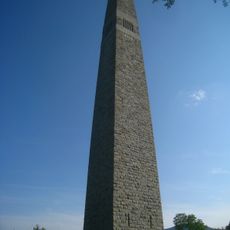
A pivotal clash occurred on August 16, 1777, when American militia forces defeated British Colonel Friedrich Baum's troops in this location. This victory proved crucial in protecting American military supplies and boosting the independence movement during the Revolutionary War.

The site preserves the routes soldiers traveled and the fields that shaped the battle, allowing visitors to walk through the actual terrain where the conflict unfolded. Walking these paths helps you understand how the land itself influenced the outcome of the fight.

The site is open from May through November with interpretive panels and walking trails that can be explored whenever conditions allow. Plan your visit for dry weather to make hiking the different routes easier and more enjoyable.

Parts of the battlefield still show original stone walls built by local farmers during the war period. These stone boundaries offer a rare glimpse into how the land was actually used and divided in the 18th century.

Location: Washington County

Operator: New York State Office of Parks, Recreation and Historic Preservation

Phone: +1(518)8609094

Website: https://nysparks.com/historic-sites/12/details.aspx

GPS coordinates: 42.93959,-73.30322

Latest update: December 11, 2025 11:06

Photos
Around this place
Bennington Battle Monument
United States of America

Bennington Battle Monument

9.1 km
Buskirk Bridge
United States of America

Buskirk Bridge

10.8 km
Catamount Tavern
United States of America

Catamount Tavern

9.4 km
Bennington Historical Museum
United States of America

Bennington Historical Museum

9.9 km
Park-McCullough Historic House
United States of America

Park-McCullough Historic House

4.8 km
Silk Covered Bridge
United States of America

Silk Covered Bridge

7.1 km
Burt Henry Covered Bridge
United States of America

Burt Henry Covered Bridge

4.9 km
Paper Mill Village Bridge
United States of America

Paper Mill Village Bridge

6.4 km
Henry House
United States of America

Henry House

5.2 km
David Mathews House
United States of America

David Mathews House

2.3 km
Downtown Bennington Historic District
United States of America

Downtown Bennington Historic District

11 km
Estabrook Octagon House
United States of America

Estabrook Octagon House

6.3 km
Hoosick Falls Historic District
United States of America

Hoosick Falls Historic District

5.8 km
Tibbits House
United States of America

Tibbits House

9.7 km
Gov. Jonas Galusha Homestead
United States of America

Gov. Jonas Galusha Homestead

9.5 km
McCullough Free Library
United States of America

McCullough Free Library

4.9 km
White Creek Historic District
United States of America

White Creek Historic District

3.7 km
Breese-Reynolds House
United States of America

Breese-Reynolds House

9.2 km
Frederick Squire House
United States of America

Frederick Squire House

10.8 km
Munro-Hawkins House
United States of America

Munro-Hawkins House

7.9 km
Carrigan Lane Historic District
United States of America

Carrigan Lane Historic District

11.3 km
Holden-Leonard Workers Housing Historic District
United States of America

Holden-Leonard Workers Housing Historic District

10.4 km
School Street Duplexes
United States of America

School Street Duplexes

10.8 km
Dutchman's Tavern
United States of America

Dutchman's Tavern

10.7 km
Robert Frost Stone House Museum at Bennington College
United States of America

Robert Frost Stone House Museum at Bennington College

7.6 km
North Bennington Historic District
United States of America

North Bennington Historic District

5.1 km
Center Shaftsbury Historic District
United States of America

Center Shaftsbury Historic District

9.3 km
The Orchards
United States of America

The Orchards

10.4 km
Show the full map
Reviews

Visited this place? Tap the stars to rate it and share your experience / photos with the community! Try now! You can cancel it anytime.

« Bennington Battlefield State Historic Site - Revolutionary War battlefield in Walloomsac, New York, United States » is provided by Around Us (aroundus.com). Images and texts are derived from Wikimedia project under a Creative Commons license. You are allowed to copy, distribute, and modify copies of this page, under the conditions set by the license, as long as this note is clearly visible.

Discover hidden gems everywhere you go!

From secret cafés to breathtaking viewpoints, skip the crowded tourist spots and find places that match your style. Our app makes it easy with voice search, smart filtering, route optimization, and insider tips from travelers worldwide. Download now for the complete mobile experience.

Around Us App Screenshot

A unique approach to discovering new places

Le Figaro

All the places worth exploring

France Info

A tailor-made excursion in just a few clicks

20 Minutes