Chest opened
+${chestReward.xp} XP
Explorer
NOUVEAU ×${chestReward.collectible.quantity}
tapez pour fermer
Chest locked

Open chests in the app

Around Us is built for your phone — chests unlock when you walk, explore and capture nearby places.

Enable Location

We need your location to show you interesting places around you

Discover nearby places

Find interesting locations and hidden gems around you

Precise directions

Get accurate directions and distances to places

Your location is never shared with other users. It's only used when you tap the location button.

Log in to your account

Start exploring — it's free

Trusted by 72,965 travelers worldwide

Continue with Google
Continue with Apple
or

We will send you a code to connect

By continuing, you accept our Terms and Conditions and our Privacy Policy

Check your inbox

We've sent a pincode in your inbox. Please enter the code below.

Briar Woods High School
Discussion Reviews Photo
15.7k Popularity

Briar Woods High School, high school in Virginia, United States

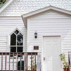
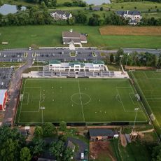
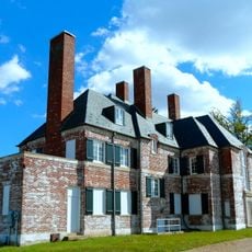
Briar Woods High School is a public secondary school in Ashburn, Virginia, serving students in grades nine through twelve. The building sits in a tree-lined residential area and includes a gymnasium, a theater, and dedicated rooms for science and technology alongside standard classrooms.

The school opened in 2005 to meet the growing demand from families moving into the Ashburn area. Student numbers rose quickly in the early years, leading to temporary classrooms before a permanent addition was built at the back of the building.

The school takes its name from the Briar Woods residential community that surrounds it. Students from many different backgrounds bring their own traditions to daily school life, making the campus a genuinely mixed environment.

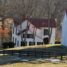
The school is in a residential area south of Ashburn and is easy to reach by car. Parking is available on the grounds for students and visitors, and the main entrance is straightforward to find.

The school's mascot is the Falcon, represented in navy and orange, and several former students have gone on to play sports at a professional level. These achievements are openly celebrated within the school and tend to motivate current students in their own pursuits.

The community of curious travelers

AroundUs brings together thousands of curated places, local tips, and hidden gems, enriched daily by 60,000 contributors worldwide.

Start exploring
Location
Inception
2005
Operator
Loudoun County Public Schools
Address
22525 Belmont Ridge Road Ashburn, VA 20148
Phone
GPS coordinates
38.99250,-77.53056
Latest update
March 3, 2026 10:14
Around this place
Steven F. Udvar-Hazy Center
United States of America

Steven F. Udvar-Hazy Center

11.7 km
Janelia Research Campus
United States of America

Janelia Research Campus

10.5 km
Belmont Manor House
United States of America

Belmont Manor House

9.2 km
Oatlands Plantation
United States of America

Oatlands Plantation

9.2 km
National Weather Service Baltimore/Washington
United States of America

National Weather Service Baltimore/Washington

4.3 km
Mount Zion Old School Baptist Church
United States of America

Mount Zion Old School Baptist Church

7.7 km
Arcola Elementary School
United States of America

Arcola Elementary School

5 km
Rokeby
United States of America

Rokeby

10.5 km
Aldie Mill Historic District
United States of America

Aldie Mill Historic District

9.8 km
Broad Run Bridge and Tollhouse
United States of America

Broad Run Bridge and Tollhouse

10.4 km
Arcola Slave Quarters
United States of America

Arcola Slave Quarters

4.9 km
Fleetwood Farm
United States of America

Fleetwood Farm

2.8 km
Merrybrook
United States of America

Merrybrook

11.3 km
Ashburn Presbyterian Church
United States of America

Ashburn Presbyterian Church

6.5 km
Vestal's Gap Road and Lanesville Historic District
United States of America

Vestal's Gap Road and Lanesville Historic District

11.4 km
Frying Pan Meetinghouse
United States of America

Frying Pan Meetinghouse

11.7 km
Home Farm
United States of America

Home Farm

11.5 km
Furr Farm
United States of America

Furr Farm

11.6 km
Mt. Olive Methodist Episcopal Church
United States of America

Mt. Olive Methodist Episcopal Church

9.2 km
Little River Turnpike Bridge
United States of America

Little River Turnpike Bridge

9.6 km
Fair Oaks
United States of America

Fair Oaks

9.5 km
Francis–Gulick Mill
United States of America

Francis–Gulick Mill

4.5 km
Loudoun Heritage Farm Museum
United States of America

Loudoun Heritage Farm Museum

11.3 km
Evergreen Sportsplex
United States of America

Evergreen Sportsplex

10.3 km
Amazing Farm Fun
United States of America

Amazing Farm Fun

11.3 km
Oak Hill
United States of America

Oak Hill

7.8 km
Janelia
United States of America

Janelia

10.2 km
Ray Muth Sr. Memorial Park
United States of America

Ray Muth Sr. Memorial Park

7.6 km
Show the full map
Reviews
Share your experience

No review yet

Discussions
Start a discussion...

No discussion yet

« Briar Woods High School - high school in Virginia, United States » is provided by Around Us (aroundus.com). Images and texts are derived from Wikimedia project under a Creative Commons license. You are allowed to copy, distribute, and modify copies of this page, under the conditions set by the license, as long as this note is clearly visible.

Discover hidden gems everywhere you go!

From secret cafés to breathtaking viewpoints, skip the crowded tourist spots and find places that match your style. Our app makes it easy with voice search, smart filtering, route optimization, and insider tips from travelers worldwide. Download now for the complete mobile experience.

Around Us App Screenshot

A unique approach to discovering new places

Le Figaro

All the places worth exploring

France Info

A tailor-made excursion in just a few clicks

20 Minutes

Around Us
Travel Guide & Maps
Download

Send to your phone

QR Code
1

Open the camera app on your mobile.

2

Point at the QR code with your camera. A notification will appear.

3

Tap the notification to open the link.