Chicamacomico Life-Saving Station

Log in to your account

AroundUs is a community-driven map of interesting places, built by curious explorers like you. It grows with every review, story, and photo you share.
Connect to save your favorite spots, contribute locations, and create personalized routes.
Continue with Google
Continue with Apple
Continue with X
Continue with Facebook
Continue with email
By continuing, you accept our Terms and Conditions and our Privacy Policy
Create an account
Add to collection
Map
Suggest a change
Share

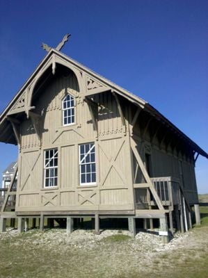
Chicamacomico Life-Saving Station, Maritime heritage museum in Rodanthe, North Carolina, US.

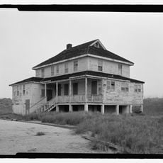
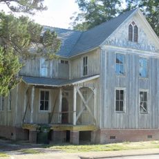
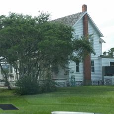
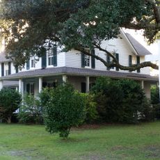
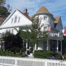
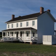
Chicamacomico Life-Saving Station is a maritime heritage museum in Rodanthe featuring two main station buildings and five outbuildings that display original rescue equipment, boats, and coastal safety artifacts. The 10-acre property contains preserved structures and historical gear from the era when sailors and ships needed protection from dangerous Atlantic waters.

Founded in 1874, this was North Carolina's first coastal rescue station built to protect vessels in dangerous waters. The operation continued until 1954, serving mariners through eight decades of Atlantic coastal service.

The station hosts regular demonstrations of traditional beach rescue techniques where visitors can watch how historical equipment such as the Lyle Gun was operated. These live performances help people understand how rescue crews worked during the early days of coastal safety.

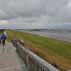
The property offers parking and restroom facilities where guests can explore the buildings and view exhibits at their own pace. Wearing comfortable walking shoes helps when touring the outdoor grounds and examining the various structures spread across the property.

In 1918, crew members rescued 42 sailors from the British tanker Mirlo after a German submarine attack, an act of heroism that earned them gold medals from King George V. This dramatic rescue remains one of the most remembered moments in the station's history.

Location: North Carolina

GPS coordinates: 35.59500,-75.46500

Latest update: December 11, 2025 11:03

Photos
Around this place
Cape Hatteras Lighthouse
United States of America

Cape Hatteras Lighthouse

38.8 km
Bodie Island Light
United States of America

Bodie Island Light

26.4 km
Alligator River National Wildlife Refuge
United States of America

Alligator River National Wildlife Refuge

40.6 km
Virginia Dare Memorial Bridge
United States of America

Virginia Dare Memorial Bridge

40.5 km
North Carolina Aquariums
United States of America

North Carolina Aquariums

41.9 km
Pea Island National Wildlife Refuge
United States of America

Pea Island National Wildlife Refuge

7.8 km
Rodanthe Bridge
United States of America

Rodanthe Bridge

2.2 km
Coquina Beach
United States of America

Coquina Beach

28 km
Roanoke Island Festival Park
United States of America

Roanoke Island Festival Park

39.7 km
Roanoke Marshes Light
United States of America

Roanoke Marshes Light

32.1 km
United States of America

Naval Facility Cape Hatteras

37.9 km
Salvo Post Office
United States of America

Salvo Post Office

6.2 km
Nags Head Beach Cottages Historic District
United States of America

Nags Head Beach Cottages Historic District

42.8 km
Bodie Island Lifesaving and Coast Guard Station
United States of America

Bodie Island Lifesaving and Coast Guard Station

27.4 km
George Washington Creef House
United States of America

George Washington Creef House

39.5 km
Mattie Midgett Store and House
United States of America

Mattie Midgett Store and House

42.7 km
University of North Carolina - Coastal Studies Institute
United States of America

University of North Carolina - Coastal Studies Institute

35.7 km
Rasmus Midgett House
United States of America

Rasmus Midgett House

5.6 km
John T. Daniels House
United States of America

John T. Daniels House

39.9 km
Theodore S. Meekins House
United States of America

Theodore S. Meekins House

39.6 km
Washington Baum Bridge
United States of America

Washington Baum Bridge

36.6 km
Bodie Island Light Station
United States of America

Bodie Island Light Station

26.5 km
Bodie Island Visitor Center
United States of America

Bodie Island Visitor Center

26.4 km
North Pond Wildlife Trail
United States of America

North Pond Wildlife Trail

13.7 km
Coastal North Carolina National Wildlife Refuges Gateway Visitor Center
United States of America

Coastal North Carolina National Wildlife Refuges Gateway Visitor Center

43.5 km
Pea Island National Wildlife Refuge Visitor Center
United States of America

Pea Island National Wildlife Refuge Visitor Center

13.8 km
Pea Island Beach
United States of America

Pea Island Beach

14.2 km
Herbert C. Bonner Bridge
United States of America

Herbert C. Bonner Bridge

20.7 km
Show the full map
Reviews

Visited this place? Tap the stars to rate it and share your experience / photos with the community! Try now! You can cancel it anytime.

« Chicamacomico Life-Saving Station - Maritime heritage museum in Rodanthe, North Carolina, US » is provided by Around Us (aroundus.com). Images and texts are derived from Wikimedia project under a Creative Commons license. You are allowed to copy, distribute, and modify copies of this page, under the conditions set by the license, as long as this note is clearly visible.

Discover hidden gems everywhere you go!

From secret cafés to breathtaking viewpoints, skip the crowded tourist spots and find places that match your style. Our app makes it easy with voice search, smart filtering, route optimization, and insider tips from travelers worldwide. Download now for the complete mobile experience.

Around Us App Screenshot

A unique approach to discovering new places

Le Figaro

All the places worth exploring

France Info

A tailor-made excursion in just a few clicks

20 Minutes