Enable Location

We need your location to show you interesting places around you

Discover nearby places

Find interesting locations and hidden gems around you

Precise directions

Get accurate directions and distances to places

Your location is never shared with other users. It's only used when you tap the location button.

Log in to your account

Start exploring — it's free

Trusted by 61,319 travelers worldwide

Continue with Google
Continue with Apple
or

We will send you a code to connect

By continuing, you accept our Terms and Conditions and our Privacy Policy

Check your inbox

We've sent a pincode in your inbox. Please enter the code below.

Naval Facility Cape Hatteras

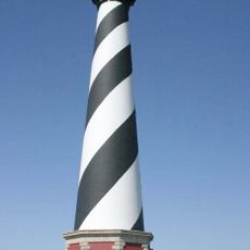
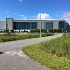
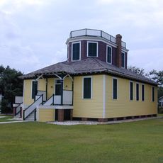
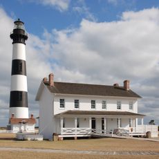
Naval Facility Cape Hatteras, Military surveillance facility near Buxton, North Carolina, United States.

Description

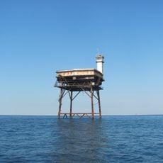
Naval Facility Cape Hatteras was a military station on the North Carolina coast equipped with underwater surveillance technology. The site used specialized acoustic sensors to detect ships and submarines operating in the Atlantic region.

History

The facility opened in 1956 and became an important listening post during the Cold War. It played a role in early detection systems that helped monitor Soviet naval activities in the Atlantic.

Culture

The facility represented a crucial component of the United States Navy's undersea monitoring network, employing 122 Navy personnel and supporting 180 family members.

Practical

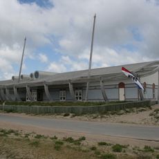
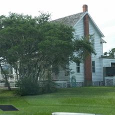
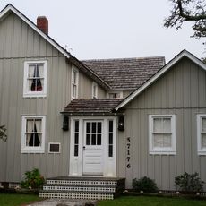
The site is not open to the public today and underwent environmental cleanup after closing. Visitors can learn about its role through nearby museums or historical markers in the Buxton area.

Did you know?

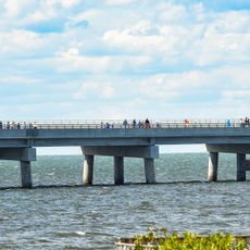
The site was accessible only by ferry from the mainland and operated under strict security restrictions. This isolated setting made daily operations particularly difficult for personnel during bad weather.

GPS coordinates
35.25817,-75.52206
Latest update
December 13, 2025 17:02

AroundUs brings together thousands of curated places, local tips, and hidden gems, enriched daily by 60,000 contributors worldwide. Discover all places nearby (United States of America).

Around this place
Cape Hatteras Lighthouse
United States of America

Cape Hatteras Lighthouse

1 km
Bodie Island Light
United States of America

Bodie Island Light

62.5 km
Alligator River National Wildlife Refuge
United States of America

Alligator River National Wildlife Refuge

65.6 km
Virginia Dare Memorial Bridge
United States of America

Virginia Dare Memorial Bridge

72.5 km
Diamond Shoal Light
United States of America

Diamond Shoal Light

23.6 km
Pea Island National Wildlife Refuge
United States of America

Pea Island National Wildlife Refuge

45 km
Ocracoke Light
United States of America

Ocracoke Light

45.4 km
Graveyard of the Atlantic Museum
United States of America

Graveyard of the Atlantic Museum

17.5 km
Rodanthe Bridge
United States of America

Rodanthe Bridge

39.4 km
Chicamacomico Life-Saving Station
United States of America

Chicamacomico Life-Saving Station

37.9 km
Coquina Beach
United States of America

Coquina Beach

64.3 km
Mattamuskeet National Wildlife Refuge
United States of America

Mattamuskeet National Wildlife Refuge

67.2 km
Roanoke Marshes Light
United States of America

Roanoke Marshes Light

63.6 km
Salvo Post Office
United States of America

Salvo Post Office

31.7 km
Lake Mattamuskeet Pump Station
United States of America

Lake Mattamuskeet Pump Station

63.1 km
Bodie Island Lifesaving and Coast Guard Station
United States of America

Bodie Island Lifesaving and Coast Guard Station

63.7 km
University of North Carolina - Coastal Studies Institute
United States of America

University of North Carolina - Coastal Studies Institute

69.6 km
Inkwell
United States of America

Inkwell

54.4 km
Hatteras Weather Bureau Station
United States of America

Hatteras Weather Bureau Station

15.9 km
Rasmus Midgett House
United States of America

Rasmus Midgett House

32.3 km
Ellsworth and Lovie Ballance House
United States of America

Ellsworth and Lovie Ballance House

15.5 km
Washington Baum Bridge
United States of America

Washington Baum Bridge

71.6 km
Bodie Island Light Station
United States of America

Bodie Island Light Station

62.5 km
Bodie Island Visitor Center
United States of America

Bodie Island Visitor Center

62.5 km
North Pond Wildlife Trail
United States of America

North Pond Wildlife Trail

51 km
Pea Island National Wildlife Refuge Visitor Center
United States of America

Pea Island National Wildlife Refuge Visitor Center

51.1 km
Pea Island Beach
United States of America

Pea Island Beach

51.5 km
Herbert C. Bonner Bridge
United States of America

Herbert C. Bonner Bridge

57.2 km
Show the full map
« Naval Facility Cape Hatteras - Military surveillance facility near Buxton, North Carolina, United States » is provided by Around Us (aroundus.com). Images and texts are derived from Wikimedia project under a Creative Commons license. You are allowed to copy, distribute, and modify copies of this page, under the conditions set by the license, as long as this note is clearly visible.

Discover hidden gems everywhere you go!

From secret cafés to breathtaking viewpoints, skip the crowded tourist spots and find places that match your style. Our app makes it easy with voice search, smart filtering, route optimization, and insider tips from travelers worldwide. Download now for the complete mobile experience.

Around Us App Screenshot

A unique approach to discovering new places

Le Figaro

All the places worth exploring

France Info

A tailor-made excursion in just a few clicks

20 Minutes

Around Us
Travel Guide & Maps
Download

Send to your phone

QR Code
1

Open the camera app on your mobile.

2

Point at the QR code with your camera. A notification will appear.

3

Tap the notification to open the link.