Chest opened
+${chestReward.xp} XP
Explorer
NOUVEAU ×${chestReward.collectible.quantity}
tapez pour fermer
Chest locked

Open chests in the app

Around Us is built for your phone — chests unlock when you walk, explore and capture nearby places.

Enable Location

We need your location to show you interesting places around you

Discover nearby places

Find interesting locations and hidden gems around you

Precise directions

Get accurate directions and distances to places

Your location is never shared with other users. It's only used when you tap the location button.

Log in to your account

Start exploring — it's free

Trusted by 72,876 travelers worldwide

Continue with Google
Continue with Apple
or

We will send you a code to connect

By continuing, you accept our Terms and Conditions and our Privacy Policy

Check your inbox

We've sent a pincode in your inbox. Please enter the code below.

Craig Lake State Park
Discussion Reviews Photo
3.4k Popularity

Craig Lake State Park, State park in Upper Peninsula, United States.

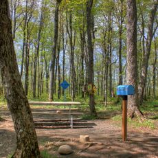
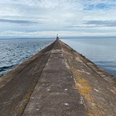
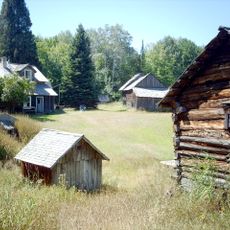
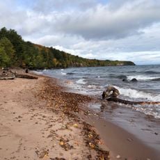
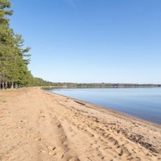
Craig Lake State Park is a wilderness area in Michigan's Upper Peninsula encompassing six lakes surrounded by dense forest and undeveloped terrain. The park contains numerous hiking trails that wind through its wooded landscape and offer access to multiple water bodies throughout the protected land.

The park was established to protect the wilderness character of Michigan's Upper Peninsula. Recent land donations expanded its boundaries and reinforced its role as a conservation area in the region.

The North Country Trail passes through the park, connecting visitors to a network of paths that span multiple states across the northern United States.

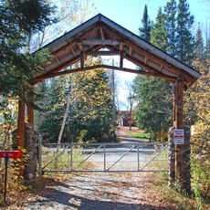
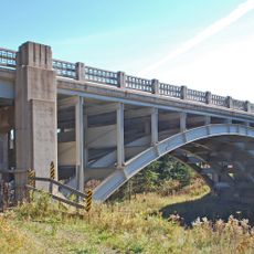
High-clearance vehicles are needed to reach the park via unpaved roads through remote terrain. Visitors should come prepared for isolated conditions and bring adequate gear for outdoor exploration.

The North Country Trail passes through the park, linking it to a multi-state network of trails that span the northern regions. This longer route allows hikers to experience the site as part of a wider regional pathway system.

The community of curious travelers

AroundUs brings together thousands of curated places, local tips, and hidden gems, enriched daily by 60,000 contributors worldwide.

Start exploring
Location
GPS coordinates
46.61190,-88.17810
Latest update
December 12, 2025 07:59
Around this place
Mount Arvon
United States of America

Mount Arvon

16.1 km
National Ski Hall of Fame
United States of America

National Ski Hall of Fame

41 km
Cliffs Shaft Mine Museum
United States of America

Cliffs Shaft Mine Museum

40.8 km
Mather Inn
United States of America

Mather Inn

41.3 km
Baraga State Park
United States of America

Baraga State Park

29.9 km
Trunk Line Bridge No. 1
United States of America

Trunk Line Bridge No. 1

16.3 km
Huron Island Light
United States of America

Huron Island Light

41.4 km
United States of America

Sturgeon River Gorge Wilderness

40.1 km
Sam Cohodas Lodge
United States of America

Sam Cohodas Lodge

16.4 km
Hebard – Ford Summer House
United States of America

Hebard – Ford Summer House

32.2 km
Vista Theater
United States of America

Vista Theater

28.5 km
Keweenaw Waterway Lower Entrance Light
United States of America

Keweenaw Waterway Lower Entrance Light

44.2 km
Herman and Anna Hanka Farm
United States of America

Herman and Anna Hanka Farm

41.7 km
Canyon Falls Bridge
United States of America

Canyon Falls Bridge

22.4 km
Jacobsville Finnish Lutheran Church
United States of America

Jacobsville Finnish Lutheran Church

45.3 km
Zeba Indian United Methodist Church
United States of America

Zeba Indian United Methodist Church

27.8 km
Sundberg Block
United States of America

Sundberg Block

45 km
Arvon Township Hall
United States of America

Arvon Township Hall

29.7 km
Old US 41–Backwater Creek Bridge
United States of America

Old US 41–Backwater Creek Bridge

28.9 km
Ishpeming Municipal Building
United States of America

Ishpeming Municipal Building

41.4 km
Cleveland Mine Engine House Number 3
United States of America

Cleveland Mine Engine House Number 3

42.1 km
Ishpeming Main Street Historic District
United States of America

Ishpeming Main Street Historic District

41.3 km
Reine utsiktspunkt
Norway

Reine utsiktspunkt

30.5 km
Negaunee State Bank Building
United States of America

Negaunee State Bank Building

45.3 km
Mino-kwe jiigibiik
United States of America

Mino-kwe jiigibiik

42.8 km
Ishpeming Carnegie Public Library
United States of America

Ishpeming Carnegie Public Library

41.2 km
Second Sand Beach
United States of America

Second Sand Beach

31.2 km
Most Holy Name of Jesus--Saint Blessed Kateri Tekakwitha Catholic Church
United States of America

Most Holy Name of Jesus--Saint Blessed Kateri Tekakwitha Catholic Church

31.7 km
Show the full map
Reviews
Share your experience

No review yet

Discussions
Start a discussion...

No discussion yet

« Craig Lake State Park - State park in Upper Peninsula, United States » is provided by Around Us (aroundus.com). Images and texts are derived from Wikimedia project under a Creative Commons license. You are allowed to copy, distribute, and modify copies of this page, under the conditions set by the license, as long as this note is clearly visible.

Discover hidden gems everywhere you go!

From secret cafés to breathtaking viewpoints, skip the crowded tourist spots and find places that match your style. Our app makes it easy with voice search, smart filtering, route optimization, and insider tips from travelers worldwide. Download now for the complete mobile experience.

Around Us App Screenshot

A unique approach to discovering new places

Le Figaro

All the places worth exploring

France Info

A tailor-made excursion in just a few clicks

20 Minutes

Around Us
Travel Guide & Maps
Download

Send to your phone

QR Code
1

Open the camera app on your mobile.

2

Point at the QR code with your camera. A notification will appear.

3

Tap the notification to open the link.