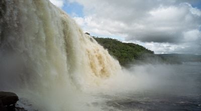
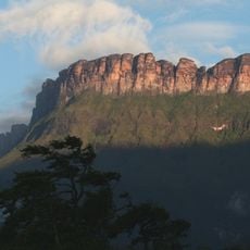
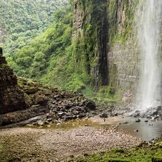
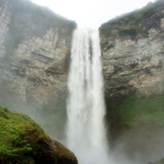
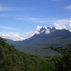
Sapo Falls, Waterfall in Canaima National Park, Venezuela.
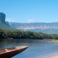
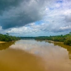
Sapo Falls drops in cascades into a separate basin within the Carrao River system in the Gran Sabana region. The water flows through rocky terrain and has a distinctive appearance due to minerals in the stone.
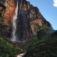
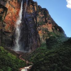
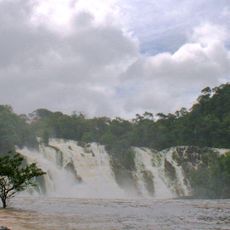
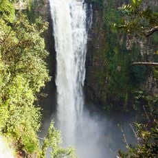
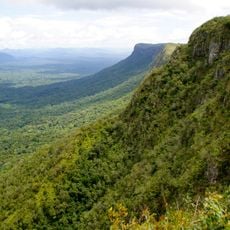
The opening of a hiking trail to this waterfall made the natural formation accessible to visitors and marked a turning point in tourism. This development brought more people to experience the site.
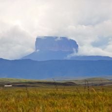
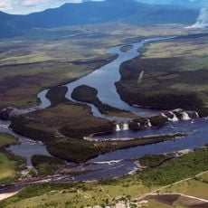
The Pemon communities of the Gran Sabana see this place as part of their ancestral land and move through it with deep familiarity. The way they know and use the surrounding forest shows how closely they are connected to this territory.
Visitors reach the waterfall by following a hiking trail that winds through the forest and requires moderate fitness. Going with a local guide is helpful, as they know the best routes and can show you safe places to cross the water and get different views.
The water has a reddish tint caused by minerals in the surrounding rock. This natural coloring makes the water visually striking and sets it apart from other waterfalls in the area.
GPS coordinates: 6.25514,-62.83853
Latest update: December 6, 2025 17:45
Venezuela presents diverse landscapes for photography. Angel Falls, the world's highest waterfall, drops 979 meters. Los Roques beaches display turquoise waters. Canaima National Park features waterfalls between table mountains. The capital Caracas shows colonial architecture next to modern buildings.
Angel Falls
46.2 km
Canaima National Park
2.3 km
Auyantepui
51.4 km
Second Orinoco crossing
224.4 km
Jesús Soto Museum of Modern Art
222.8 km
Casa del Congreso de Angostura
224.5 km
Ptari-tepui
126 km
Aponwao Falls
167.7 km
St. Thomas Cathedral
224.5 km
Cueva Charles Brewer - Carías
98.3 km
Para Falls
185.2 km
Salto Kamá
202.1 km
Ilú–Tramen Massif
224 km
King George VI Falls
201.2 km
Aprada-tepui
103.4 km
Estación Terrena de Luepa
157.3 km
Kamarang Great Falls
204.8 km
Guri Reservoir
169.4 km
Anatoly Island
621 m
Suspension bridge over Cuyuní river
145.2 km
Capilla de Santa Teresita
141.6 km
La Paragua Forest Reserve
46.3 km
El Caura Forest Reserve
184.6 km
San Pedro Forest Reserve
136.4 km
Mount Guaiquinima Natural Monument
97.6 km
Cerros Ichúm y Guanacoco Natural Monument
208.7 km
El Dorado - Tumeremo Forest Reserve
170.8 km
El Frio Forest Reserve
79.3 kmReviews
Visited this place? Tap the stars to rate it and share your experience / photos with the community! Try now! You can cancel it anytime.
Discover hidden gems everywhere you go!
From secret cafés to breathtaking viewpoints, skip the crowded tourist spots and find places that match your style. Our app makes it easy with voice search, smart filtering, route optimization, and insider tips from travelers worldwide. Download now for the complete mobile experience.
A unique approach to discovering new places❞
— Le Figaro
All the places worth exploring❞
— France Info
A tailor-made excursion in just a few clicks❞
— 20 Minutes