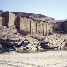
Al-Hajarayn, Ancient settlement in Hadhramaut Governorate, Yemen
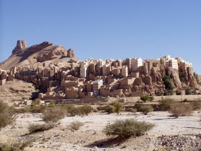
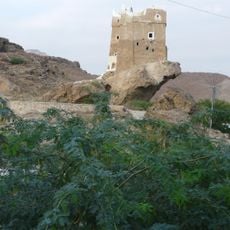
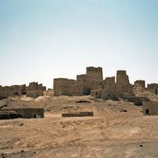
Al-Hajarayn is an ancient settlement that rises up steep cliffs, built with traditional mud-brick structures that adapt to the valley's natural slope. The buildings stack vertically and follow the terrain of Wadi Kasr, creating a layered pattern against the rock face.
The settlement was governed by Sultan Abdul M'Barrek Hamout al Kaiti in the 1890s before shifting to Qu'aiti rule in 1901. This transition changed the local administration and regional power structure.
Local people practice traditional crafts like pottery and weaving that have been passed down through families and shape daily life here. These skills connect residents to their surroundings and give the settlement its distinctive character.
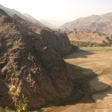
Access is by local roads through the Wadi Duan area, which provide the main route to reach the settlement. Walking through the village requires care on steep, uneven paths between the stacked buildings.
The settlement's position in lower Wadi Duan creates an unusual building arrangement where mountainous terrain and agricultural terraces shape the architecture. This pattern shows how residents adapted construction to an extreme landscape.
The community of curious travelers
AroundUs brings together thousands of curated places, local tips, and hidden gems, enriched daily by 60,000 contributors worldwide.