Enable Location

We need your location to show you interesting places around you

Discover nearby places

Find interesting locations and hidden gems around you

Precise directions

Get accurate directions and distances to places

Your location is never shared with other users. It's only used when you tap the location button.

Oymyakonsky District

Log in to your account

Start exploring — it's free

Trusted by 62,836 travelers worldwide

Continue with Google
Continue with Apple
or

We will send you a code to connect

By continuing, you accept our Terms and Conditions and our Privacy Policy

Check your inbox

We've sent a pincode in your inbox. Please enter the code below.

Oymyakonsky District

Oymyakonsky District, Municipal district in Sakha Republic, Russia.

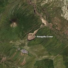
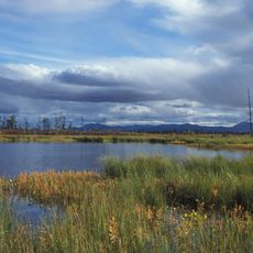
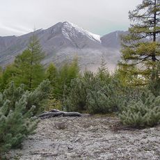
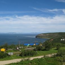
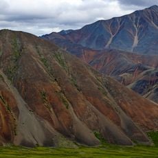
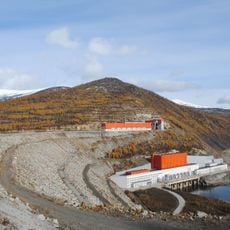
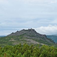
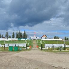
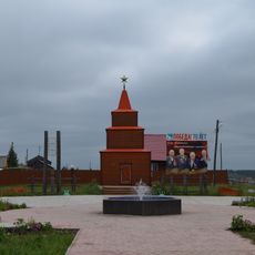
Oymyakonsky District is a large administrative region in eastern Sakha Republic that contains mountains, plateaus, and the Indigirka River system. The landscape consists of remote, rugged terrain shaped by extreme cold conditions.

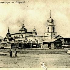
The region was established as an administrative district in 1931 and became known as one of Earth's most extreme climate zones. Since then it has experienced dramatic shifts in population and remains one of Russia's most sparsely settled areas.

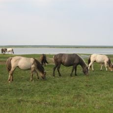
Different ethnic groups live together in this region and maintain their own traditions within the community. Yakuts, Russians, and Evens shape daily life and local customs that you can observe here.

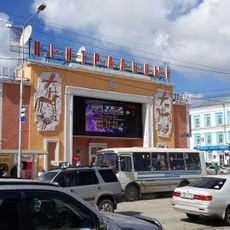
The Kolyma Highway connects this region to Yakutsk and Magadan and provides the main travel route through the area. Visitors should prepare for extreme weather conditions and plan visits during warmer months only.

The settlement of Oymyakon once held the record for the lowest temperature ever recorded in the northern hemisphere. This extreme cold record has brought worldwide attention to the place and makes it a location of scientific interest.

The community of curious travelers

AroundUs brings together thousands of curated places, local tips, and hidden gems, enriched daily by 60,000 contributors worldwide.

Start exploring
Location
Inception
May 20, 1931
Capital city
Ust-Nera
GPS coordinates
63.45000,142.78333
Latest update
December 7, 2025 20:40
Around this place
Amur Yakutsk Mainline
Russian Federation

Amur Yakutsk Mainline

677.7 km
Batagaika crater
Russian Federation

Batagaika crater

589 km
Labynkyr
Russian Federation

Labynkyr

113.1 km
Mask of Sorrow
Russian Federation

Mask of Sorrow

604.2 km
Jack London Lake
Russian Federation

Jack London Lake

375.7 km
Peak Pobeda, Sakha
Russian Federation

Peak Pobeda, Sakha

247.4 km
Magadan Nature Reserve
Russian Federation

Magadan Nature Reserve

490.6 km
Kolyma Mountains
Russian Federation

Kolyma Mountains

656.8 km
Sakha Academic Theater
Russian Federation

Sakha Academic Theater

682 km
Magadan Music and Drama Theater
Russian Federation

Magadan Music and Drama Theater

606 km
Gertner Cove
Russian Federation

Gertner Cove

611.6 km
Momsky nature park
Russian Federation

Momsky nature park

281 km
Victory memorial in Yakutsk
Russian Federation

Victory memorial in Yakutsk

681.2 km
Lake Ozhogino
Russian Federation

Lake Ozhogino

668 km
Holy Trinity Cathedral
Russian Federation

Holy Trinity Cathedral

605.9 km
Russian Federation

Bolschaja-Momskaja-Aufeis

302.9 km
Kolyma Reservoir
Russian Federation

Kolyma Reservoir

401.9 km
Monastery of the Savior Not Made with Hands
Russian Federation

Monastery of the Savior Not Made with Hands

682.1 km
Кинотеатр «Центральный» (Якутск)
Russian Federation

Кинотеатр «Центральный» (Якутск)

682.3 km
Myuryu
Russian Federation

Myuryu

594.1 km
Russian Federation

Tank memorial to fallen in WWII, Yakutsk

681.2 km
Angachak Range
Russian Federation

Angachak Range

370.9 km
Намская улусная гимназия
Russian Federation

Намская улусная гимназия

664.9 km
Gory Kamennyy Venets
Russian Federation

Gory Kamennyy Venets

605 km
F. K. Popov yodgorlik-byusti
Russian Federation

F. K. Popov yodgorlik-byusti

666.9 km
Памятник воинам-землякам, участникам Великой Отечественной войны (Петровка, Якутия)
Russian Federation

Памятник воинам-землякам, участникам Великой Отечественной войны (Петровка, Якутия)

668.2 km
Памятник воинам-землякам (Майя)
Russian Federation

Памятник воинам-землякам (Майя)

666.8 km
Памятник-часовня (Петровка)
Russian Federation

Памятник-часовня (Петровка)

668.1 km
Show the full map
« Oymyakonsky District - Municipal district in Sakha Republic, Russia » is provided by Around Us (aroundus.com). Images and texts are derived from Wikimedia project under a Creative Commons license. You are allowed to copy, distribute, and modify copies of this page, under the conditions set by the license, as long as this note is clearly visible.

Discover hidden gems everywhere you go!

From secret cafés to breathtaking viewpoints, skip the crowded tourist spots and find places that match your style. Our app makes it easy with voice search, smart filtering, route optimization, and insider tips from travelers worldwide. Download now for the complete mobile experience.

Around Us App Screenshot

A unique approach to discovering new places

Le Figaro

All the places worth exploring

France Info

A tailor-made excursion in just a few clicks

20 Minutes

Around Us
Travel Guide & Maps
Download

Send to your phone

QR Code
1

Open the camera app on your mobile.

2

Point at the QR code with your camera. A notification will appear.

3

Tap the notification to open the link.