See the monuments around you in AROpen chests in the app
Around Us is built for your phone — point your camera at the streets and discover the monuments and places around you in augmented reality.Around Us is built for your phone — chests unlock when you walk, explore and capture nearby places.
Hokkaido offers landscapes that change with each season, from the primary forests of the north to the flower fields of the center and the hot springs of the south.
Hokkaido, the northernmost island of Japan, shows different faces depending on the season. From north to south, you will find thick forests, mountain lakes, flower fields that change color with the months, and hot springs that steam all year round. It is a place where nature dominates, even near the cities. This collection presents places worth the detour: parks where bears and eagles live, lakes with particular waters, mountains where you can climb, valleys formed by volcanic activity, and villages where you can discover the traditions of the Ainu, the original inhabitants. Each of these places tells a different story of Hokkaido. You can explore gorges carved by rivers, walk on rural roads between colorful fields, bathe in natural hot springs, or look at a bay from a summit. There are also museums, historic forts, and lighthouses that mark the extreme points of the island. Hokkaido suits everyone who likes to walk outside, look at landscapes, or simply take time to see how people live in the north of Japan.
Hokkaido offers landscapes that change with each season, from the primary forests of the north to the flower fields of the center and the hot springs of the south.
Hokkaido, the northernmost island of Japan, shows different faces depending on the season. From north to south, you will find thick forests, mountain lakes, flower fields that change color with the months, and hot springs that steam all year round. It is a place where nature dominates, even near the cities. This collection presents places worth the detour: parks where bears and eagles live, lakes with particular waters, mountains where you can climb, valleys formed by volcanic activity, and villages where you can discover the traditions of the Ainu, the original inhabitants. Each of these places tells a different story of Hokkaido. You can explore gorges carved by rivers, walk on rural roads between colorful fields, bathe in natural hot springs, or look at a bay from a summit. There are also museums, historic forts, and lighthouses that mark the extreme points of the island. Hokkaido suits everyone who likes to walk outside, look at landscapes, or simply take time to see how people live in the north of Japan.
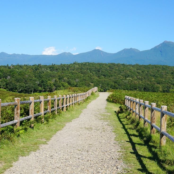
Shiretoko National Park sits on the northeastern tip of Hokkaido, where cliffs drop straight into the Sea of Okhotsk. Behind the coast, old-growth forests cover the hills, home to brown bears, deer, and Steller's sea eagles. In winter, drift ice from Siberia reaches the shore. Visitors can take boat tours along the cliffs, hike across the peninsula, or walk the raised boardwalks of the Shiretoko Five Lakes area.
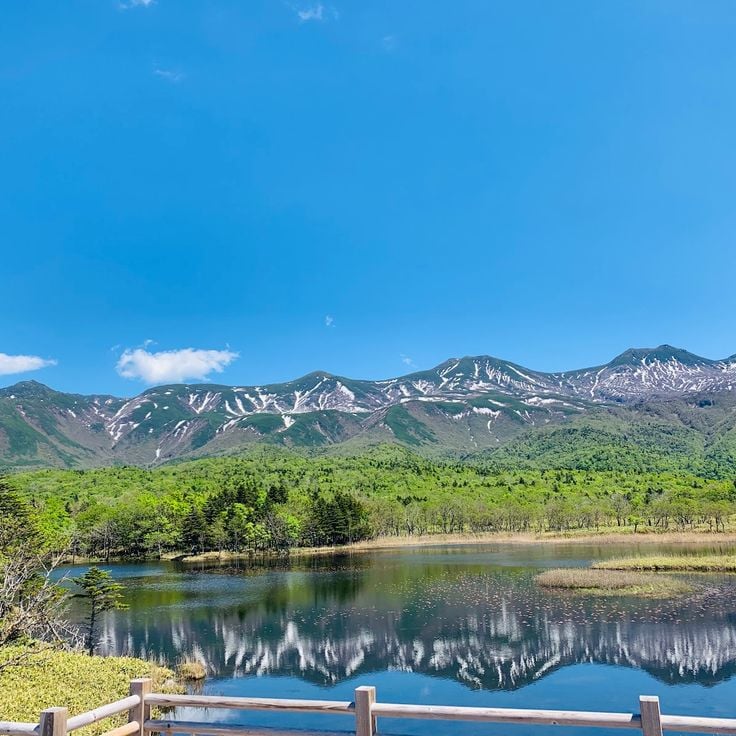
The Shiretoko Five Lakes sit on the Shiretoko Peninsula in northern Hokkaido, within an area recognized as a UNESCO World Natural Heritage site. The five lakes are surrounded by thick forests, and their still waters mirror the trees and sky above. Walking trails run close along their shores, through a setting where brown bears, deer, and foxes roam freely. In autumn, the leaves change color and the whole scene transforms.
Sapporo is the capital of Hokkaido and its largest city. Wide avenues, urban parks, local restaurants and museums give the city a comfortable rhythm. In winter, the city hosts a snow festival where large ice and snow sculptures are built in the streets. Sapporo is also a natural starting point for exploring the rest of Hokkaido, with mountains, lakes and rural areas all within easy reach.
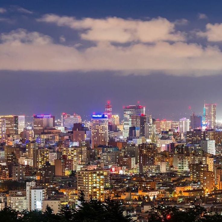
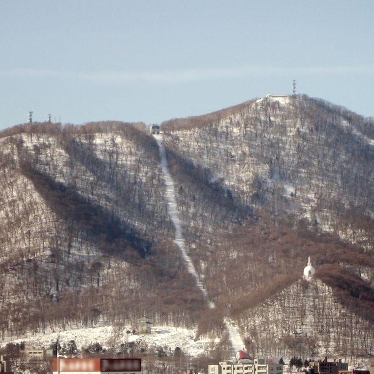
Mount Moiwa sits at the edge of Sapporo and offers a wide view over the city and the plain around it. You can ride a ropeway and then a small gondola to reach the top. From the summit, you can see the city rooftops, the mountains beyond, and on clear days the sea in the distance. The view changes completely after dark, when the city lights spread across the valley below.
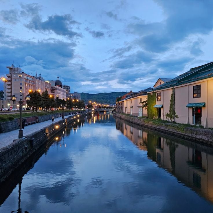
The Otaru Canal was built in the early 20th century to help move goods between ships and the city. Today, the old stone warehouses that line the water have been turned into restaurants, shops, and small museums. Walking along the canal, you get a real sense of what this trading port once looked like. The area is calm in the morning and busy in the evening, when lanterns along the water light up the stone facades.
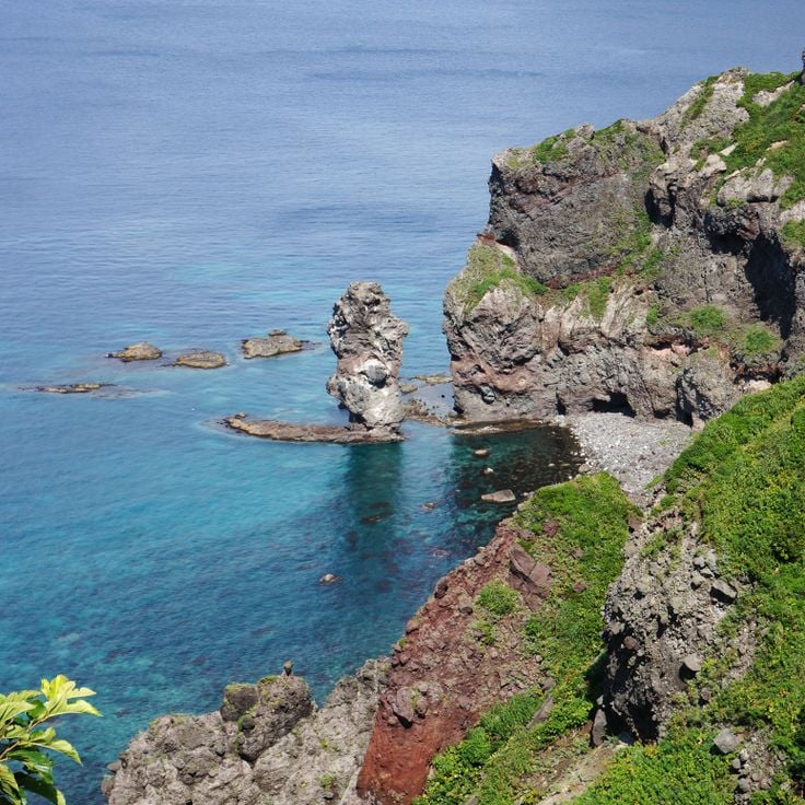
Cape Kamui is a rocky headland on the western coast of Hokkaido that juts out into the Sea of Japan. A walking trail leads to a lighthouse at the tip, with the ocean visible on nearly every side. The cliffs drop sharply into the water, and the wind is often strong along the path. In summer, wildflowers grow along the trail. It is a raw, open place where the sea feels very close, no matter where you stand.
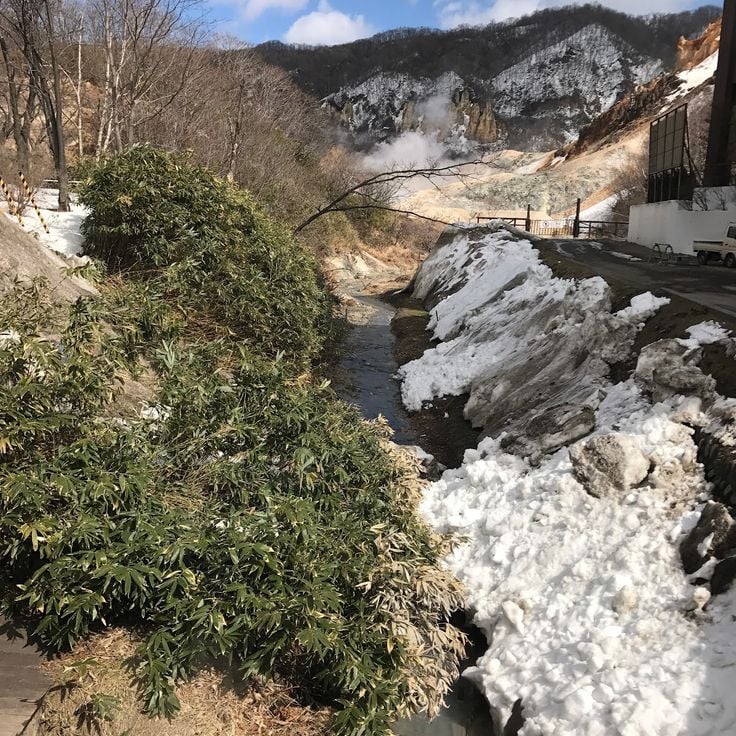
Noboribetsu Onsen is one of Hokkaido's most visited hot spring towns. The springs here produce several types of water, ranging from sulfuric to iron-rich, each with a different color and smell. Most visitors stay in traditional ryokan inns, where the baths are fed directly by the springs. A short walk leads to Jigokudani, a volcanic valley where steam rises constantly from the ground. The combination of natural activity and traditional bathing makes this a good stop on any journey through southern Hokkaido.
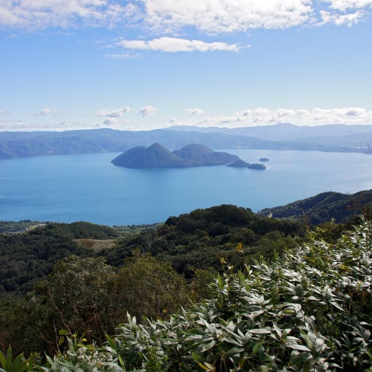
Lake Toya sits in southwestern Hokkaido, in the middle of a volcanically active area. At the center of the lake lies a forested island visible from the shore. Hot springs steam year-round around the lake, and the surrounding hills slope down to the water. Visitors often walk along the lakeside path or stop at one of the nearby thermal baths. The lake stays unfrozen even in winter, which makes it unlike most other lakes on the island.
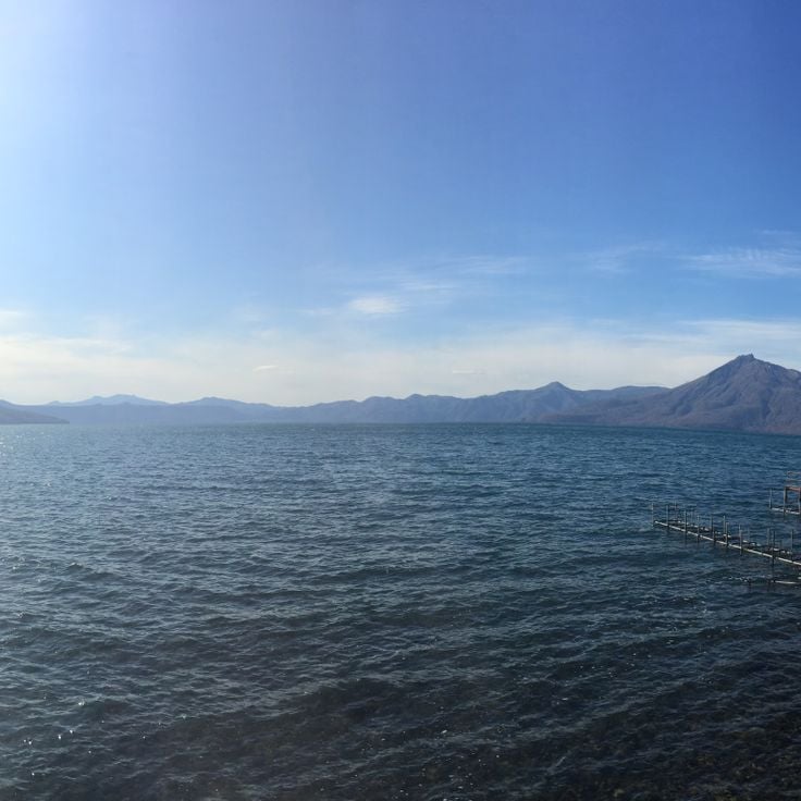
Lake Shikotsu sits in an old volcanic caldera to the southwest of Sapporo, surrounded by forested mountains. The water is remarkably clear, with a deep blue color that stands out even on overcast days. Because the lake is very deep, it rarely freezes in winter, which makes it one of the northernmost lakes in Japan to stay open year-round. The nearby hot spring resort of Shikotsu Onsen offers a place to soak after hiking the surrounding peaks. The whole area is part of a national park, making it a natural base for exploring the volcanoes nearby.
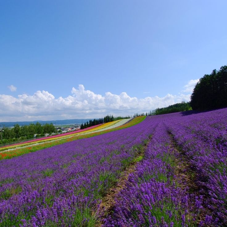
Farm Tomita sits in the Furano valley and is known above all for its lavender fields, which turn deep purple in summer. Alongside lavender, you find rows of poppies, cosmos, and other flowers planted in wide bands of color that shift from one month to the next. Visitors walk freely between the rows, and small shops sell lavender-based products on site. The farm is at its busiest in midsummer, but it draws visitors in spring and fall too.
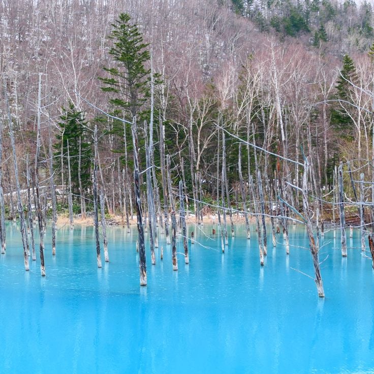
Shirogane Blue Pond is a small man-made lake near the town of Biei in Hokkaido. The water has a blue-green color that comes from minerals naturally found in the area. Dead larch trees stand in the water, their pale trunks rising above the surface. The color can shift depending on the light and the time of day. In winter, the pond sometimes freezes over, and it is occasionally lit up at night, giving it a completely different feel than during the day.
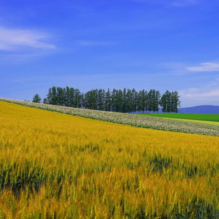
The Patchwork Road of Biei runs through open countryside where fields of flowers and crops sit side by side. Each field carries a different color, and as you walk or drive along the road, the land looks like a large pattern of colored squares. In summer, yellow, purple, and green dominate. In autumn, the tones shift to brown and gold. This road shows how farming shapes the look of the countryside in Hokkaido.
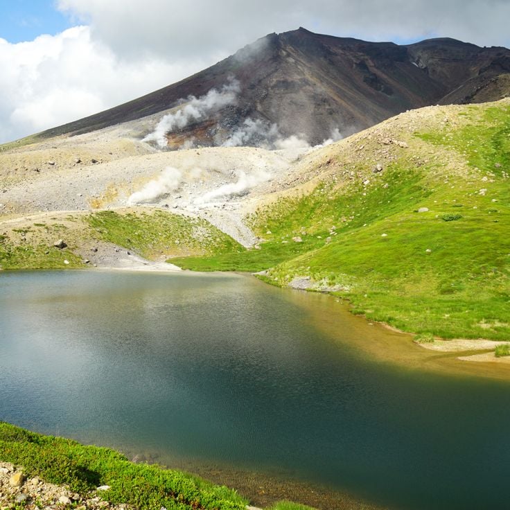
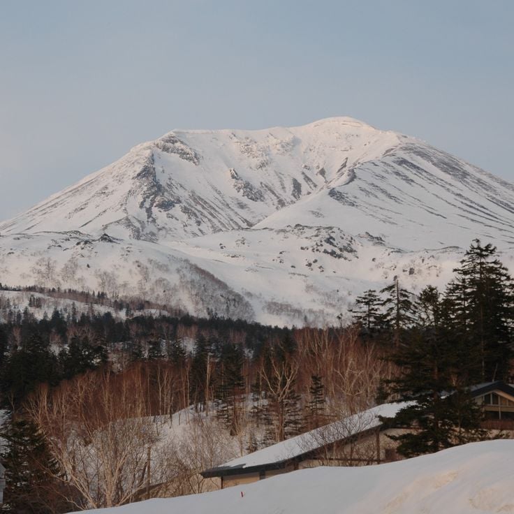
Mount Asahidake is the highest peak in Hokkaido and a starting point for hikes through volcanic terrain, steam vents, and alpine meadows. A gondola brings visitors partway up, where the views over the surrounding mountains open wide. In fall, the slopes here are among the first on the island to change color, drawing hikers who come to watch the season turn.
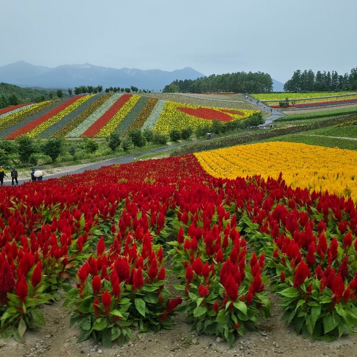
Shikisai no Oka is a hill in Hokkaido covered in large flower fields that change with the seasons. In summer, lavender and sunflowers take over, while in fall, cosmos and sage give the hill warmer tones. Visitors can walk through the rows of flowers or ride a small vehicle to reach the top and look out over the surrounding countryside. The hill is close to the town of Biei, making it easy to combine with other stops in the area.
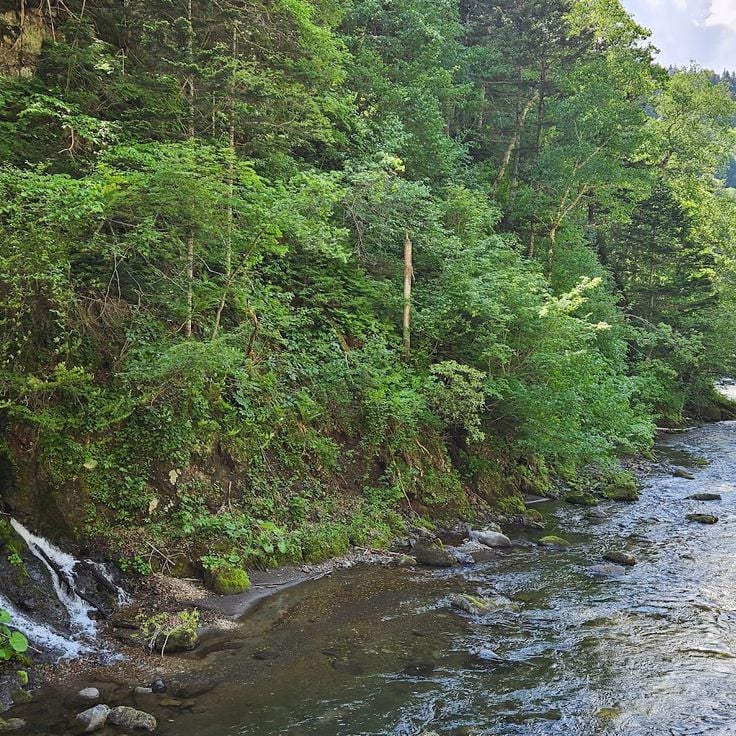
Sounkyo Gorge was carved by a river through the volcanic rock of the Daisetsuzan mountains in central Hokkaido. Sheer rock walls rise on both sides, and several waterfalls drop down the slopes. In spring, cherry blossoms line the area; in autumn, the trees turn red and orange. In winter, some waterfalls freeze into columns of ice that you can walk right up to. A path runs through the gorge and makes it easy to explore on foot.
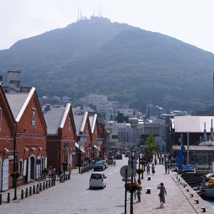
Mount Hakodate rises directly above the city and offers a clear view of the bay on both sides of the narrow peninsula. You can walk up or take the cable car to the top. During the day, the landscape of rooftops, water, and hills stretches in every direction. At night, the city lights spread across the dark shoreline, making this one of the most visited spots in southern Hokkaido.
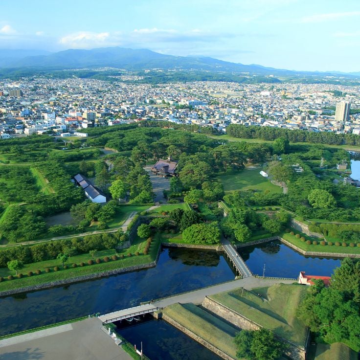
Fort Goryokaku in Hakodate is the most famous star-shaped fort in Japan. It was built in the 19th century to defend the southern tip of Hokkaido. Today, you can walk along the old earthen walls and moats that still stand. A museum on the grounds tells the story of the fort, especially the final battle of the Edo period that took place here. From a nearby observation tower, the star shape of the fort is easy to see from above.
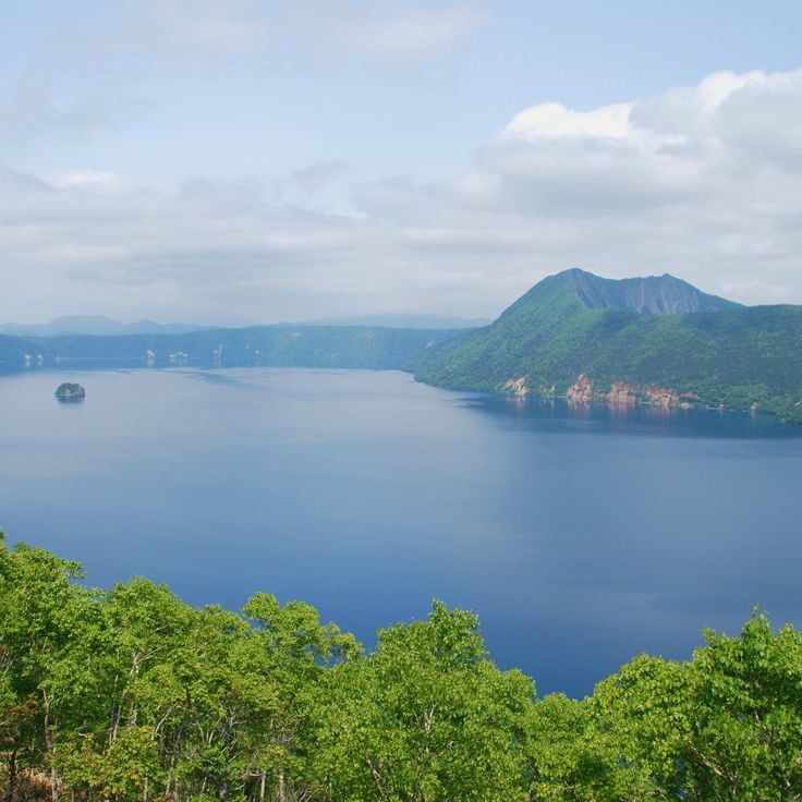
Lake Mashu sits inside an old volcanic crater in Akan-Mashu National Park. Its water is dark blue and very deep. Steep cliffs drop straight into the lake on all sides, making it impossible to reach the shoreline on foot. Fog often rolls in and covers the surface, sometimes for days at a time. Visitors look down at the lake from viewpoints along the crater rim, where the view shifts depending on the weather and the season.
Lake Akan sits in eastern Hokkaido and is known for its marimo, round balls of algae that drift slowly through the water. These rare formations grow in only a few lakes in the world. Dense forests surround the lake, and Ainu communities live along its shores, keeping their traditions alive through crafts, music and dance. The lake sits in a volcanic area, which gives the water a particular color.
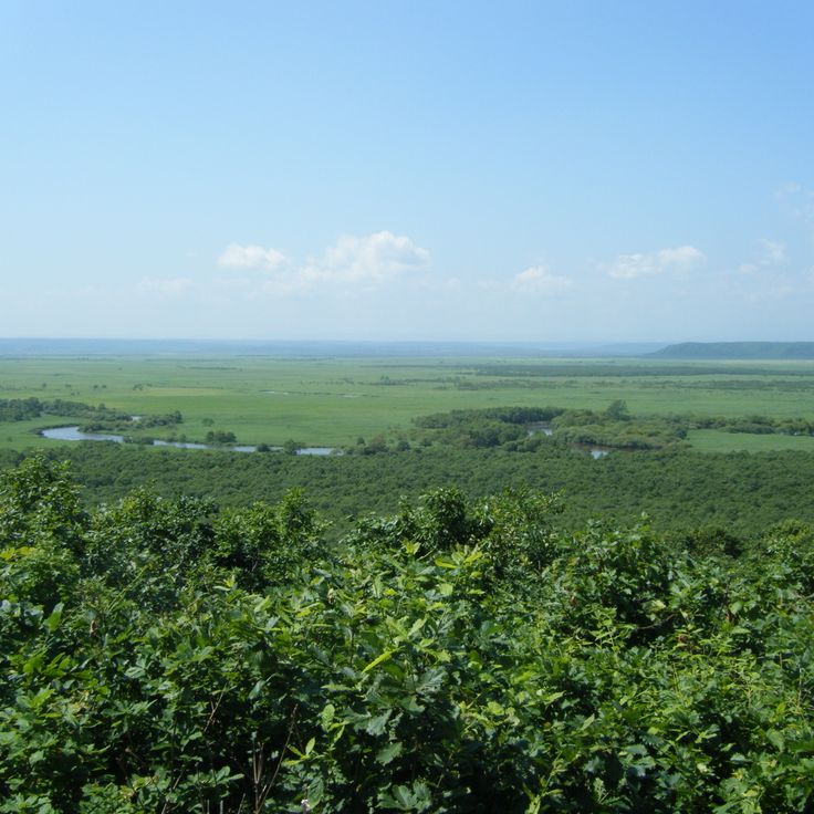
Kushiro Shitsugen National Park protects the largest wetland in Japan. Walking along its boardwalks, you can watch red-crowned cranes moving slowly through the reeds, especially in winter when they gather in large groups. The landscape is flat and open, with tall grasses and marshes stretching as far as the eye can see. This is one of the best places in Hokkaido to see birds in their natural habitat.
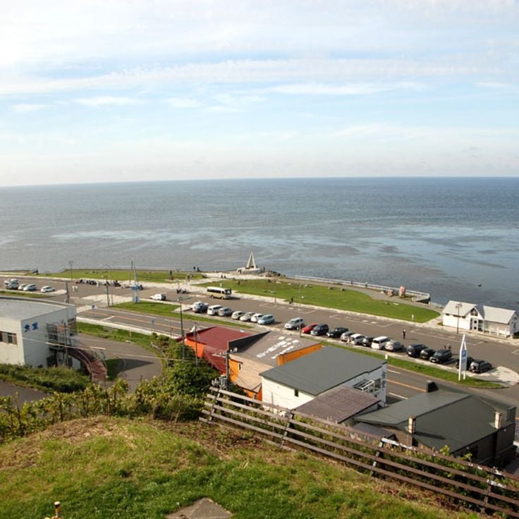
Cape Soya is the northernmost point of Hokkaido, and of Japan as a whole, sitting at the edge of a strait that separates the island from Sakhalin. A white lighthouse stands here, marking the tip of the land. On clear days, the Russian island appears on the horizon, close enough to feel real. The wind is nearly constant, and the sea looks open and rough. Many visitors make the trip just to stand at this far end of the country.
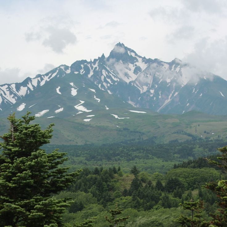
Rishiri Island sits off the northwestern coast of Hokkaido and can only be reached by ferry. The Rishiri-zan volcano rises steeply from the sea and is visible from almost anywhere on the island. Its slopes are covered with grass and rock, and those who climb to the top can see the ocean on all sides on a clear day. Down in the village, fishermen harvest sea urchins and kelp, two products the island is known for.
Daisetsuzan National Park sits at the heart of Hokkaido and is Japan's largest national park. Several peaks rise above 6,500 feet (2,000 m), including Asahi-dake, the island's highest point. The terrain shifts between volcanic craters, hot springs, subalpine forests, and open mountain meadows. Autumn arrives here earlier than anywhere else in Japan, and the hillsides turn vivid shades of red and orange well before the rest of the country. Hikers and wildlife watchers will find long trails and a wide range of mountain birds and animals.
Shiretoko National Park sits on the northeastern tip of Hokkaido, where cliffs drop straight into the Sea of Okhotsk. Behind the coast, old-growth forests cover the hills, home to brown bears, deer, and Steller's sea eagles. In winter, drift ice from Siberia reaches the shore. Visitors can take boat tours along the cliffs, hike across the peninsula, or walk the raised boardwalks of the Shiretoko Five Lakes area.
The Shiretoko Five Lakes sit on the Shiretoko Peninsula in northern Hokkaido, within an area recognized as a UNESCO World Natural Heritage site. The five lakes are surrounded by thick forests, and their still waters mirror the trees and sky above. Walking trails run close along their shores, through a setting where brown bears, deer, and foxes roam freely. In autumn, the leaves change color and the whole scene transforms.
Sapporo is the capital of Hokkaido and its largest city. Wide avenues, urban parks, local restaurants and museums give the city a comfortable rhythm. In winter, the city hosts a snow festival where large ice and snow sculptures are built in the streets. Sapporo is also a natural starting point for exploring the rest of Hokkaido, with mountains, lakes and rural areas all within easy reach.
Mount Moiwa sits at the edge of Sapporo and offers a wide view over the city and the plain around it. You can ride a ropeway and then a small gondola to reach the top. From the summit, you can see the city rooftops, the mountains beyond, and on clear days the sea in the distance. The view changes completely after dark, when the city lights spread across the valley below.
The Otaru Canal was built in the early 20th century to help move goods between ships and the city. Today, the old stone warehouses that line the water have been turned into restaurants, shops, and small museums. Walking along the canal, you get a real sense of what this trading port once looked like. The area is calm in the morning and busy in the evening, when lanterns along the water light up the stone facades.
Cape Kamui is a rocky headland on the western coast of Hokkaido that juts out into the Sea of Japan. A walking trail leads to a lighthouse at the tip, with the ocean visible on nearly every side. The cliffs drop sharply into the water, and the wind is often strong along the path. In summer, wildflowers grow along the trail. It is a raw, open place where the sea feels very close, no matter where you stand.
Noboribetsu Onsen is one of Hokkaido's most visited hot spring towns. The springs here produce several types of water, ranging from sulfuric to iron-rich, each with a different color and smell. Most visitors stay in traditional ryokan inns, where the baths are fed directly by the springs. A short walk leads to Jigokudani, a volcanic valley where steam rises constantly from the ground. The combination of natural activity and traditional bathing makes this a good stop on any journey through southern Hokkaido.
Lake Toya sits in southwestern Hokkaido, in the middle of a volcanically active area. At the center of the lake lies a forested island visible from the shore. Hot springs steam year-round around the lake, and the surrounding hills slope down to the water. Visitors often walk along the lakeside path or stop at one of the nearby thermal baths. The lake stays unfrozen even in winter, which makes it unlike most other lakes on the island.
Lake Shikotsu sits in an old volcanic caldera to the southwest of Sapporo, surrounded by forested mountains. The water is remarkably clear, with a deep blue color that stands out even on overcast days. Because the lake is very deep, it rarely freezes in winter, which makes it one of the northernmost lakes in Japan to stay open year-round. The nearby hot spring resort of Shikotsu Onsen offers a place to soak after hiking the surrounding peaks. The whole area is part of a national park, making it a natural base for exploring the volcanoes nearby.
Farm Tomita sits in the Furano valley and is known above all for its lavender fields, which turn deep purple in summer. Alongside lavender, you find rows of poppies, cosmos, and other flowers planted in wide bands of color that shift from one month to the next. Visitors walk freely between the rows, and small shops sell lavender-based products on site. The farm is at its busiest in midsummer, but it draws visitors in spring and fall too.
Shirogane Blue Pond is a small man-made lake near the town of Biei in Hokkaido. The water has a blue-green color that comes from minerals naturally found in the area. Dead larch trees stand in the water, their pale trunks rising above the surface. The color can shift depending on the light and the time of day. In winter, the pond sometimes freezes over, and it is occasionally lit up at night, giving it a completely different feel than during the day.
The Patchwork Road of Biei runs through open countryside where fields of flowers and crops sit side by side. Each field carries a different color, and as you walk or drive along the road, the land looks like a large pattern of colored squares. In summer, yellow, purple, and green dominate. In autumn, the tones shift to brown and gold. This road shows how farming shapes the look of the countryside in Hokkaido.
Mount Asahidake is the highest peak in Hokkaido and a starting point for hikes through volcanic terrain, steam vents, and alpine meadows. A gondola brings visitors partway up, where the views over the surrounding mountains open wide. In fall, the slopes here are among the first on the island to change color, drawing hikers who come to watch the season turn.
Shikisai no Oka is a hill in Hokkaido covered in large flower fields that change with the seasons. In summer, lavender and sunflowers take over, while in fall, cosmos and sage give the hill warmer tones. Visitors can walk through the rows of flowers or ride a small vehicle to reach the top and look out over the surrounding countryside. The hill is close to the town of Biei, making it easy to combine with other stops in the area.
Sounkyo Gorge was carved by a river through the volcanic rock of the Daisetsuzan mountains in central Hokkaido. Sheer rock walls rise on both sides, and several waterfalls drop down the slopes. In spring, cherry blossoms line the area; in autumn, the trees turn red and orange. In winter, some waterfalls freeze into columns of ice that you can walk right up to. A path runs through the gorge and makes it easy to explore on foot.
Mount Hakodate rises directly above the city and offers a clear view of the bay on both sides of the narrow peninsula. You can walk up or take the cable car to the top. During the day, the landscape of rooftops, water, and hills stretches in every direction. At night, the city lights spread across the dark shoreline, making this one of the most visited spots in southern Hokkaido.
Fort Goryokaku in Hakodate is the most famous star-shaped fort in Japan. It was built in the 19th century to defend the southern tip of Hokkaido. Today, you can walk along the old earthen walls and moats that still stand. A museum on the grounds tells the story of the fort, especially the final battle of the Edo period that took place here. From a nearby observation tower, the star shape of the fort is easy to see from above.
Lake Mashu sits inside an old volcanic crater in Akan-Mashu National Park. Its water is dark blue and very deep. Steep cliffs drop straight into the lake on all sides, making it impossible to reach the shoreline on foot. Fog often rolls in and covers the surface, sometimes for days at a time. Visitors look down at the lake from viewpoints along the crater rim, where the view shifts depending on the weather and the season.
Lake Akan sits in eastern Hokkaido and is known for its marimo, round balls of algae that drift slowly through the water. These rare formations grow in only a few lakes in the world. Dense forests surround the lake, and Ainu communities live along its shores, keeping their traditions alive through crafts, music and dance. The lake sits in a volcanic area, which gives the water a particular color.
Kushiro Shitsugen National Park protects the largest wetland in Japan. Walking along its boardwalks, you can watch red-crowned cranes moving slowly through the reeds, especially in winter when they gather in large groups. The landscape is flat and open, with tall grasses and marshes stretching as far as the eye can see. This is one of the best places in Hokkaido to see birds in their natural habitat.
Cape Soya is the northernmost point of Hokkaido, and of Japan as a whole, sitting at the edge of a strait that separates the island from Sakhalin. A white lighthouse stands here, marking the tip of the land. On clear days, the Russian island appears on the horizon, close enough to feel real. The wind is nearly constant, and the sea looks open and rough. Many visitors make the trip just to stand at this far end of the country.
Rishiri Island sits off the northwestern coast of Hokkaido and can only be reached by ferry. The Rishiri-zan volcano rises steeply from the sea and is visible from almost anywhere on the island. Its slopes are covered with grass and rock, and those who climb to the top can see the ocean on all sides on a clear day. Down in the village, fishermen harvest sea urchins and kelp, two products the island is known for.
Daisetsuzan National Park sits at the heart of Hokkaido and is Japan's largest national park. Several peaks rise above 6,500 feet (2,000 m), including Asahi-dake, the island's highest point. The terrain shifts between volcanic craters, hot springs, subalpine forests, and open mountain meadows. Autumn arrives here earlier than anywhere else in Japan, and the hillsides turn vivid shades of red and orange well before the rest of the country. Hikers and wildlife watchers will find long trails and a wide range of mountain birds and animals.
Shiretoko National Park sits on the northeastern tip of Hokkaido, where cliffs drop straight into the Sea of Okhotsk. Behind the coast, old-growth forests cover the hills, home to brown bears, deer, and Steller's sea eagles. In winter, drift ice from Siberia reaches the shore. Visitors can take boat tours along the cliffs, hike across the peninsula, or walk the raised boardwalks of the Shiretoko Five Lakes area.
The Shiretoko Five Lakes sit on the Shiretoko Peninsula in northern Hokkaido, within an area recognized as a UNESCO World Natural Heritage site. The five lakes are surrounded by thick forests, and their still waters mirror the trees and sky above. Walking trails run close along their shores, through a setting where brown bears, deer, and foxes roam freely. In autumn, the leaves change color and the whole scene transforms.
Sapporo is the capital of Hokkaido and its largest city. Wide avenues, urban parks, local restaurants and museums give the city a comfortable rhythm. In winter, the city hosts a snow festival where large ice and snow sculptures are built in the streets. Sapporo is also a natural starting point for exploring the rest of Hokkaido, with mountains, lakes and rural areas all within easy reach.
Mount Moiwa sits at the edge of Sapporo and offers a wide view over the city and the plain around it. You can ride a ropeway and then a small gondola to reach the top. From the summit, you can see the city rooftops, the mountains beyond, and on clear days the sea in the distance. The view changes completely after dark, when the city lights spread across the valley below.
The Otaru Canal was built in the early 20th century to help move goods between ships and the city. Today, the old stone warehouses that line the water have been turned into restaurants, shops, and small museums. Walking along the canal, you get a real sense of what this trading port once looked like. The area is calm in the morning and busy in the evening, when lanterns along the water light up the stone facades.
Cape Kamui is a rocky headland on the western coast of Hokkaido that juts out into the Sea of Japan. A walking trail leads to a lighthouse at the tip, with the ocean visible on nearly every side. The cliffs drop sharply into the water, and the wind is often strong along the path. In summer, wildflowers grow along the trail. It is a raw, open place where the sea feels very close, no matter where you stand.
Noboribetsu Onsen is one of Hokkaido's most visited hot spring towns. The springs here produce several types of water, ranging from sulfuric to iron-rich, each with a different color and smell. Most visitors stay in traditional ryokan inns, where the baths are fed directly by the springs. A short walk leads to Jigokudani, a volcanic valley where steam rises constantly from the ground. The combination of natural activity and traditional bathing makes this a good stop on any journey through southern Hokkaido.
Lake Toya sits in southwestern Hokkaido, in the middle of a volcanically active area. At the center of the lake lies a forested island visible from the shore. Hot springs steam year-round around the lake, and the surrounding hills slope down to the water. Visitors often walk along the lakeside path or stop at one of the nearby thermal baths. The lake stays unfrozen even in winter, which makes it unlike most other lakes on the island.
Lake Shikotsu sits in an old volcanic caldera to the southwest of Sapporo, surrounded by forested mountains. The water is remarkably clear, with a deep blue color that stands out even on overcast days. Because the lake is very deep, it rarely freezes in winter, which makes it one of the northernmost lakes in Japan to stay open year-round. The nearby hot spring resort of Shikotsu Onsen offers a place to soak after hiking the surrounding peaks. The whole area is part of a national park, making it a natural base for exploring the volcanoes nearby.
Farm Tomita sits in the Furano valley and is known above all for its lavender fields, which turn deep purple in summer. Alongside lavender, you find rows of poppies, cosmos, and other flowers planted in wide bands of color that shift from one month to the next. Visitors walk freely between the rows, and small shops sell lavender-based products on site. The farm is at its busiest in midsummer, but it draws visitors in spring and fall too.
Shirogane Blue Pond is a small man-made lake near the town of Biei in Hokkaido. The water has a blue-green color that comes from minerals naturally found in the area. Dead larch trees stand in the water, their pale trunks rising above the surface. The color can shift depending on the light and the time of day. In winter, the pond sometimes freezes over, and it is occasionally lit up at night, giving it a completely different feel than during the day.
The Patchwork Road of Biei runs through open countryside where fields of flowers and crops sit side by side. Each field carries a different color, and as you walk or drive along the road, the land looks like a large pattern of colored squares. In summer, yellow, purple, and green dominate. In autumn, the tones shift to brown and gold. This road shows how farming shapes the look of the countryside in Hokkaido.
Mount Asahidake is the highest peak in Hokkaido and a starting point for hikes through volcanic terrain, steam vents, and alpine meadows. A gondola brings visitors partway up, where the views over the surrounding mountains open wide. In fall, the slopes here are among the first on the island to change color, drawing hikers who come to watch the season turn.
Shikisai no Oka is a hill in Hokkaido covered in large flower fields that change with the seasons. In summer, lavender and sunflowers take over, while in fall, cosmos and sage give the hill warmer tones. Visitors can walk through the rows of flowers or ride a small vehicle to reach the top and look out over the surrounding countryside. The hill is close to the town of Biei, making it easy to combine with other stops in the area.
Sounkyo Gorge was carved by a river through the volcanic rock of the Daisetsuzan mountains in central Hokkaido. Sheer rock walls rise on both sides, and several waterfalls drop down the slopes. In spring, cherry blossoms line the area; in autumn, the trees turn red and orange. In winter, some waterfalls freeze into columns of ice that you can walk right up to. A path runs through the gorge and makes it easy to explore on foot.
Mount Hakodate rises directly above the city and offers a clear view of the bay on both sides of the narrow peninsula. You can walk up or take the cable car to the top. During the day, the landscape of rooftops, water, and hills stretches in every direction. At night, the city lights spread across the dark shoreline, making this one of the most visited spots in southern Hokkaido.
Fort Goryokaku in Hakodate is the most famous star-shaped fort in Japan. It was built in the 19th century to defend the southern tip of Hokkaido. Today, you can walk along the old earthen walls and moats that still stand. A museum on the grounds tells the story of the fort, especially the final battle of the Edo period that took place here. From a nearby observation tower, the star shape of the fort is easy to see from above.
Lake Mashu sits inside an old volcanic crater in Akan-Mashu National Park. Its water is dark blue and very deep. Steep cliffs drop straight into the lake on all sides, making it impossible to reach the shoreline on foot. Fog often rolls in and covers the surface, sometimes for days at a time. Visitors look down at the lake from viewpoints along the crater rim, where the view shifts depending on the weather and the season.
Lake Akan sits in eastern Hokkaido and is known for its marimo, round balls of algae that drift slowly through the water. These rare formations grow in only a few lakes in the world. Dense forests surround the lake, and Ainu communities live along its shores, keeping their traditions alive through crafts, music and dance. The lake sits in a volcanic area, which gives the water a particular color.
Kushiro Shitsugen National Park protects the largest wetland in Japan. Walking along its boardwalks, you can watch red-crowned cranes moving slowly through the reeds, especially in winter when they gather in large groups. The landscape is flat and open, with tall grasses and marshes stretching as far as the eye can see. This is one of the best places in Hokkaido to see birds in their natural habitat.
Cape Soya is the northernmost point of Hokkaido, and of Japan as a whole, sitting at the edge of a strait that separates the island from Sakhalin. A white lighthouse stands here, marking the tip of the land. On clear days, the Russian island appears on the horizon, close enough to feel real. The wind is nearly constant, and the sea looks open and rough. Many visitors make the trip just to stand at this far end of the country.
Rishiri Island sits off the northwestern coast of Hokkaido and can only be reached by ferry. The Rishiri-zan volcano rises steeply from the sea and is visible from almost anywhere on the island. Its slopes are covered with grass and rock, and those who climb to the top can see the ocean on all sides on a clear day. Down in the village, fishermen harvest sea urchins and kelp, two products the island is known for.
Daisetsuzan National Park sits at the heart of Hokkaido and is Japan's largest national park. Several peaks rise above 6,500 feet (2,000 m), including Asahi-dake, the island's highest point. The terrain shifts between volcanic craters, hot springs, subalpine forests, and open mountain meadows. Autumn arrives here earlier than anywhere else in Japan, and the hillsides turn vivid shades of red and orange well before the rest of the country. Hikers and wildlife watchers will find long trails and a wide range of mountain birds and animals.
Prepare your visit according to the seasons: each month reveals a different Hokkaido, and some paths become impassable in winter. Check local calendars before you go.