Enable Location

We need your location to show you interesting places around you

Discover nearby places

Find interesting locations and hidden gems around you

Precise directions

Get accurate directions and distances to places

Your location is never shared with other users. It's only used when you tap the location button.

Alexander County

Log in to your account

Start exploring — it's free

Trusted by 61,920 travelers worldwide

Continue with Google
Continue with Apple
or

We will send you a code to connect

By continuing, you accept our Terms and Conditions and our Privacy Policy

Check your inbox

We've sent a pincode in your inbox. Please enter the code below.

Alexander County, Administrative county in southern Illinois, United States.

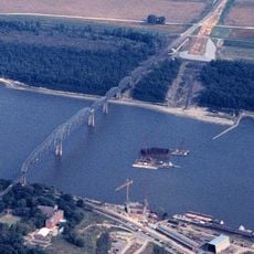
Alexander County is an administrative county in the southernmost part of Illinois where the Mississippi River and Ohio River converge. The territory encompasses several small towns and rural communities spread across the landscape.

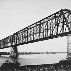
The county was established in March 1819 and named after William M. Alexander, who served as Speaker of the Illinois House of Representatives. The region was economically tied to river commerce and farming during this period.

The county experienced significant demographic changes through migrations, leading to a diverse population mix of European and African American communities.

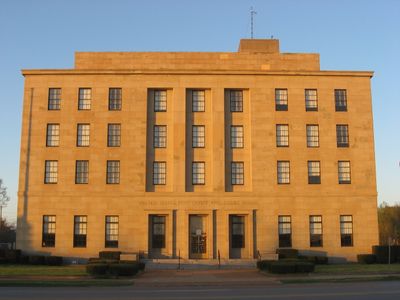
County administration operates from the courthouse in Cairo, serving residents throughout the region. Visitors should focus on the central towns and riverfront areas for the most accessible experience.

Alexander County recorded the largest population decrease among all United States counties between 2010 and 2020, declining by 36.4 percent.

The community of curious travelers

AroundUs brings together thousands of curated places, local tips, and hidden gems, enriched daily by 60,000 contributors worldwide.

Start exploring
Location
Inception
March 4, 1819
Capital city
Cairo
Part of
Cape Girardeau, MO-IL Metropolitan Statistical Area
Shares border with
Union County, Ballard County, Pulaski County, Mississippi County, Scott County, Cape Girardeau County
GPS coordinates
37.19000,-89.34000
Latest update
December 20, 2025 14:46
Around this place
United States of America

Fort Defiance

28.5 km
Cairo Mississippi River Bridge
United States of America

Cairo Mississippi River Bridge

29.1 km
Magnolia Manor
United States of America

Magnolia Manor

24.5 km
Cache River
United States of America

Cache River

20.2 km
Bill Emerson Memorial Bridge
United States of America

Bill Emerson Memorial Bridge

19.5 km
Cairo Ohio River Bridge
United States of America

Cairo Ohio River Bridge

27.8 km
Cape Girardeau Bridge
United States of America

Cape Girardeau Bridge

19.5 km
Cairo Rail Bridge
United States of America

Cairo Rail Bridge

23.6 km
Cairo I-57 Bridge
United States of America

Cairo I-57 Bridge

21.8 km
Thebes Bridge
United States of America

Thebes Bridge

11.6 km
United States of America

Twin Mounds Site

22.1 km
Cairo Historic District
United States of America

Cairo Historic District

25.3 km
Dogtooth Bend Mounds and Village Site
United States of America

Dogtooth Bend Mounds and Village Site

14 km
United States of America

Horseshoe Lake State Fish and Wildlife Area

6.6 km
Mound City National Cemetery
United States of America

Mound City National Cemetery

19.5 km
Horseshoe Lake
United States of America

Horseshoe Lake

4.8 km
Glenn House
United States of America

Glenn House

20 km
Mound City Civil War Naval Hospital
United States of America

Mound City Civil War Naval Hospital

19.5 km
St. Vincent De Paul Catholic Church
United States of America

St. Vincent De Paul Catholic Church

20.1 km
Thebes Courthouse
United States of America

Thebes Courthouse

11.1 km
B'Nai Israel Synagogue
United States of America

B'Nai Israel Synagogue

20.2 km
United States of America

Confederate War Memorial

20.5 km
Thomas J. and Caroline McClure House
United States of America

Thomas J. and Caroline McClure House

16.4 km
Cape Girardeau Commercial Historic District
United States of America

Cape Girardeau Commercial Historic District

20.5 km
Pulaski County Courthouse
United States of America

Pulaski County Courthouse

19.3 km
Charles Isaac and Lizzie Hunter Moore Anderson House
United States of America

Charles Isaac and Lizzie Hunter Moore Anderson House

10.5 km
Cape Girardeau Court of Common Pleas
United States of America

Cape Girardeau Court of Common Pleas

20.5 km
August and Amalia Shivelbine House
United States of America

August and Amalia Shivelbine House

20.2 km
Show the full map
« Alexander County - Administrative county in southern Illinois, United States » is provided by Around Us (aroundus.com). Images and texts are derived from Wikimedia project under a Creative Commons license. You are allowed to copy, distribute, and modify copies of this page, under the conditions set by the license, as long as this note is clearly visible.

Discover hidden gems everywhere you go!

From secret cafés to breathtaking viewpoints, skip the crowded tourist spots and find places that match your style. Our app makes it easy with voice search, smart filtering, route optimization, and insider tips from travelers worldwide. Download now for the complete mobile experience.

Around Us App Screenshot

A unique approach to discovering new places

Le Figaro

All the places worth exploring

France Info

A tailor-made excursion in just a few clicks

20 Minutes

Around Us
Travel Guide & Maps
Download

Send to your phone

QR Code
1

Open the camera app on your mobile.

2

Point at the QR code with your camera. A notification will appear.

3

Tap the notification to open the link.