Vilas County

Log in to your account

AroundUs is a community-driven map of interesting places, built by curious explorers like you. It grows with every review, story, and photo you share.
Connect to save your favorite spots, contribute locations, and create personalized routes.
By continuing, you accept our Terms and Conditions and our Privacy Policy
Add to collection
Map
Suggest a change
Share

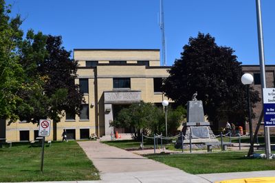
Vilas County, County administrative division in northern Wisconsin, United States.

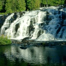
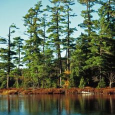
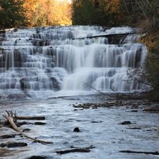
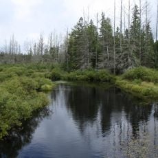
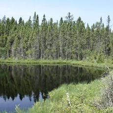
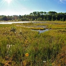
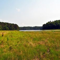
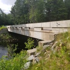
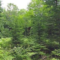
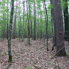
Vilas County is an administrative division in northern Wisconsin characterized by forests and extensive waterways. The landscape consists largely of woodlands interspersed with numerous lakes and rivers that define the region.

The county was established in 1893 and named after William Freeman Vilas, a prominent Wisconsin Senator. The region has long been shaped by the Ojibwe people, who secured a reservation through a treaty made that same year.

The Lac du Flambeau Indian Reservation shapes the cultural identity of the area and keeps Ojibwe traditions alive in the community. Visitors can experience this heritage through local events and gathering places.

Visitors can navigate the area using the free 'Map It Vilas County' app, which offers offline maps for outdoor activities. This tool allows exploration without requiring cellular service across the region.

The region contains an exceptional number of over 1,300 lakes, including the longest chain of connected freshwater lakes in the world. This concentration of water bodies makes the area a remarkable natural phenomenon.

Location: Wisconsin

Inception: 1893

Capital city: Eagle River

Shares border with: Gogebic County, Iron County, Forest County, Oneida County, Price County, Iron County

Website: http://co.vilas.wi.us

GPS coordinates: 46.05000,-89.51000

Latest update: December 7, 2025 19:23

Photos
Around this place
Show the full map
Bond Falls
United States of America

Bond Falls

49.5 km
Sylvania Wilderness
United States of America

Sylvania Wilderness

24.7 km
Agate Falls Scenic Site
United States of America

Agate Falls Scenic Site

57.8 km
Northern Highland-American Legion State Forest
United States of America

Northern Highland-American Legion State Forest

11.2 km
Powell Marsh Wildlife Area
United States of America

Powell Marsh Wildlife Area

28.7 km
Headwaters Wilderness
United States of America

Headwaters Wilderness

50.6 km
Blackjack Springs Wilderness
United States of America

Blackjack Springs Wilderness

33.7 km
Eagle River Stadium
United States of America

Eagle River Stadium

27.7 km
Pioneer Park Historical Complex
United States of America

Pioneer Park Historical Complex

44.8 km
Black Tern Bog State Natural Area
United States of America

Black Tern Bog State Natural Area

17.2 km
Sunset Point
United States of America

Sunset Point

30.2 km
Wind Pudding Lake State Natural Area
United States of America

Wind Pudding Lake State Natural Area

33.6 km
Franklin Lake Campground
United States of America

Franklin Lake Campground

42.1 km
Oneida County Courthouse
United States of America

Oneida County Courthouse

46.6 km
Rice Creek State Natural Area
United States of America

Rice Creek State Natural Area

22.4 km
Solon and Mathilda Sutliff House
United States of America

Solon and Mathilda Sutliff House

46.5 km
First National Bank
United States of America

First National Bank

46.5 km
Forest Route 157–Tamarack River Bridge
United States of America

Forest Route 157–Tamarack River Bridge

46.5 km
Bergland Administrative Site
United States of America

Bergland Administrative Site

60.5 km
Bose Lake Hemlock Hardwoods
United States of America

Bose Lake Hemlock Hardwoods

43.6 km
Finnerud Forest Scientific Area
United States of America

Finnerud Forest Scientific Area

28.2 km
Lake Gogebic State Park
United States of America

Lake Gogebic State Park

45.6 km
PPHC - Railroad Museum
United States of America

PPHC - Railroad Museum

47.3 km
Lake Gogebic
United States of America

Lake Gogebic

50.4 km
Main Street – Black River Bridge
United States of America

Main Street – Black River Bridge

60.4 km
State Theatre
United States of America

State Theatre

46.4 km
Smith Rapids Covered Bridge
United States of America

Smith Rapids Covered Bridge

53.5 km
James W. Toumey Nursery
United States of America

James W. Toumey Nursery

36 km
Show the full map
Reviews

Visited this place? Tap the stars to rate it and share your experience / photos with the community! Try now! You can cancel it anytime.

« Vilas County - County administrative division in northern Wisconsin, United States » is provided by Around Us (aroundus.com). Images and texts are derived from Wikimedia project under a Creative Commons license. You are allowed to copy, distribute, and modify copies of this page, under the conditions set by the license, as long as this note is clearly visible.

Discover hidden gems everywhere you go!

From secret cafés to breathtaking viewpoints, skip the crowded tourist spots and find places that match your style. Our app makes it easy with voice search, smart filtering, route optimization, and insider tips from travelers worldwide. Download now for the complete mobile experience.

Around Us App Screenshot

A unique approach to discovering new places

Le Figaro

All the places worth exploring

France Info

A tailor-made excursion in just a few clicks

20 Minutes