Agate Falls Scenic Site

Log in to your account

AroundUs is a community-driven map of interesting places, built by curious explorers like you. It grows with every review, story, and photo you share.
Connect to save your favorite spots, contribute locations, and create personalized routes.
Continue with Google
Continue with Apple
Continue with X
Continue with Facebook
Continue with email
By continuing, you accept our Terms and Conditions and our Privacy Policy
Create an account
Add to collection
Map
Suggest a change
Share

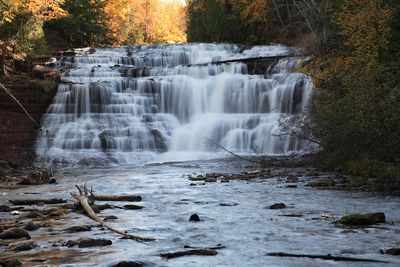
Agate Falls Scenic Site, State park waterfall in Ontonagon County, Michigan.

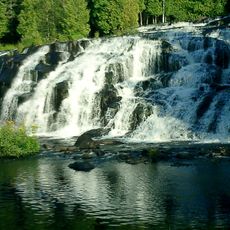
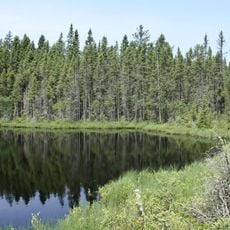
Agate Falls is a waterfall in Ontonagon County where water drops over multiple sandstone layers, creating several streams of flow.The water eventually reaches the middle branch of the Ontonagon River, forming a natural structure shaped by the erosion of geological layers over long periods of time.

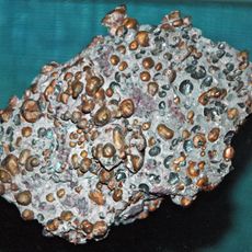
The Ontonagon River carved this formation over millions of years, cutting through sandstone and exposing different geological layers.These erosion processes show how water reshapes the land across vast spans of time.

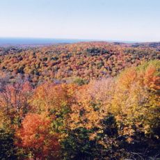
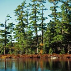
The waterfall draws visitors interested in experiencing the natural landscape of Michigan's Upper Peninsula across different seasons.People come here to observe how water interacts with rock formations and to photograph the changing environment throughout the year.

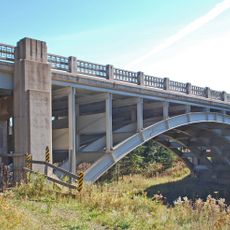
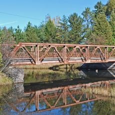
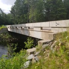
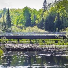
The site is reachable via a half-mile trail that passes under the M-28 highway and leads to an observation platform.This path offers views of both the waterfall and the railroad bridges, with good vantage points for photography.

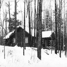
In winter months, the flowing water freezes into complicated ice formations, transforming the entire site into a natural ice sculpture.These ice structures form when the cascading water hardens in cold temperatures and creates striking patterns.

Location: Ontonagon County

Location: Michigan

Part of: Ontonagon River

Website: https://www2.dnr.state.mi.us/parksandtrails/details.aspx?id=413&type=SPRK

GPS coordinates: 46.48083,-89.09096

Latest update: December 11, 2025 18:02

Photos
Around this place
Porcupine Mountains
United States of America

Porcupine Mountains

59.6 km
Copper mining in Michigan
United States of America

Copper mining in Michigan

47.9 km
Bond Falls
United States of America

Bond Falls

8.5 km
Sylvania Wilderness
United States of America

Sylvania Wilderness

33.5 km
Ontonagon School
United States of America

Ontonagon School

46.3 km
Blackjack Springs Wilderness
United States of America

Blackjack Springs Wilderness

56.2 km
Twin Lakes State Park
United States of America

Twin Lakes State Park

49 km
United States of America

Sturgeon River Gorge Wilderness

33 km
United States of America

O Kun de Kun Falls

19.3 km
Ontonagon Light
United States of America

Ontonagon Light

47.1 km
Central School
United States of America

Central School

55.3 km
Franklin Lake Campground
United States of America

Franklin Lake Campground

61.6 km
Canyon Falls Bridge
United States of America

Canyon Falls Bridge

50.2 km
Ontonagon Harbor Piers Historic District
United States of America

Ontonagon Harbor Piers Historic District

47.2 km
Ontonagon County Courthouse
United States of America

Ontonagon County Courthouse

46.9 km
Zeba Indian United Methodist Church
United States of America

Zeba Indian United Methodist Church

61.5 km
Saint Henry's Evangelical Lutheran Church and Cemetery
United States of America

Saint Henry's Evangelical Lutheran Church and Cemetery

39.4 km
Old US 41–Backwater Creek Bridge
United States of America

Old US 41–Backwater Creek Bridge

54.8 km
Rice Creek State Natural Area
United States of America

Rice Creek State Natural Area

61.6 km
Forest Route 157–Tamarack River Bridge
United States of America

Forest Route 157–Tamarack River Bridge

27.4 km
Bergland Administrative Site
United States of America

Bergland Administrative Site

39.2 km
Bose Lake Hemlock Hardwoods
United States of America

Bose Lake Hemlock Hardwoods

61.8 km
Chicagon Mine Road–Chicagon Creek Bridge
United States of America

Chicagon Mine Road–Chicagon Creek Bridge

62 km
Lake Gogebic State Park
United States of America

Lake Gogebic State Park

37.3 km
Porcupine Mountains Wilderness State Park
United States of America

Porcupine Mountains Wilderness State Park

60.8 km
Lake Gogebic
United States of America

Lake Gogebic

37.8 km
Most Holy Name of Jesus--Saint Blessed Kateri Tekakwitha Catholic Church
United States of America

Most Holy Name of Jesus--Saint Blessed Kateri Tekakwitha Catholic Church

59.7 km
James W. Toumey Nursery
United States of America

James W. Toumey Nursery

24 km
Show the full map
Reviews

Visited this place? Tap the stars to rate it and share your experience / photos with the community! Try now! You can cancel it anytime.

« Agate Falls Scenic Site - State park waterfall in Ontonagon County, Michigan » is provided by Around Us (aroundus.com). Images and texts are derived from Wikimedia project under a Creative Commons license. You are allowed to copy, distribute, and modify copies of this page, under the conditions set by the license, as long as this note is clearly visible.

Discover hidden gems everywhere you go!

From secret cafés to breathtaking viewpoints, skip the crowded tourist spots and find places that match your style. Our app makes it easy with voice search, smart filtering, route optimization, and insider tips from travelers worldwide. Download now for the complete mobile experience.

Around Us App Screenshot

A unique approach to discovering new places

Le Figaro

All the places worth exploring

France Info

A tailor-made excursion in just a few clicks

20 Minutes