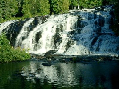
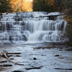
Bond Falls, Waterfall in Ontonagon County, United States.
Bond Falls consists of several cascading drops that plunge approximately 50 feet, forming white water patterns against dark stone walls. The falls sit within a forested river setting where the multiple tiers create a layered natural structure that changes appearance depending on water flow and season.
Recognition of the site grew during the 1920s when a nearby hydroelectric dam construction altered the river's water discharge. This engineering project had lasting effects on how water flows through the falls and the landscape's appearance over time.
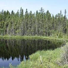
The Ojibwe people regarded these cascading waters as a sacred place for their gatherings before settlers arrived in the region. Visitors today can sense this spiritual connection when standing near the falls and observing how the landscape still holds deep meaning for indigenous communities.
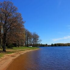
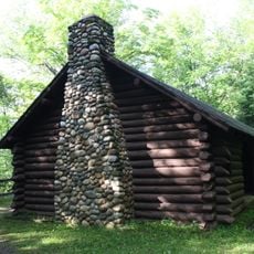
An accessible boardwalk system with observation platforms allows visitors to view the falls safely and comfortably from multiple angles. Parking is available on-site, and maintained walking trails remain open throughout the year regardless of weather conditions.
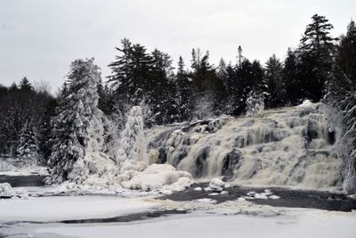
During winter, the falling water freezes into towering ice formations that cling to the rock faces, transforming the appearance completely. Photographers and winter visitors often return specifically to capture this frozen landscape, which looks entirely different from warmer months.
Location: Michigan
Part of: Ontonagon River
GPS coordinates: 46.40967,-89.13265
Latest update: December 6, 2025 16:03
Michigan holds a wide array of natural and historical sites across its two peninsulas. The shoreline runs for hundreds of miles along the Great Lakes, showing sand beaches, rocky cliffs, and dune formations. In the north, dense forests, waterfalls, and rock formations shaped by erosion dominate the...
Copper mining in Michigan
52 km
Sylvania Wilderness
25 km
Agate Falls Scenic Site
8.5 kmNorthern Highland-American Legion State Forest
56.9 km
Ontonagon School
52.9 km
Blackjack Springs Wilderness
48.4 km
Twin Lakes State Park
57.5 km
Eagle River Stadium
55.9 kmSturgeon River Gorge Wilderness
39.7 kmO Kun de Kun Falls
26.7 km
Ontonagon Light
53.6 km
Sunset Point
56.8 km
Central School
51.7 km
Franklin Lake Campground
54.3 km
Canyon Falls Bridge
56.1 km
Ontonagon Harbor Piers Historic District
53.7 km
Ontonagon County Courthouse
53.5 km
Saint Henry's Evangelical Lutheran Church and Cemetery
47.7 km
Rice Creek State Natural Area
54.6 km
Forest Route 157–Tamarack River Bridge
21.6 km
Bergland Administrative Site
39.6 km
Anvil Lake Campground Shelter
52.9 km
Bose Lake Hemlock Hardwoods
54.6 km
Lake Gogebic State Park Beach
33.8 km
Ontonagon Township Park Beach
54.5 km
Lake Gogebic State Park
34.4 km
Lake Gogebic
36 km
James W. Toumey Nursery
15.6 kmVisited this place? Tap the stars to rate it and share your experience / photos with the community! Try now! You can cancel it anytime.
Discover hidden gems everywhere you go!
From secret cafés to breathtaking viewpoints, skip the crowded tourist spots and find places that match your style. Our app makes it easy with voice search, smart filtering, route optimization, and insider tips from travelers worldwide. Download now for the complete mobile experience.
A unique approach to discovering new places❞
— Le Figaro
All the places worth exploring❞
— France Info
A tailor-made excursion in just a few clicks❞
— 20 Minutes