Enable Location

We need your location to show you interesting places around you

Discover nearby places

Find interesting locations and hidden gems around you

Precise directions

Get accurate directions and distances to places

Your location is never shared with other users. It's only used when you tap the location button.

Sylvania Wilderness

Log in to your account

Start exploring — it's free

Trusted by 61,357 travelers worldwide

Continue with Google
Continue with Apple
or

We will send you a code to connect

By continuing, you accept our Terms and Conditions and our Privacy Policy

Check your inbox

We've sent a pincode in your inbox. Please enter the code below.

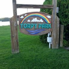
Sylvania Wilderness, Protected wilderness area in Michigan, United States.

Description

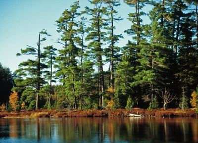
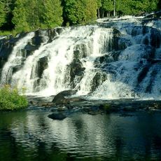
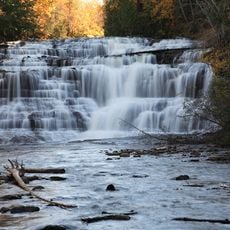
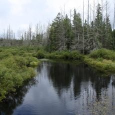
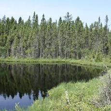
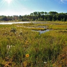
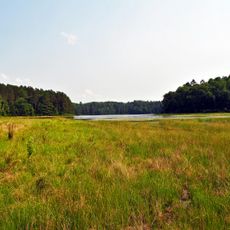
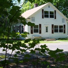
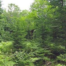
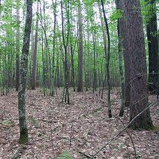
Sylvania Wilderness is a protected area in northern Michigan where dense forests of maple, oak, and pine surround multiple lakes. The refuge provides routes for hiking and paddling through forest terrain with minimal development.

History

Native American tribes used these lands for hunting and gathering for centuries before modern protection arrived. The federal designation as a Wilderness Area came to ensure the forest would remain undeveloped.

Culture

The refuge reflects American commitment to preserving wild places where people can reconnect with nature away from daily life. Visitors experience this conservation ethic directly through the rules that keep the forest and lakes in their natural state.

Practical

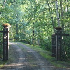
Plan for a remote experience with limited facilities and few entry points into the refuge. Bring proper gear for camping and water activities, as this is true backcountry terrain.

Did you know?

Special fishing rules here restrict moving bass between water systems to protect native fish populations from unwanted species. These specific regulations reflect careful management of the ecosystem.

Location
Operator
United States Forest Service
GPS coordinates
46.21600,-89.29800
Latest update
December 8, 2025 19:59

AroundUs brings together thousands of curated places, local tips, and hidden gems, enriched daily by 60,000 contributors worldwide. Discover all places nearby (Michigan).

Around this place
Bond Falls
United States of America

Bond Falls

25 km
Agate Falls Scenic Site
United States of America

Agate Falls Scenic Site

33.5 km
United States of America

Northern Highland-American Legion State Forest

33.2 km
United States of America

Powell Marsh Wildlife Area

47.7 km
Headwaters Wilderness
United States of America

Headwaters Wilderness

52.2 km
Blackjack Springs Wilderness
United States of America

Blackjack Springs Wilderness

31.3 km
Eagle River Stadium
United States of America

Eagle River Stadium

34.6 km
Pioneer Park Historical Complex
United States of America

Pioneer Park Historical Complex

61.2 km
United States of America

O Kun de Kun Falls

49.5 km
Black Tern Bog State Natural Area
United States of America

Black Tern Bog State Natural Area

41.5 km
Sunset Point
United States of America

Sunset Point

36.2 km
Central School
United States of America

Central School

52.5 km
Wind Pudding Lake State Natural Area
United States of America

Wind Pudding Lake State Natural Area

56.9 km
Franklin Lake Campground
United States of America

Franklin Lake Campground

39.5 km
Rice Creek State Natural Area
United States of America

Rice Creek State Natural Area

35.2 km
Forest Route 157–Tamarack River Bridge
United States of America

Forest Route 157–Tamarack River Bridge

24.9 km
Bergland Administrative Site
United States of America

Bergland Administrative Site

47 km
Anvil Lake Campground Shelter
United States of America

Anvil Lake Campground Shelter

36 km
Bose Lake Hemlock Hardwoods
United States of America

Bose Lake Hemlock Hardwoods

40.4 km
Planter Road – Jackson Creek Bridge
United States of America

Planter Road – Jackson Creek Bridge

61.3 km
Torpy Park Beach
United States of America

Torpy Park Beach

49.6 km
Finnerud Forest Scientific Area
United States of America

Finnerud Forest Scientific Area

52.9 km
Lake Gogebic State Park Beach
United States of America

Lake Gogebic State Park Beach

33.9 km
Lake Gogebic State Park
United States of America

Lake Gogebic State Park

34.3 km
Lake Gogebic
United States of America

Lake Gogebic

38.5 km
Main Street – Black River Bridge
United States of America

Main Street – Black River Bridge

61.2 km
M 189 / W 139 Highway Bridge over Brule River
United States of America

M 189 / W 139 Highway Bridge over Brule River

55.9 km
James W. Toumey Nursery
United States of America

James W. Toumey Nursery

11.6 km
Show the full map
« Sylvania Wilderness - Protected wilderness area in Michigan, United States » is provided by Around Us (aroundus.com). Images and texts are derived from Wikimedia project under a Creative Commons license. You are allowed to copy, distribute, and modify copies of this page, under the conditions set by the license, as long as this note is clearly visible.

Discover hidden gems everywhere you go!

From secret cafés to breathtaking viewpoints, skip the crowded tourist spots and find places that match your style. Our app makes it easy with voice search, smart filtering, route optimization, and insider tips from travelers worldwide. Download now for the complete mobile experience.

Around Us App Screenshot

A unique approach to discovering new places

Le Figaro

All the places worth exploring

France Info

A tailor-made excursion in just a few clicks

20 Minutes

Around Us
Travel Guide & Maps
Download

Send to your phone

QR Code
1

Open the camera app on your mobile.

2

Point at the QR code with your camera. A notification will appear.

3

Tap the notification to open the link.