Lake Gogebic State Park Beach

Log in to your account

AroundUs is a community-driven map of interesting places, built by curious explorers like you. It grows with every review, story, and photo you share.
Connect to save your favorite spots, contribute locations, and create personalized routes.
Continue with Google
Continue with Apple
Continue with X
Continue with Facebook
Continue with email
By continuing, you accept our Terms and Conditions and our Privacy Policy
Create an account

Lake Gogebic State Park Beach

Add to collection
Map
Suggest a change
Share

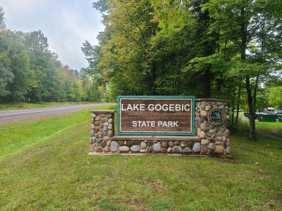
Lake Gogebic State Park Beach, Sandy beach at Lake Gogebic State Park in Marenisco Township, United States

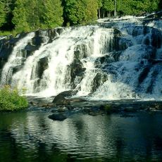
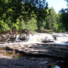
Lake Gogebic State Park Beach sits along the northern shore of Michigan's largest inland lake in the Upper Peninsula and provides swimming and water access. The grounds feature picnic tables, grills, and marked parking areas that make it easy to spend a full day by the water.

The area was established as a state park by Michigan's Department of Natural Resources in the early 1900s and has maintained its natural character throughout the decades. This long-standing commitment shows the state's dedication to protecting the lake and its shoreline for public use.

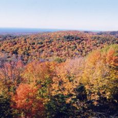
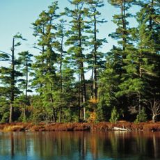
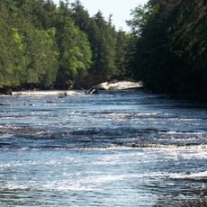
The beach serves as a meeting point for anglers and families who value its open waters and quiet coves. You will see people fishing and swimming together during summer, showing how this spot draws different types of water users.

Visitors need a Recreation Passport to enter the park, which can be obtained at local offices or in advance. The grounds are well marked with clear pathways to the beach and parking areas that make navigation straightforward.

The lake is home to healthy populations of walleye, perch, and northern pike that can be caught year-round, making it a draw for fishing enthusiasts. The water depth and fish stocks have made it a preferred destination for recreational anglers throughout the region.

Location: Marenisco Township

Address: N9995 State Highway M64, Marenisco, MI 49947, USA

Phone: +19068423341

Website: http://michigandnr.com/parksandtrails/Details.aspx?type=SPRK&id=421

GPS coordinates: 46.45671,-89.56766

Latest update: December 14, 2025 20:23

Photos
Around this place
Porcupine Mountains
United States of America

Porcupine Mountains

37.2 km
Copper mining in Michigan
United States of America

Copper mining in Michigan

37 km
Copper Peak
United States of America

Copper Peak

43.1 km
Bond Falls
United States of America

Bond Falls

33.8 km
Sylvania Wilderness
United States of America

Sylvania Wilderness

33.9 km
Agate Falls Scenic Site
United States of America

Agate Falls Scenic Site

36.6 km
United States of America

Northern Highland-American Legion State Forest

46 km
United States of America

Powell Marsh Wildlife Area

49.2 km
Ironwood Theatre
United States of America

Ironwood Theatre

46.1 km
United States of America

O Kun de Kun Falls

38.5 km
Great Conglomerate Falls
United States of America

Great Conglomerate Falls

42.1 km
Manido Falls
United States of America

Manido Falls

41.3 km
Nawadaha Falls
United States of America

Nawadaha Falls

41.2 km
Ironwood Memorial/Municipal Building
United States of America

Ironwood Memorial/Municipal Building

45.9 km
Ironwood Carnegie Library
United States of America

Ironwood Carnegie Library

46.4 km
Gogebic County Courthouse
United States of America

Gogebic County Courthouse

37.3 km
Solomon S. Curry House
United States of America

Solomon S. Curry House

45.5 km
Annala Round Barn
United States of America

Annala Round Barn

45.8 km
Rice Creek State Natural Area
United States of America

Rice Creek State Natural Area

35.3 km
Old Iron County Courthouse
United States of America

Old Iron County Courthouse

47.2 km
Bergland Administrative Site
United States of America

Bergland Administrative Site

15 km
Ironwood City Hall
United States of America

Ironwood City Hall

45.9 km
Planter Road – Jackson Creek Bridge
United States of America

Planter Road – Jackson Creek Bridge

31.5 km
Lake Gogebic State Park
United States of America

Lake Gogebic State Park

653 m
Porcupine Mountains Wilderness State Park
United States of America

Porcupine Mountains Wilderness State Park

38.9 km
Lake Gogebic
United States of America

Lake Gogebic

5 km
Main Street – Black River Bridge
United States of America

Main Street – Black River Bridge

33.3 km
James W. Toumey Nursery
United States of America

James W. Toumey Nursery

36.8 km
Show the full map
Reviews

Visited this place? Tap the stars to rate it and share your experience / photos with the community! Try now! You can cancel it anytime.

« Lake Gogebic State Park Beach - Sandy beach at Lake Gogebic State Park in Marenisco Township, United States » is provided by Around Us (aroundus.com). Images and texts are derived from Wikimedia project under a Creative Commons license. You are allowed to copy, distribute, and modify copies of this page, under the conditions set by the license, as long as this note is clearly visible.

Discover hidden gems everywhere you go!

From secret cafés to breathtaking viewpoints, skip the crowded tourist spots and find places that match your style. Our app makes it easy with voice search, smart filtering, route optimization, and insider tips from travelers worldwide. Download now for the complete mobile experience.

Around Us App Screenshot

A unique approach to discovering new places

Le Figaro

All the places worth exploring

France Info

A tailor-made excursion in just a few clicks

20 Minutes