Copper mining in Michigan

Log in to your account

AroundUs is a community-driven map of interesting places, built by curious explorers like you. It grows with every review, story, and photo you share.
Connect to save your favorite spots, contribute locations, and create personalized routes.
By continuing, you accept our Terms and Conditions and our Privacy Policy

Copper mining in Michigan

Add to collection
Map
Suggest a change
Share

Copper mining in Michigan, Historic copper mines in Upper Peninsula, Michigan, United States

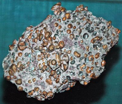
Copper mining in Michigan refers to the extraction of copper deposits in the Upper Peninsula, where pure copper occurs in ancient lava flows. The mines reached substantial depths and required specialized techniques for extracting and transporting the mineral.

Native peoples began extracting copper from surface deposits about 7000 years ago, establishing one of the world's earliest mining traditions. European and American mining companies took over in the 1800s and transformed the region into an industrial center.

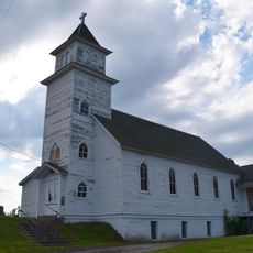
The region attracted workers from many countries, especially Finland, Cornwall, and Slovakia, who brought their traditions and shaped the communities. These immigrants built churches, shops, and neighborhoods that still define the character and appearance of Copper Country today.

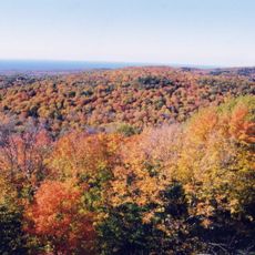
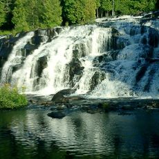
Visitors can best explore the region on foot or by car, with good support from local museums and information centers. The best time to visit is between spring and fall, when weather is mild and access to historical sites is greatest.

Some pieces of copper extracted from these mines weighed over 100 tons, among the largest pure copper specimens ever found. These discoveries reveal the exceptional quality and abundance of the copper deposits that made the region renowned.

Location: Michigan

GPS coordinates: 46.78830,-89.53000

Latest update: December 7, 2025 09:22

Photos
Around this place
Porcupine Mountains
United States of America

Porcupine Mountains

16.9 km
Bond Falls
United States of America

Bond Falls

52 km
Agate Falls Scenic Site
United States of America

Agate Falls Scenic Site

47.9 km
SS Ira H. Owen
United States of America

SS Ira H. Owen

45.1 km
Ontonagon School
United States of America

Ontonagon School

19 km
Twin Lakes State Park
United States of America

Twin Lakes State Park

52.5 km
United States of America

Agate Beach

53.6 km
Ironwood Theatre
United States of America

Ironwood Theatre

61.4 km
United States of America

O Kun de Kun Falls

32.9 km
Ontonagon Light
United States of America

Ontonagon Light

18.7 km
Great Conglomerate Falls
United States of America

Great Conglomerate Falls

43.7 km
Manido Falls
United States of America

Manido Falls

34.9 km
Nawadaha Falls
United States of America

Nawadaha Falls

35.2 km
Ironwood Memorial/Municipal Building
United States of America

Ironwood Memorial/Municipal Building

61.1 km
Ironwood Carnegie Library
United States of America

Ironwood Carnegie Library

61.7 km
Ontonagon Harbor Piers Historic District
United States of America

Ontonagon Harbor Piers Historic District

19.4 km
Gogebic County Courthouse
United States of America

Gogebic County Courthouse

52.5 km
Ontonagon County Courthouse
United States of America

Ontonagon County Courthouse

19.2 km
Solomon S. Curry House
United States of America

Solomon S. Curry House

60.8 km
Annala Round Barn
United States of America

Annala Round Barn

63.5 km
Saint Henry's Evangelical Lutheran Church and Cemetery
United States of America

Saint Henry's Evangelical Lutheran Church and Cemetery

56.9 km
Old Iron County Courthouse
United States of America

Old Iron County Courthouse

62.7 km
Bergland Administrative Site
United States of America

Bergland Administrative Site

22.2 km
Planter Road – Jackson Creek Bridge
United States of America

Planter Road – Jackson Creek Bridge

45.5 km
Lake Gogebic State Park
United States of America

Lake Gogebic State Park

37 km
Porcupine Mountains Wilderness State Park
United States of America

Porcupine Mountains Wilderness State Park

17.1 km
Lake Gogebic
United States of America

Lake Gogebic

32.4 km
Main Street – Black River Bridge
United States of America

Main Street – Black River Bridge

50.3 km
Show the full map
Reviews

Visited this place? Tap the stars to rate it and share your experience / photos with the community! Try now! You can cancel it anytime.

« Copper mining in Michigan - Historic copper mines in Upper Peninsula, Michigan, United States » is provided by Around Us (aroundus.com). Images and texts are derived from Wikimedia project under a Creative Commons license. You are allowed to copy, distribute, and modify copies of this page, under the conditions set by the license, as long as this note is clearly visible.

Discover hidden gems everywhere you go!

From secret cafés to breathtaking viewpoints, skip the crowded tourist spots and find places that match your style. Our app makes it easy with voice search, smart filtering, route optimization, and insider tips from travelers worldwide. Download now for the complete mobile experience.

Around Us App Screenshot

A unique approach to discovering new places

Le Figaro

All the places worth exploring

France Info

A tailor-made excursion in just a few clicks

20 Minutes