Licking River, Major river system in northeastern Kentucky, United States
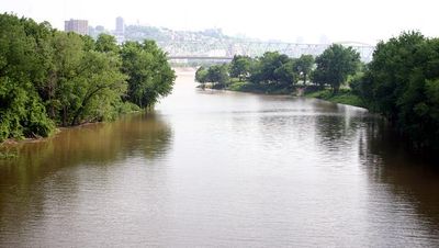
The Licking River is a major waterway system in northeastern Kentucky that flows for approximately 303 miles. It forms a complex network of channels and tributaries that drain the region situated between the Kentucky River and Big Sandy River watersheds.
The river became the site of the Battle of Blue Licks in 1782, when frontier fighters commanded by George Rogers Clark clashed with British forces during the Revolutionary War. This battle was a turning point in the struggle for control of the region.
Native peoples relied on the river as a highway for moving goods and people across the land. The waterway shaped early settlement patterns in Kentucky and remains part of the region's sense of place.
Multiple access points along the river allow visitors to enjoy paddling, canoeing, fishing, and other water activities. Different sections have varying difficulty levels, and several parks provide boat ramps and rest areas for travelers.
The river harbors more than fifty species of freshwater mussels, which display remarkable variety in form and color. The water also pools behind a large dam to create Cave Run Lake, which lies within Daniel Boone National Forest and offers dramatic scenery.
The community of curious travelers
AroundUs brings together thousands of curated places, local tips, and hidden gems, enriched daily by 60,000 contributors worldwide.