Chest opened
+${chestReward.xp} XP
Explorer
NOUVEAU ×${chestReward.collectible.quantity}
tapez pour fermer
Chest locked

Open chests in the app

Around Us is built for your phone — chests unlock when you walk, explore and capture nearby places.

Enable Location

We need your location to show you interesting places around you

Discover nearby places

Find interesting locations and hidden gems around you

Precise directions

Get accurate directions and distances to places

Your location is never shared with other users. It's only used when you tap the location button.

Kelly Barnes Dam

Log in to your account

Start exploring — it's free

Trusted by 72,905 travelers worldwide

Continue with Google
Continue with Apple
or

We will send you a code to connect

By continuing, you accept our Terms and Conditions and our Privacy Policy

Check your inbox

We've sent a pincode in your inbox. Please enter the code below.

Kelly Barnes Dam
Discussion Reviews 1 Photos
18.8k Popularity

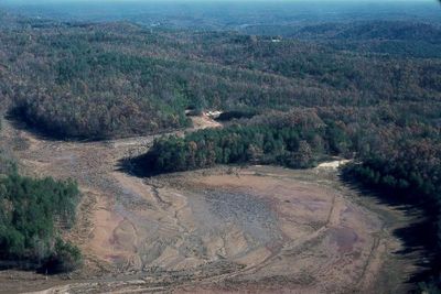
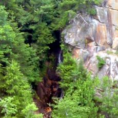
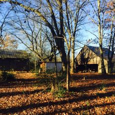
Kelly Barnes Dam, Earthen embankment dam near Toccoa Falls Bible College, Georgia.

Kelly Barnes Dam is an earthen embankment that crosses Toccoa Creek in Georgia. The structure held back water to form a lake used for power generation and later for local recreation.

The dam was built in 1899 to generate electricity for the surrounding area. It experienced a catastrophic failure in 1977 that caused extensive destruction.

The disaster led to the formation of the Association of State Dam Safety Officials and influenced national policies regarding infrastructure maintenance.

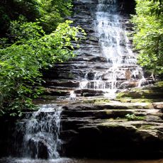
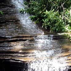
The site is accessible by road near Toccoa Falls and offers views of the remaining structure and surrounding landscape. Visitors should be aware of the open terrain and plan accordingly for weather conditions.

The structure's collapse released 24,000 cubic feet of water per second, causing the deaths of 39 people and $2.8 million in damages.

The community of curious travelers

AroundUs brings together thousands of curated places, local tips, and hidden gems, enriched daily by 60,000 contributors worldwide.

Start exploring
Location
GPS coordinates
34.60056,-83.36306
Latest update
December 7, 2025 10:08
Around this place
Currahee Mountain
United States of America

Currahee Mountain

8 km
Tallulah Gorge State Park
United States of America

Tallulah Gorge State Park

15.8 km
Toccoa Falls
United States of America

Toccoa Falls

569 m
Minnehaha Falls
United States of America

Minnehaha Falls

19.5 km
Tallulah Falls School
United States of America

Tallulah Falls School

14.9 km
United States of America

Bull Sluice

24.4 km
Travelers Rest
United States of America

Travelers Rest

11.4 km
Fort Hollingsworth–White House
United States of America

Fort Hollingsworth–White House

24.9 km
Stovall Mill Covered Bridge
United States of America

Stovall Mill Covered Bridge

29.7 km
Caledonia Cascade
United States of America

Caledonia Cascade

16.2 km
Panther Falls
United States of America

Panther Falls

21.4 km
Chenocetah Mountain
United States of America

Chenocetah Mountain

17.1 km
Angel Falls
United States of America

Angel Falls

20.4 km
Long Creek Academy
United States of America

Long Creek Academy

23.6 km
Nacoochee Valley Historic District
United States of America

Nacoochee Valley Historic District

31.3 km
Becky Branch Falls
United States of America

Becky Branch Falls

31.5 km
Stephens County Courthouse
United States of America

Stephens County Courthouse

3.8 km
Chenocetah Fire Tower
United States of America

Chenocetah Fire Tower

17.1 km
Mauldin House Welcome Center
United States of America

Mauldin House Welcome Center

15 km
James B. Simmons House
United States of America

James B. Simmons House

3.7 km
Retreat Rosenwald School
United States of America

Retreat Rosenwald School

27.8 km
Lavonia-Carnegie Library
United States of America

Lavonia-Carnegie Library

30.1 km
Sautee Valley Historic District
United States of America

Sautee Valley Historic District

29.7 km
Henry Asbury House
United States of America

Henry Asbury House

14.8 km
Jarrett-Hayes House
United States of America

Jarrett-Hayes House

10 km
Walnut Hill Historic District
United States of America

Walnut Hill Historic District

27.2 km
McConnell Historic District
United States of America

McConnell Historic District

26.1 km
Franklin County Courthouse
United States of America

Franklin County Courthouse

28.2 km
Show the full map
Reviews
Share your experience

No review yet

Discussions
Start a discussion...

No discussion yet

« Kelly Barnes Dam - Earthen embankment dam near Toccoa Falls Bible College, Georgia » is provided by Around Us (aroundus.com). Images and texts are derived from Wikimedia project under a Creative Commons license. You are allowed to copy, distribute, and modify copies of this page, under the conditions set by the license, as long as this note is clearly visible.

Discover hidden gems everywhere you go!

From secret cafés to breathtaking viewpoints, skip the crowded tourist spots and find places that match your style. Our app makes it easy with voice search, smart filtering, route optimization, and insider tips from travelers worldwide. Download now for the complete mobile experience.

Around Us App Screenshot

A unique approach to discovering new places

Le Figaro

All the places worth exploring

France Info

A tailor-made excursion in just a few clicks

20 Minutes

Around Us
Travel Guide & Maps
Download

Send to your phone

QR Code
1

Open the camera app on your mobile.

2

Point at the QR code with your camera. A notification will appear.

3

Tap the notification to open the link.