Bourne

Log in to your account

AroundUs is a community-driven map of interesting places, built by curious explorers like you. It grows with every review, story, and photo you share.
Connect to save your favorite spots, contribute locations, and create personalized routes.
Continue with Google
Continue with Apple
Continue with X
Continue with Facebook
Continue with email
By continuing, you accept our Terms and Conditions and our Privacy Policy
Create an account
Add to collection
Map
Suggest a change
Share

Bourne, Coastal town in Barnstable County, Massachusetts.

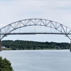
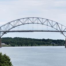
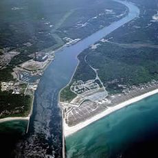
Bourne is a coastal town in Barnstable County in southeastern Massachusetts that stretches on both sides of the Cape Cod Canal. The area contains nine distinct villages located along Buzzards Bay and at the base of the Cape Cod peninsula.

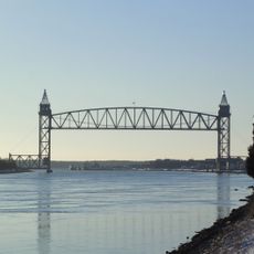
The area was originally part of Sandwich but became an independent town in 1884, named after the prosperous whale-oil merchant Jonathan Bourne. The town grew as a trading and port center, especially after the Cape Cod Canal was built in 1914.

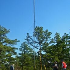
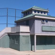
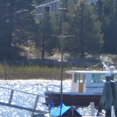
The town has deep roots in maritime life, with many residents working or studying in shipping and seafaring professions. The local academy trains future ship captains and marine professionals who shape the community's connection to the sea.

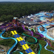
The best time to explore is during the warmer months from May through October when weather is mild and the sea is accessible. The villages are easy to reach and offer plenty of parking, especially if you avoid peak season travel.

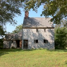
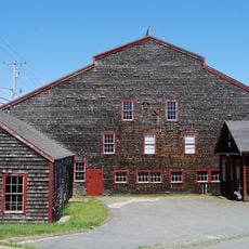
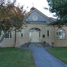
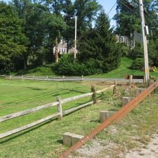
Where Native Americans and English settlers once traded around 1626, a museum now stands with a rebuilt trading post from that era. The site shows how the two cultures lived and exchanged goods together.

Location: Barnstable County

Inception: 1640

Elevation above the sea: 13 m

Shares border with: Sandwich, Falmouth

Website: http://townofbourne.com

GPS coordinates: 41.74111,-70.59944

Latest update: December 14, 2025 18:40

Photos
Around this place
Cape Cod Canal
United States of America

Cape Cod Canal

3.6 km
Sagamore Bridge
United States of America

Sagamore Bridge

6.1 km
Bourne Bridge
United States of America

Bourne Bridge

1.1 km
Water Wizz
United States of America

Water Wizz

5.3 km
Cape Cod Canal Railroad Bridge
United States of America

Cape Cod Canal Railroad Bridge

1.2 km
Scusset Beach State Reservation
United States of America

Scusset Beach State Reservation

9.2 km
Heritage Museums and Gardens
United States of America

Heritage Museums and Gardens

7.8 km
Sandwich Glass Museum
United States of America

Sandwich Glass Museum

8.4 km
Hoxie House
United States of America

Hoxie House

8.6 km
Massachusetts National Cemetery
United States of America

Massachusetts National Cemetery

7.7 km
Fort Banks
United States of America

Fort Banks

6.3 km
Shawme-Crowell State Forest
United States of America

Shawme-Crowell State Forest

6.5 km
Pine Hill
United States of America

Pine Hill

4.6 km
First Church, Sandwich Massachusetts
United States of America

First Church, Sandwich Massachusetts

8.5 km
Clem Spillane Field
United States of America

Clem Spillane Field

10.4 km
Wing's Neck Light
United States of America

Wing's Neck Light

8.3 km
Tremont Nail Factory District
United States of America

Tremont Nail Factory District

10.6 km
Jonathan Bourne Public Library
United States of America

Jonathan Bourne Public Library

165 m
Bourne Town Hall
United States of America

Bourne Town Hall

800 m
Jarvesville Historic District
United States of America

Jarvesville Historic District

9 km
Forestdale School
United States of America

Forestdale School

9.8 km
John and Mary Waterman Jarves House
United States of America

John and Mary Waterman Jarves House

8.8 km
Gypsy
United States of America

Gypsy

5.2 km
George I. Briggs House
United States of America

George I. Briggs House

186 m
Spring Hill Historic District (Sandwich, Massachusetts)
United States of America

Spring Hill Historic District (Sandwich, Massachusetts)

10.5 km
Town Hall Square Historic District
United States of America

Town Hall Square Historic District

8.4 km
Tobey Homestead
United States of America

Tobey Homestead

9.7 km
Old Bourne High School building
United States of America

Old Bourne High School building

404 m
Show the full map
Reviews

Visited this place? Tap the stars to rate it and share your experience / photos with the community! Try now! You can cancel it anytime.

« Bourne - Coastal town in Barnstable County, Massachusetts » is provided by Around Us (aroundus.com). Images and texts are derived from Wikimedia project under a Creative Commons license. You are allowed to copy, distribute, and modify copies of this page, under the conditions set by the license, as long as this note is clearly visible.

Discover hidden gems everywhere you go!

From secret cafés to breathtaking viewpoints, skip the crowded tourist spots and find places that match your style. Our app makes it easy with voice search, smart filtering, route optimization, and insider tips from travelers worldwide. Download now for the complete mobile experience.

Around Us App Screenshot

A unique approach to discovering new places

Le Figaro

All the places worth exploring

France Info

A tailor-made excursion in just a few clicks

20 Minutes