Enable Location

We need your location to show you interesting places around you

Discover nearby places

Find interesting locations and hidden gems around you

Precise directions

Get accurate directions and distances to places

Your location is never shared with other users. It's only used when you tap the location button.

Log in to your account

Start exploring — it's free

Trusted by 62,468 travelers worldwide

Continue with Google
Continue with Apple
or

We will send you a code to connect

By continuing, you accept our Terms and Conditions and our Privacy Policy

Check your inbox

We've sent a pincode in your inbox. Please enter the code below.

Beaver River Bridge

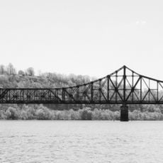
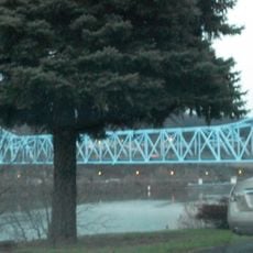
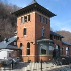
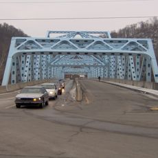
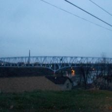
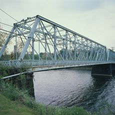
Beaver River Bridge, Road bridge in Beaver County, Pennsylvania, United States.

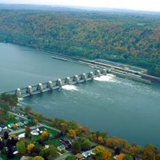
The Beaver River Bridge is a road bridge that crosses the Beaver River in Pennsylvania, carrying traffic over the water as it connects different parts of Beaver County. The structure uses a cantilever and truss design to span across the river valley below.

The bridge was built in 1951 and opened in 1952, part of a wave of infrastructure projects that strengthened regional connections across Pennsylvania after World War II. This construction helped support economic growth in the area during the postwar period.

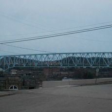
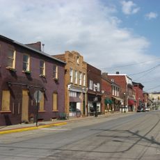
The bridge forms part of the Pennsylvania Turnpike system, connecting communities and supporting local economic growth through improved transportation networks.

The bridge serves as a main traffic route connecting different sections of the county, with steady vehicle flow throughout the day. Plan your crossing during lighter traffic periods if possible, and check local road conditions before traveling.

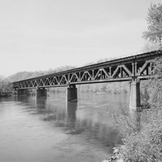
The bridge stands significantly taller than many comparable river crossings in the state, allowing boats to pass beneath it on the waterway. This height was intentionally designed to preserve river navigation capabilities while handling heavy road traffic.

The community of curious travelers

AroundUs brings together thousands of curated places, local tips, and hidden gems, enriched daily by 60,000 contributors worldwide.

Start exploring
Location
Inception
1952
Official opening
1952
GPS coordinates
40.81150,-80.31900
Latest update
December 13, 2025 12:20
Around this place
McConnells Mill State Park
United States of America

McConnells Mill State Park

16.8 km
Pittsburgh International Race Complex
United States of America

Pittsburgh International Race Complex

4.6 km
Cascade Park
United States of America

Cascade Park

18.4 km
Fort McIntosh
United States of America

Fort McIntosh

13.4 km
Harmony Historic District
United States of America

Harmony Historic District

16.1 km
Montgomery Locks and Dam
United States of America

Montgomery Locks and Dam

18.8 km
Beaver Bridge
United States of America

Beaver Bridge

13.4 km
Strand Theater
United States of America

Strand Theater

15.4 km
Matthew S. Quay House
United States of America

Matthew S. Quay House

13.2 km
Carnegie Free Library of Beaver Falls
United States of America

Carnegie Free Library of Beaver Falls

6.5 km
Merrick Art Gallery
United States of America

Merrick Art Gallery

8.8 km
Monaca – East Rochester Bridge
United States of America

Monaca – East Rochester Bridge

14 km
McConnell's Mill Covered Bridge
United States of America

McConnell's Mill Covered Bridge

20.1 km
Captain William Vicary House
United States of America

Captain William Vicary House

15.6 km
Rochester-Monaca Bridge
United States of America

Rochester-Monaca Bridge

13.2 km
William B. Dunlap Mansion
United States of America

William B. Dunlap Mansion

11.7 km
Watts Mill Bridge
United States of America

Watts Mill Bridge

14.9 km
Merrill Lock No. 6
United States of America

Merrill Lock No. 6

16.1 km
Eastvale Bridge
United States of America

Eastvale Bridge

5 km
Vanport Bridge
United States of America

Vanport Bridge

14.8 km
Bridgewater Historic District
United States of America

Bridgewater Historic District

11.9 km
Fallston Bridge
United States of America

Fallston Bridge

9.4 km
Passavant House
United States of America

Passavant House

15.5 km
Rochester-Beaver Railroad Bridge
United States of America

Rochester-Beaver Railroad Bridge

12.9 km
Old Homestead
United States of America

Old Homestead

14.6 km
Sim's Bowling Lanes
United States of America

Sim's Bowling Lanes

1.3 km
Beaver River Railroad Bridge
United States of America

Beaver River Railroad Bridge

8 km
Beaver Historic District
United States of America

Beaver Historic District

13 km
Show the full map
« Beaver River Bridge - Road bridge in Beaver County, Pennsylvania, United States » is provided by Around Us (aroundus.com). Images and texts are derived from Wikimedia project under a Creative Commons license. You are allowed to copy, distribute, and modify copies of this page, under the conditions set by the license, as long as this note is clearly visible.

Discover hidden gems everywhere you go!

From secret cafés to breathtaking viewpoints, skip the crowded tourist spots and find places that match your style. Our app makes it easy with voice search, smart filtering, route optimization, and insider tips from travelers worldwide. Download now for the complete mobile experience.

Around Us App Screenshot

A unique approach to discovering new places

Le Figaro

All the places worth exploring

France Info

A tailor-made excursion in just a few clicks

20 Minutes

Around Us
Travel Guide & Maps
Download

Send to your phone

QR Code
1

Open the camera app on your mobile.

2

Point at the QR code with your camera. A notification will appear.

3

Tap the notification to open the link.