Chest opened
+${chestReward.xp} XP
Explorer
NOUVEAU ×${chestReward.collectible.quantity}
tapez pour fermer
Chest locked

Open chests in the app

Around Us is built for your phone — chests unlock when you walk, explore and capture nearby places.

Enable Location

We need your location to show you interesting places around you

Discover nearby places

Find interesting locations and hidden gems around you

Precise directions

Get accurate directions and distances to places

Your location is never shared with other users. It's only used when you tap the location button.

Log in to your account

Start exploring — it's free

Trusted by 73,082 travelers worldwide

Continue with Google
Continue with Apple
or

We will send you a code to connect

By continuing, you accept our Terms and Conditions and our Privacy Policy

Check your inbox

We've sent a pincode in your inbox. Please enter the code below.

Boyer Chute National Wildlife Refuge
Discussion Reviews Photo
2.1k Popularity

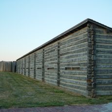
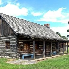
Boyer Chute National Wildlife Refuge, National Wildlife Refuge near Fort Calhoun, Nebraska.

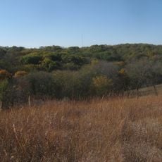
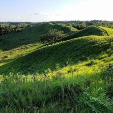
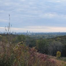
Boyer Chute National Wildlife Refuge is a protected area along the Missouri River with restored wetlands, woodlands, and grasslands spread across the landscape. A side channel that was once closed now allows water to flow naturally through the habitat again.

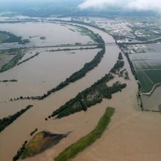
A dam built in 1937 for river navigation cut off the natural flow of the Missouri River for more than 50 years. Beginning in 1992, work started to reverse the damage and reopen the water channels.

The refuge functions as a learning space for the surrounding region, demonstrating how to bring back floodplain habitats and the animals that live there naturally. You can see how wildlife has returned after decades when the area looked very different.

The area is accessible through eight miles of hiking trails, with fishing and hunting opportunities spread throughout. The main entrance sits three miles east of Fort Calhoun and is the best starting point for your visit.

The reopened channel is a rare chance to watch a heavily altered river section heal itself naturally. This place demonstrates in real terms how river systems work when given the opportunity to restore themselves.

The community of curious travelers

AroundUs brings together thousands of curated places, local tips, and hidden gems, enriched daily by 60,000 contributors worldwide.

Start exploring
Location
Inception
1992
GPS coordinates
41.45160,-95.95520
Latest update
December 13, 2025 17:03
Around this place
Fort Atkinson
United States of America

Fort Atkinson

4.8 km
Fort Atkinson State Historical Park
United States of America

Fort Atkinson State Historical Park

4.9 km
Hummel Park
United States of America

Hummel Park

8.9 km
Fort Omaha
United States of America

Fort Omaha

16.1 km
DeSoto National Wildlife Refuge
United States of America

DeSoto National Wildlife Refuge

9.6 km
Malcolm X House
United States of America

Malcolm X House

17.9 km
Glenn Cunningham Lake
United States of America

Glenn Cunningham Lake

14 km
General Crook House
United States of America

General Crook House

12.7 km
Sacred Heart Catholic Church
United States of America

Sacred Heart Catholic Church

18.4 km
Bank of Florence Museum
United States of America

Bank of Florence Museum

12.7 km
Neale Woods
United States of America

Neale Woods

6.9 km
Calvin Memorial Presbyterian Church
United States of America

Calvin Memorial Presbyterian Church

18.3 km
Lizzie Robinson House
United States of America

Lizzie Robinson House

18.6 km
Blair High School
United States of America

Blair High School

18.1 km
George H. Kelly House
United States of America

George H. Kelly House

18.4 km
Blair Bridge
United States of America

Blair Bridge

16.1 km
Blair Bridge
United States of America

Blair Bridge

16.1 km
Hitchcock Nature Center
United States of America

Hitchcock Nature Center

8.7 km
Henry B. Neef House
United States of America

Henry B. Neef House

14.1 km
Congregational Church of Blair
United States of America

Congregational Church of Blair

18.1 km
Washington County Courthouse
United States of America

Washington County Courthouse

17.9 km
Alfred H. and Sarah Frahm House
United States of America

Alfred H. and Sarah Frahm House

6.1 km
Abraham Castetter House
United States of America

Abraham Castetter House

18.4 km
Neale Woods
United States of America

Neale Woods

6.1 km
Winter Quarters Mill Museum
United States of America

Winter Quarters Mill Museum

12.1 km
Florence Mill Museum
United States of America

Florence Mill Museum

12.1 km
Harrison County Historical Village & Iowa Welcome Center
United States of America

Harrison County Historical Village & Iowa Welcome Center

17.1 km
Notre Dame Academy and Convent
United States of America

Notre Dame Academy and Convent

13.1 km
Show the full map
Reviews
Share your experience

No review yet

Discussions
Start a discussion...

No discussion yet

« Boyer Chute National Wildlife Refuge - National Wildlife Refuge near Fort Calhoun, Nebraska » is provided by Around Us (aroundus.com). Images and texts are derived from Wikimedia project under a Creative Commons license. You are allowed to copy, distribute, and modify copies of this page, under the conditions set by the license, as long as this note is clearly visible.

Discover hidden gems everywhere you go!

From secret cafés to breathtaking viewpoints, skip the crowded tourist spots and find places that match your style. Our app makes it easy with voice search, smart filtering, route optimization, and insider tips from travelers worldwide. Download now for the complete mobile experience.

Around Us App Screenshot

A unique approach to discovering new places

Le Figaro

All the places worth exploring

France Info

A tailor-made excursion in just a few clicks

20 Minutes

Around Us
Travel Guide & Maps
Download

Send to your phone

QR Code
1

Open the camera app on your mobile.

2

Point at the QR code with your camera. A notification will appear.

3

Tap the notification to open the link.