Chest opened
+${chestReward.xp} XP
Explorer
NOUVEAU ×${chestReward.collectible.quantity}
tapez pour fermer
Chest locked

Open chests in the app

Around Us is built for your phone — chests unlock when you walk, explore and capture nearby places.

Enable Location

We need your location to show you interesting places around you

Discover nearby places

Find interesting locations and hidden gems around you

Precise directions

Get accurate directions and distances to places

Your location is never shared with other users. It's only used when you tap the location button.

El Chorro

Log in to your account

Start exploring — it's free

Trusted by 72,890 travelers worldwide

Continue with Google
Continue with Apple
or

We will send you a code to connect

By continuing, you accept our Terms and Conditions and our Privacy Policy

Check your inbox

We've sent a pincode in your inbox. Please enter the code below.

El Chorro
Discussion Reviews 1 Photos
17.1k Popularity

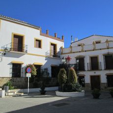
El Chorro, locality in Spain

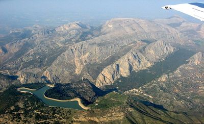
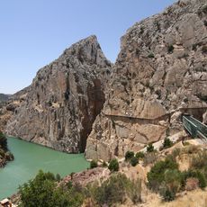
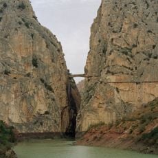
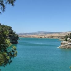
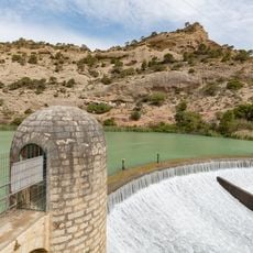
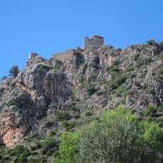
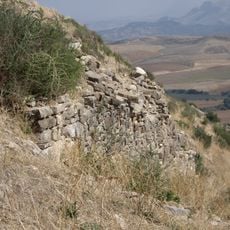
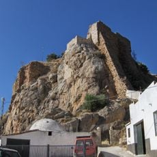
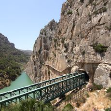
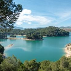
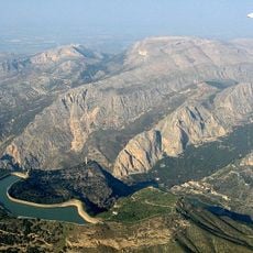
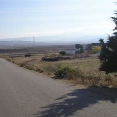
El Chorro is a small locality in Malaga Province situated near a reservoir on the Guadalhorce River, surrounded by mountains and rock formations. It features the Desfiladero de los Gaitanes gorge, a canyon roughly three kilometers long with walls reaching 300 meters high, plus the Caminito del Rey, a walkway built along the cliffs, and the Conde de Guadalhorce Reservoir.

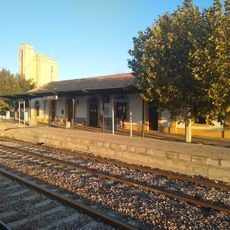
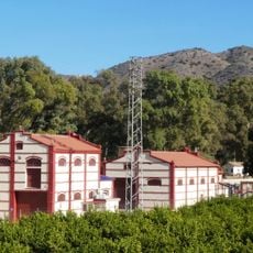
The area developed around a railroad line built in the 19th century connecting Malaga with Cordoba, which required extensive tunneling and bridging through rugged terrain. In the 20th century, construction of the Conde de Guadalhorce Dam, the region's first of its kind, accelerated settlement by providing electricity and flood control to the valley.

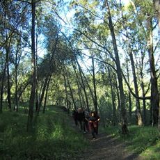
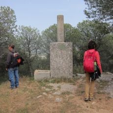
Climbing and hiking have become central to how locals live and work in this area. The small community supports visitors through restaurants, guesthouses, and rental services, creating a rhythm where outdoor sports define daily activity and employment.

The locality is about one hour from Malaga by car, train, or bus, with the train journey offering scenic views along the way. Accommodations include campsites and small hotels near main attractions, while tourist offices in nearby towns provide maps and help with planning visits and finding places to stay.

The Caminito del Rey was originally built in the early 1900s to connect hydroelectric plants but became so deteriorated and dangerous that it remained closed for decades until its full restoration and reopening in 2015. Today it is a popular hiking trail with views along the cliff face, accessible only under safe, controlled conditions.

The community of curious travelers

AroundUs brings together thousands of curated places, local tips, and hidden gems, enriched daily by 60,000 contributors worldwide.

Start exploring
Location
GPS coordinates
36.91528,-4.77167
Latest update
March 4, 2026 16:17
Reviews
Share your experience

No review yet

Discussions
Start a discussion...

No discussion yet

« El Chorro - locality in Spain » is provided by Around Us (aroundus.com). Images and texts are derived from Wikimedia project under a Creative Commons license. You are allowed to copy, distribute, and modify copies of this page, under the conditions set by the license, as long as this note is clearly visible.

Discover hidden gems everywhere you go!

From secret cafés to breathtaking viewpoints, skip the crowded tourist spots and find places that match your style. Our app makes it easy with voice search, smart filtering, route optimization, and insider tips from travelers worldwide. Download now for the complete mobile experience.

Around Us App Screenshot

A unique approach to discovering new places

Le Figaro

All the places worth exploring

France Info

A tailor-made excursion in just a few clicks

20 Minutes

Around Us
Travel Guide & Maps
Download

Send to your phone

QR Code
1

Open the camera app on your mobile.

2

Point at the QR code with your camera. A notification will appear.

3

Tap the notification to open the link.