Enable Location

We need your location to show you interesting places around you

Discover nearby places

Find interesting locations and hidden gems around you

Precise directions

Get accurate directions and distances to places

Your location is never shared with other users. It's only used when you tap the location button.

Sheikh Bureik, Lajjun

Log in to your account

Start exploring — it's free

Trusted by 61,616 travelers worldwide

Continue with Google
Continue with Apple
or

We will send you a code to connect

By continuing, you accept our Terms and Conditions and our Privacy Policy

Check your inbox

We've sent a pincode in your inbox. Please enter the code below.

Sheikh Bureik, Lajjun

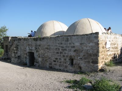
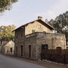
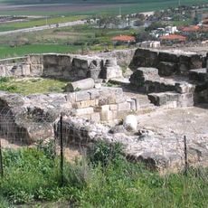
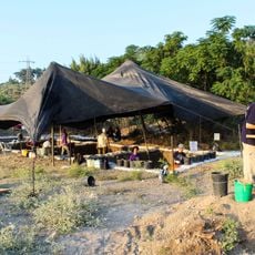
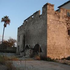
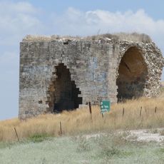
Sheikh Bureik, Lajjun, Former Palestinian village structure in Jezreel Valley, Israel.

Description

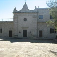
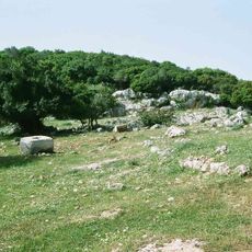
Sheikh Bureik was a settlement built on three hills between 135-175 meters above sea level, positioned at the southwestern edge of the Jezreel Valley plain. The structures included residential buildings, a white stone mosque built in 1943, mills, a health facility, and a marketplace.

History

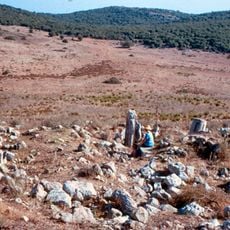
The settlement served as the capital of an administrative district during the Abbasid period and maintained a postal station position throughout the Mamluk era. This strategic importance reflects its long history as a connection point in the region.

Culture

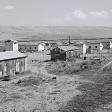
The settlement served as a gathering place for the community, with places of worship, marketplaces, and mills powered by natural springs. Different family groups occupied separate quarters, shaping the rhythm of daily life here.

Practical

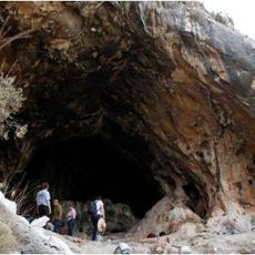
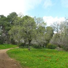
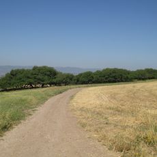
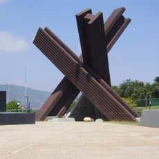
The site sits on elevated terrain offering views across the valley and can be explored on foot. The remains are partially preserved, so visitors should walk carefully and watch for uneven ground.

Did you know?

The name comes from the Roman 'Legio,' marking where a Roman military legion established a station more than 2,000 years ago. This ancient connection shows how the location drew different peoples across multiple historical periods.

GPS coordinates
32.70094,35.12894
Latest update
December 10, 2025 16:26

AroundUs brings together thousands of curated places, local tips, and hidden gems, enriched daily by 60,000 contributors worldwide. Discover all places nearby (Jezreel Valley Regional Council).

« Sheikh Bureik, Lajjun - Former Palestinian village structure in Jezreel Valley, Israel » is provided by Around Us (aroundus.com). Images and texts are derived from Wikimedia project under a Creative Commons license. You are allowed to copy, distribute, and modify copies of this page, under the conditions set by the license, as long as this note is clearly visible.

Discover hidden gems everywhere you go!

From secret cafés to breathtaking viewpoints, skip the crowded tourist spots and find places that match your style. Our app makes it easy with voice search, smart filtering, route optimization, and insider tips from travelers worldwide. Download now for the complete mobile experience.

Around Us App Screenshot

A unique approach to discovering new places

Le Figaro

All the places worth exploring

France Info

A tailor-made excursion in just a few clicks

20 Minutes

Around Us
Travel Guide & Maps
Download

Send to your phone

QR Code
1

Open the camera app on your mobile.

2

Point at the QR code with your camera. A notification will appear.

3

Tap the notification to open the link.