Enable Location

We need your location to show you interesting places around you

Discover nearby places

Find interesting locations and hidden gems around you

Precise directions

Get accurate directions and distances to places

Your location is never shared with other users. It's only used when you tap the location button.

Jacques Cartier Bridge

Log in to your account

Start exploring — it's free

Trusted by 61,763 travelers worldwide

Continue with Google
Continue with Apple
or

We will send you a code to connect

By continuing, you accept our Terms and Conditions and our Privacy Policy

Check your inbox

We've sent a pincode in your inbox. Please enter the code below.

Jacques Cartier Bridge

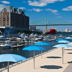
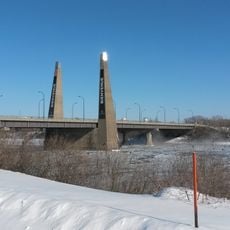
Jacques Cartier Bridge, Cantilever bridge in Ville-Marie, Canada

Description

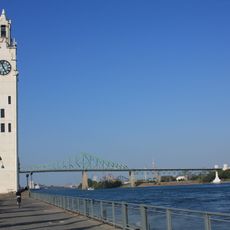
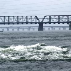
The Jacques Cartier Bridge is a cantilever structure spanning the Saint Lawrence River in Ville-Marie, linking Montreal to Longueuil over a distance of 2687 meters. It carries five vehicle lanes along with separate pathways for pedestrians and cyclists on either side of the roadway.

History

Engineer Philip Louis Pratley designed the steel structure, which opened in 1930 as the Harbour Bridge and initially served to connect the port with the southern shore. Four years later, it received its current name to commemorate the French explorer's first voyage into these waters in 1534.

Culture

The structure has carried its current name since 1934, honoring the 400th anniversary of Jacques Cartier's first arrival in the region. The evening lighting system responds to environmental data such as wind, temperature, and seasonal changes, casting shifting colors across the river that Montrealers watch from both shores.

Practical

The vehicle roadway runs through the center, while the walking and cycling paths sit on the outer edges and offer open views of the river. Crossing on foot or by bicycle takes between 30 and 45 minutes depending on pace, and requires some stamina due to the incline.

Did you know?

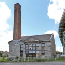
The roadway alignment deviates twice from a straight line, once through the Craig curve and again to bypass a soap factory property whose owner refused to sell. These deviations are barely noticeable when crossing, but they shape the recognizable silhouette of the bridge when viewed from a distance.

Location
Inception
May 14, 1930
Architects
Philip Louis Pratley
Official opening
May 24, 1930
Height
104 m
Length
2,687 m
Made from material
steel
Part of
St. Lawrence River
GPS coordinates
45.52083,-73.53500
Latest update
December 20, 2025 12:56

AroundUs brings together thousands of curated places, local tips, and hidden gems, enriched daily by 60,000 contributors worldwide. Discover all places nearby (Ville-Marie).

« Jacques Cartier Bridge - Cantilever bridge in Ville-Marie, Canada » is provided by Around Us (aroundus.com). Images and texts are derived from Wikimedia project under a Creative Commons license. You are allowed to copy, distribute, and modify copies of this page, under the conditions set by the license, as long as this note is clearly visible.

Discover hidden gems everywhere you go!

From secret cafés to breathtaking viewpoints, skip the crowded tourist spots and find places that match your style. Our app makes it easy with voice search, smart filtering, route optimization, and insider tips from travelers worldwide. Download now for the complete mobile experience.

Around Us App Screenshot

A unique approach to discovering new places

Le Figaro

All the places worth exploring

France Info

A tailor-made excursion in just a few clicks

20 Minutes

Around Us
Travel Guide & Maps
Download

Send to your phone

QR Code
1

Open the camera app on your mobile.

2

Point at the QR code with your camera. A notification will appear.

3

Tap the notification to open the link.