Chest opened
+${chestReward.xp} XP
Explorer
NOUVEAU ×${chestReward.collectible.quantity}
tapez pour fermer
Chest locked

Open chests in the app

Around Us is built for your phone — chests unlock when you walk, explore and capture nearby places.

Enable Location

We need your location to show you interesting places around you

Discover nearby places

Find interesting locations and hidden gems around you

Precise directions

Get accurate directions and distances to places

Your location is never shared with other users. It's only used when you tap the location button.

Log in to your account

Start exploring — it's free

Trusted by 72,879 travelers worldwide

Continue with Google
Continue with Apple
or

We will send you a code to connect

By continuing, you accept our Terms and Conditions and our Privacy Policy

Check your inbox

We've sent a pincode in your inbox. Please enter the code below.

La Verendrye Provincial Park
Discussion Reviews Photo
2.8k Popularity

La Verendrye Provincial Park, Provincial park in Thunder Bay District, Canada.

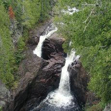
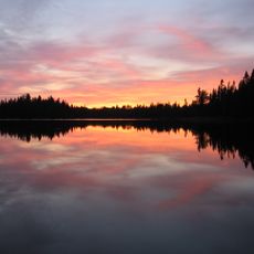
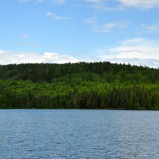
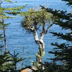
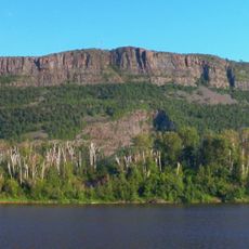
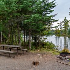
La Verendrye Provincial Park is a wilderness area in Thunder Bay District that links lakes and waterways while connecting two other provincial parks. The landscape features dense forests and multiple water routes designed for canoe travel.

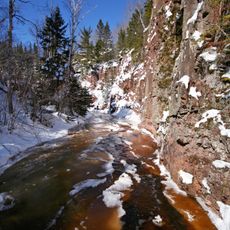
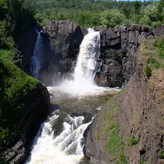
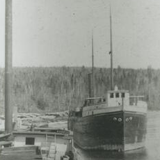
The area was once part of the key trading routes that fur traders and merchants used between Lake Superior and the interior. Those waterways remain a testament to the old passages that opened up the continent's interior.

The park bears the name of Pierre Gaultier de Varennes, a fur trader explorer whose legacy is tied to this region's trading history. Today it serves as a water passage that connects communities on both sides of the Canada-United States border.

The park has no on-site staff and charges no entrance fee, so visitors can explore freely. Support services run through an office at a nearby provincial park, so plan ahead for any questions.

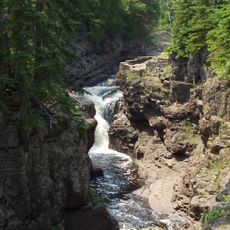
The area sits on a geographic watershed where rivers flow in opposite directions. Water on one side flows toward the Atlantic, while water on the other side flows toward the Arctic.

The community of curious travelers

AroundUs brings together thousands of curated places, local tips, and hidden gems, enriched daily by 60,000 contributors worldwide.

Start exploring
Inception
1989
GPS coordinates
48.10420,-90.36720
Latest update
December 12, 2025 14:24
Around this place
Judge C. R. Magney State Park
United States of America

Judge C. R. Magney State Park

36.4 km
Boundary Waters Canoe Area Wilderness
United States of America

Boundary Waters Canoe Area Wilderness

69.8 km
Eagle Mountain
United States of America

Eagle Mountain

27.1 km
Superior Hiking Trail
United States of America

Superior Hiking Trail

68.7 km
Kakabeka Falls
Canada

Kakabeka Falls

64.2 km
Witch Tree
United States of America

Witch Tree

56.4 km
Mount McKay
Canada

Mount McKay

84.3 km
Devil's Kettle
United States of America

Devil's Kettle

38.7 km
Grand Portage State Park
United States of America

Grand Portage State Park

57.2 km
Temperance River State Park
United States of America

Temperance River State Park

71.9 km
Rock of Ages Light
United States of America

Rock of Ages Light

82.9 km
Cascade River State Park
United States of America

Cascade River State Park

45.4 km
Grand Marais Light
United States of America

Grand Marais Light

40 km
Thunder Bay Soroptimist International Friendship Garden
Canada

Thunder Bay Soroptimist International Friendship Garden

87.5 km
Grand Portage State Forest
United States of America

Grand Portage State Forest

36.8 km
Amboy and George Spencer Shipwreck Sites
United States of America

Amboy and George Spencer Shipwreck Sites

84.2 km
United States of America

North Shore Commercial Fishing Museum

68.3 km
Schroeder Lumber Company Bunkhouse
United States of America

Schroeder Lumber Company Bunkhouse

73.9 km
Church of St. Francis Xavier
United States of America

Church of St. Francis Xavier

38.8 km
Cook County Courthouse
United States of America

Cook County Courthouse

39.1 km
Jim Scott Fishhouse
United States of America

Jim Scott Fishhouse

39.6 km
Pigeon River Provincial Park
Canada

Pigeon River Provincial Park

58.9 km
Kakabeka Falls Provincial Park
Canada

Kakabeka Falls Provincial Park

63.9 km
Heritage Visitors Center - Grand Portage National Monument
United States of America

Heritage Visitors Center - Grand Portage National Monument

53.1 km
Fort William Collegiate Institute
Canada

Fort William Collegiate Institute

88 km
Cascade Lookout Tower
United States of America

Cascade Lookout Tower

45 km
Hovland Lookout Tower
United States of America

Hovland Lookout Tower

37.1 km
Kekekabic Lookout Tower
United States of America

Kekekabic Lookout Tower

58 km
Show the full map
Reviews
Share your experience

No review yet

Discussions
Start a discussion...

No discussion yet

« La Verendrye Provincial Park - Provincial park in Thunder Bay District, Canada » is provided by Around Us (aroundus.com). Images and texts are derived from Wikimedia project under a Creative Commons license. You are allowed to copy, distribute, and modify copies of this page, under the conditions set by the license, as long as this note is clearly visible.

Discover hidden gems everywhere you go!

From secret cafés to breathtaking viewpoints, skip the crowded tourist spots and find places that match your style. Our app makes it easy with voice search, smart filtering, route optimization, and insider tips from travelers worldwide. Download now for the complete mobile experience.

Around Us App Screenshot

A unique approach to discovering new places

Le Figaro

All the places worth exploring

France Info

A tailor-made excursion in just a few clicks

20 Minutes

Around Us
Travel Guide & Maps
Download

Send to your phone

QR Code
1

Open the camera app on your mobile.

2

Point at the QR code with your camera. A notification will appear.

3

Tap the notification to open the link.