Enable Location

We need your location to show you interesting places around you

Discover nearby places

Find interesting locations and hidden gems around you

Precise directions

Get accurate directions and distances to places

Your location is never shared with other users. It's only used when you tap the location button.

Log in to your account

Start exploring — it's free

Trusted by 61,368 travelers worldwide

Continue with Google
Continue with Apple
or

We will send you a code to connect

By continuing, you accept our Terms and Conditions and our Privacy Policy

Check your inbox

We've sent a pincode in your inbox. Please enter the code below.

St. Raphael Provincial Park

St. Raphael Provincial Park, Waterway provincial park in Thunder Bay District, Canada.

Description

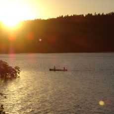
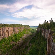
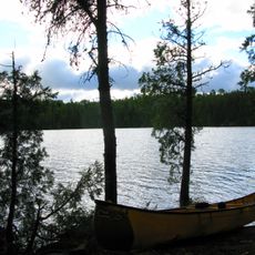
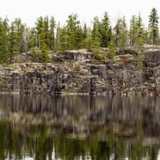
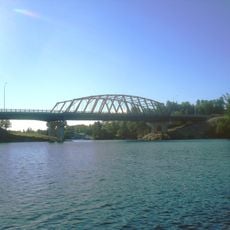
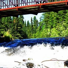
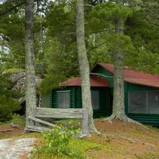
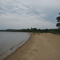
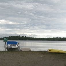
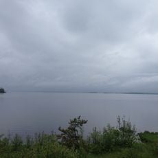
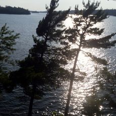
St. Raphael Provincial Park is a wilderness area in Northern Ontario featuring many connected lakes, granite rock formations, and large forest areas. The park spans multiple lakes including Churchill, De Lesseps, and Vincent, surrounded by glacial landscape features.

History

The park received its official protection status in 2003 as part of Ontario's initiative to preserve wild areas in Northern Ontario. This action came as the region sought to maintain its natural landscape.

Culture

The land holds deep meaning for the Ojibway Nation, the Saugeen Band, and the Mishkeegogamang First Nation, who have known this territory for generations. Visitors today can experience a landscape that remains culturally important to these communities.

Practical

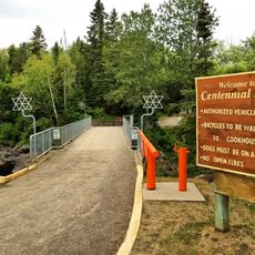
Visitors reach the park by boat from Minchin Lake or via the Payne River to Medcalf Lake, both accessible from Highway 599. It is important to prepare for wilderness conditions and check local access information before visiting.

Did you know?

Eight lakes including Churchill, De Lesseps, and Vincent form a distinctive pattern within the park, surrounded by glacial landforms like esker ridges and drumlin hills. This pattern reveals traces of the ice age that shaped the region thousands of years ago.

Inception
2003
GPS coordinates
50.76722,-90.90167
Latest update
December 14, 2025 11:43

AroundUs brings together thousands of curated places, local tips, and hidden gems, enriched daily by 60,000 contributors worldwide. Discover all places nearby (Thunder Bay District).

« St. Raphael Provincial Park - Waterway provincial park in Thunder Bay District, Canada » is provided by Around Us (aroundus.com). Images and texts are derived from Wikimedia project under a Creative Commons license. You are allowed to copy, distribute, and modify copies of this page, under the conditions set by the license, as long as this note is clearly visible.

Discover hidden gems everywhere you go!

From secret cafés to breathtaking viewpoints, skip the crowded tourist spots and find places that match your style. Our app makes it easy with voice search, smart filtering, route optimization, and insider tips from travelers worldwide. Download now for the complete mobile experience.

Around Us App Screenshot

A unique approach to discovering new places

Le Figaro

All the places worth exploring

France Info

A tailor-made excursion in just a few clicks

20 Minutes

Around Us
Travel Guide & Maps
Download

Send to your phone

QR Code
1

Open the camera app on your mobile.

2

Point at the QR code with your camera. A notification will appear.

3

Tap the notification to open the link.