Enable Location

We need your location to show you interesting places around you

Discover nearby places

Find interesting locations and hidden gems around you

Precise directions

Get accurate directions and distances to places

Your location is never shared with other users. It's only used when you tap the location button.

Mount Ōmuro

Log in to your account

Start exploring — it's free

Trusted by 62,839 travelers worldwide

Continue with Google
Continue with Apple
or

We will send you a code to connect

By continuing, you accept our Terms and Conditions and our Privacy Policy

Check your inbox

We've sent a pincode in your inbox. Please enter the code below.

Mount Ōmuro, Cinder cone in Ito, Japan

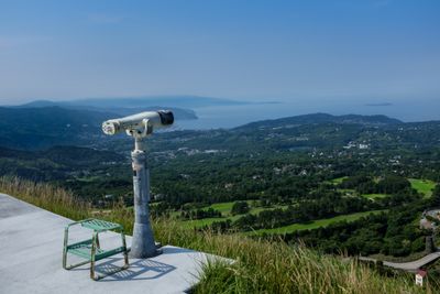
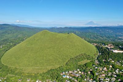
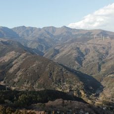
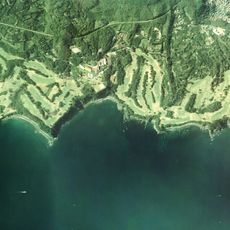
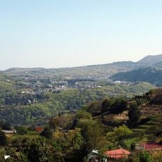
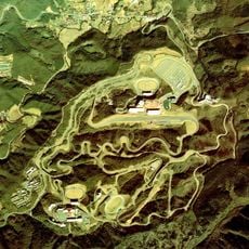
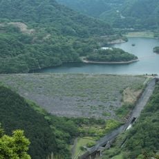
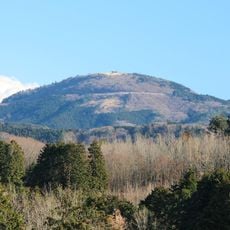
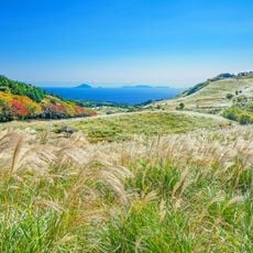
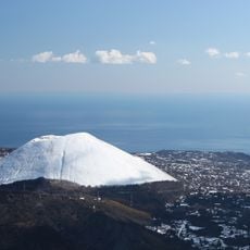
Mount Ōmuro is an extinct volcano in Ito with a round crater measuring 300 meters across and 70 meters deep at the summit. The grass-covered cone reaches 580 meters above sea level and offers open views across the surrounding area to the coast.

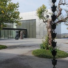
The volcano formed around 4000 years ago through several eruptions that deposited volcanic fragments and created its symmetrical shape. Since the 18th century, the area has been part of Fuji-Hakone-Izu National Park and was protected as a Natural Monument of Japan.

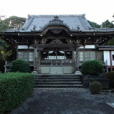
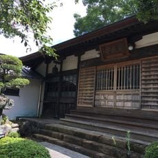
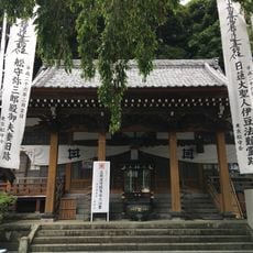
The Sengen Shrine on the mountainside serves as a religious place where visitors pray for blessings related to birth and marriage. During ceremonies, guests can watch believers write their wishes on small wooden plaques and hang them at the shrine.

A chairlift brings visitors from the parking area to the summit and operates from 9 AM to 5:15 PM, with hours reduced between October and March to 4:15 PM. The walk from the chairlift end to the crater rim takes around ten minutes along grassy paths.

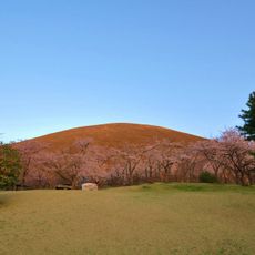
Every February, the Yamayaki festival takes place when controlled fires run across the grassy slopes and burn off the dry vegetation. This old practice prevents pests and encourages new grass growth for the coming season.

The community of curious travelers

AroundUs brings together thousands of curated places, local tips, and hidden gems, enriched daily by 60,000 contributors worldwide.

Start exploring
Location
Ito
Elevation above the sea
580 m
Part of
Izu-Tobu
GPS coordinates
34.90314,139.09476
Latest update
December 13, 2025 18:54
« Mount Ōmuro - Cinder cone in Ito, Japan » is provided by Around Us (aroundus.com). Images and texts are derived from Wikimedia project under a Creative Commons license. You are allowed to copy, distribute, and modify copies of this page, under the conditions set by the license, as long as this note is clearly visible.

Discover hidden gems everywhere you go!

From secret cafés to breathtaking viewpoints, skip the crowded tourist spots and find places that match your style. Our app makes it easy with voice search, smart filtering, route optimization, and insider tips from travelers worldwide. Download now for the complete mobile experience.

Around Us App Screenshot

A unique approach to discovering new places

Le Figaro

All the places worth exploring

France Info

A tailor-made excursion in just a few clicks

20 Minutes

Around Us
Travel Guide & Maps
Download

Send to your phone

QR Code
1

Open the camera app on your mobile.

2

Point at the QR code with your camera. A notification will appear.

3

Tap the notification to open the link.