Enable Location

We need your location to show you interesting places around you

Discover nearby places

Find interesting locations and hidden gems around you

Precise directions

Get accurate directions and distances to places

Your location is never shared with other users. It's only used when you tap the location button.

Mount Akaiwanoatama

Log in to your account

Start exploring — it's free

Trusted by 61,382 travelers worldwide

Continue with Google
Continue with Apple
or

We will send you a code to connect

By continuing, you accept our Terms and Conditions and our Privacy Policy

Check your inbox

We've sent a pincode in your inbox. Please enter the code below.

Mount Akaiwanoatama

Mount Akaiwanoatama, Mountain summit in Chino, Japan

Description

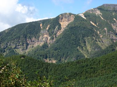
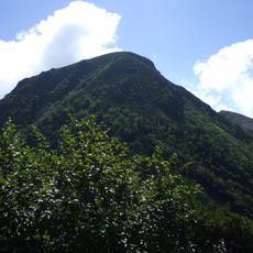
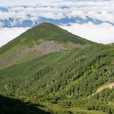
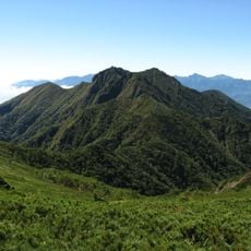
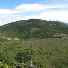
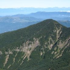
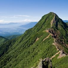
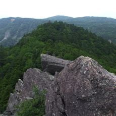
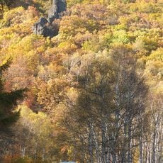
Mount Akaiwanoatama is a 2,656-meter peak within the Yatsugatake Mountains, displaying volcanic formations and steep rocky slopes throughout its terrain. Multiple hiking trails lead up the mountainside from different starting locations, offering various routes through the alpine landscape.

History

The mountain formed through volcanic activity roughly 1 million to 200,000 years ago as part of the Southern Yatsugatake Volcanic Group. This geological history shaped the peak and the rocky configurations visible today.

Culture

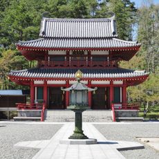
The mountain sits within the Yatsugatake-Chushin-Kogen Quasi-National Park area, where visitors find traditional shrines and prayer sites along the trails. People climb these peaks year-round, combining hiking with spiritual practices that have been passed down through generations.

Practical

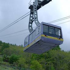
Reach the area via Chino Station followed by a bus ride to the Minotoguchi stop, where hiking trails begin from various points. The best climbing season runs from late spring through early fall when snow has melted from most of the mountain.

Did you know?

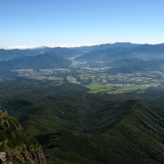
The summit view reaches neighboring peaks such as 2,899-meter Mount Aka, while snow persists on certain sections until late spring. This lingering snow cover creates a special alpine setting as the rest of the region has already turned green.

Location
Elevation above the sea
2,656 m
GPS coordinates
35.99541,138.36389
Latest update
December 14, 2025 12:24

AroundUs brings together thousands of curated places, local tips, and hidden gems, enriched daily by 60,000 contributors worldwide. Discover all places nearby (Chino).

« Mount Akaiwanoatama - Mountain summit in Chino, Japan » is provided by Around Us (aroundus.com). Images and texts are derived from Wikimedia project under a Creative Commons license. You are allowed to copy, distribute, and modify copies of this page, under the conditions set by the license, as long as this note is clearly visible.

Discover hidden gems everywhere you go!

From secret cafés to breathtaking viewpoints, skip the crowded tourist spots and find places that match your style. Our app makes it easy with voice search, smart filtering, route optimization, and insider tips from travelers worldwide. Download now for the complete mobile experience.

Around Us App Screenshot

A unique approach to discovering new places

Le Figaro

All the places worth exploring

France Info

A tailor-made excursion in just a few clicks

20 Minutes

Around Us
Travel Guide & Maps
Download

Send to your phone

QR Code
1

Open the camera app on your mobile.

2

Point at the QR code with your camera. A notification will appear.

3

Tap the notification to open the link.