Chest opened
+${chestReward.xp} XP
Explorer
NOUVEAU ×${chestReward.collectible.quantity}
tapez pour fermer
Chest locked

Open chests in the app

Around Us is built for your phone — chests unlock when you walk, explore and capture nearby places.

Enable Location

We need your location to show you interesting places around you

Discover nearby places

Find interesting locations and hidden gems around you

Precise directions

Get accurate directions and distances to places

Your location is never shared with other users. It's only used when you tap the location button.

Log in to your account

Start exploring — it's free

Trusted by 72,879 travelers worldwide

Continue with Google
Continue with Apple
or

We will send you a code to connect

By continuing, you accept our Terms and Conditions and our Privacy Policy

Check your inbox

We've sent a pincode in your inbox. Please enter the code below.

Discussion Reviews Photo
12.3k Popularity

South Down, Electoral constituency in County Down, Northern Ireland.

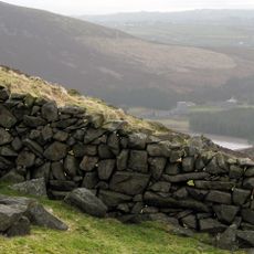
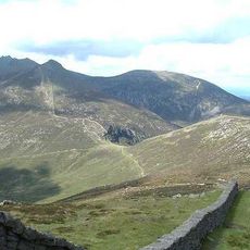
South Down is an electoral constituency in County Down, Northern Ireland. The district covers portions of the county including areas near the Mourne Mountains and extends northward to Downpatrick, where five Assembly members serve the electorate.

The constituency was established in 1973 following a reorganization of local government structures in Northern Ireland. This creation enabled communities to elect representatives to the Northern Ireland Assembly through a new electoral framework.

The constituency reflects the diverse political traditions of Northern Ireland through its regular electoral participation and representation from multiple political parties.

Elections in this constituency use the Single Transferable Vote system for proportional representation. Voters rank candidates by preference, and votes are redistributed according to a specific counting method to determine winners.

The constituency recorded notable electoral history when Éamon de Valera won the seat with 92.3 percent of votes in 1933 but never took his position.

The community of curious travelers

AroundUs brings together thousands of curated places, local tips, and hidden gems, enriched daily by 60,000 contributors worldwide.

Start exploring
Location
Inception
1973
GPS coordinates
54.24420,-5.95083
Latest update
December 7, 2025 20:45
Around this place
Slieve Donard
United Kingdom

Slieve Donard

7.4 km
Tollymore Forest Park
United Kingdom

Tollymore Forest Park

3.8 km
Royal County Down Golf Club
United Kingdom

Royal County Down Golf Club

5.2 km
Mourne Wall
United Kingdom

Mourne Wall

12.2 km
Slieve Croob
United Kingdom

Slieve Croob

10.8 km
Slieve Binnian
United Kingdom

Slieve Binnian

11.5 km
Castlewellan Forest Park
United Kingdom

Castlewellan Forest Park

2.3 km
Slieve Commedagh
United Kingdom

Slieve Commedagh

6.2 km
Legananny Dolmen
United Kingdom

Legananny Dolmen

9.9 km
Slieve Bearnagh
United Kingdom

Slieve Bearnagh

7.1 km
Murlough Nature Reserve
United Kingdom

Murlough Nature Reserve

6.5 km
Clough Castle
United Kingdom

Clough Castle

9.3 km
Ben Crom Reservoir
United Kingdom

Ben Crom Reservoir

10.2 km
Ben Crom
United Kingdom

Ben Crom

9.1 km
Donard Park
United Kingdom

Donard Park

5.5 km
Slieve Meelmore
United Kingdom

Slieve Meelmore

6.9 km
Goward Dolmen
United Kingdom

Goward Dolmen

10 km
Burrenwood
United Kingdom

Burrenwood

487 m
Slieve Meelbeg
United Kingdom

Slieve Meelbeg

7.7 km
Rathfriland Castle
United Kingdom

Rathfriland Castle

13.5 km
Castlewellan Castle Castlewellan Co.down
United Kingdom

Castlewellan Castle Castlewellan Co.down

2.3 km
Peace Maze at Castlewellan Forest Park
United Kingdom

Peace Maze at Castlewellan Forest Park

1.6 km
Kilcoo C Of I Parish Church Bryansford Village Ballyhafry Newcastle Co Down Bt33 0pt
United Kingdom

Kilcoo C Of I Parish Church Bryansford Village Ballyhafry Newcastle Co Down Bt33 0pt

1.9 km
Murland Tomb Clough Non-subscribing Presbyterian Church Castlewellan Road Clough Downpatrick Co Down
United Kingdom

Murland Tomb Clough Non-subscribing Presbyterian Church Castlewellan Road Clough Downpatrick Co Down

8.9 km
Clough Non-subscribing Presbyterian Church Castlewellan Road Clough Downpatrick Co Down Bt30 8rd
United Kingdom

Clough Non-subscribing Presbyterian Church Castlewellan Road Clough Downpatrick Co Down Bt30 8rd

8.9 km
Slidderyford Bridge (the Twelve Arches) Old Ballynahinch Road Wateresk Dundrum Newcastle Co.down
United Kingdom

Slidderyford Bridge (the Twelve Arches) Old Ballynahinch Road Wateresk Dundrum Newcastle Co.down

5.9 km
Newcastle Library
United Kingdom

Newcastle Library

5.4 km
Overflow Pipe Silent Valley Reservoir Head Road Kilkeel Newry Co Down Bt34 4pu
United Kingdom

Overflow Pipe Silent Valley Reservoir Head Road Kilkeel Newry Co Down Bt34 4pu

13.2 km
Show the full map
Reviews
Share your experience

No review yet

Discussions
Start a discussion...

No discussion yet

« South Down - Electoral constituency in County Down, Northern Ireland » is provided by Around Us (aroundus.com). Images and texts are derived from Wikimedia project under a Creative Commons license. You are allowed to copy, distribute, and modify copies of this page, under the conditions set by the license, as long as this note is clearly visible.

Discover hidden gems everywhere you go!

From secret cafés to breathtaking viewpoints, skip the crowded tourist spots and find places that match your style. Our app makes it easy with voice search, smart filtering, route optimization, and insider tips from travelers worldwide. Download now for the complete mobile experience.

Around Us App Screenshot

A unique approach to discovering new places

Le Figaro

All the places worth exploring

France Info

A tailor-made excursion in just a few clicks

20 Minutes

Around Us
Travel Guide & Maps
Download

Send to your phone

QR Code
1

Open the camera app on your mobile.

2

Point at the QR code with your camera. A notification will appear.

3

Tap the notification to open the link.