Accomack County

Log in to your account

AroundUs is a community-driven map of interesting places, built by curious explorers like you. It grows with every review, story, and photo you share.
Connect to save your favorite spots, contribute locations, and create personalized routes.
By continuing, you accept our Terms and Conditions and our Privacy Policy
Add to collection
Map
Suggest a change
Share

Accomack County, Administrative county in Eastern Virginia, United States

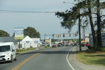
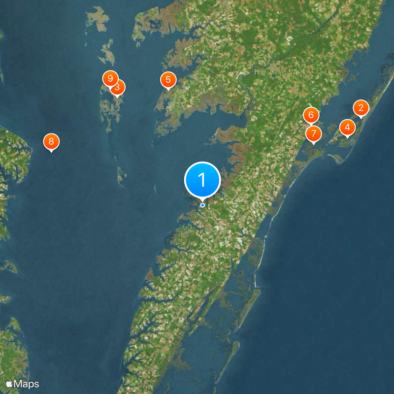
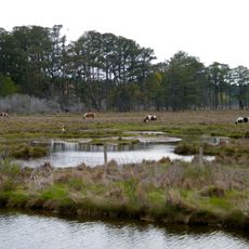
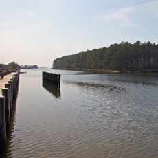
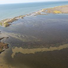
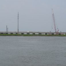
Accomack County is a county in eastern Virginia bordered by the Chesapeake Bay and Atlantic Ocean. Its location between major water bodies shapes how the landscape looks and how people live and work there.

The county traces back to Accomac Shire, established in 1634 as one of Virginia's earliest administrative divisions. Over time the region evolved and took on its current name, which it has kept to this day.

The name comes from the Accawmack people who lived here long ago and shaped the region. Local residents today keep this heritage alive through place names and traditions passed down through generations.

Plan to spend time near the water, since the area is shaped by its closeness to the bay and ocean. The best time to explore is when weather is mild and pathways are easy to access.

The region has an unusually large share of water compared to its land area, which sets it apart from other places. This special geographic makeup strongly influences the nature, economy, and daily life of people who live here.

Location: Virginia

Inception: 1663

Capital city: Accomac

Shares border with: Somerset County, Worcester County, Northampton County

Website: http://co.accomack.va.us

GPS coordinates: 37.76000,-75.76000

Latest update: December 14, 2025 20:27

Photos
Around this place
Chincoteague National Wildlife Refuge
United States of America

Chincoteague National Wildlife Refuge

44.6 km
Captain John Smith Chesapeake National Historic Trail
United States of America

Captain John Smith Chesapeake National Historic Trail

34 km
Assateague Light
United States of America

Assateague Light

39.3 km
Janes Island State Park
United States of America

Janes Island State Park

29.8 km
NASA Visitor Center
United States of America

NASA Visitor Center

33.2 km
Wallops Island National Wildlife Refuge
United States of America

Wallops Island National Wildlife Refuge

31.3 km
Smith Point Light
United States of America

Smith Point Light

39.6 km
Glenn Martin National Wildlife Refuge
United States of America

Glenn Martin National Wildlife Refuge

36.7 km
Parramore Island Natural Area Preserve
United States of America

Parramore Island Natural Area Preserve

26.4 km
Windmill Point Light
United States of America

Windmill Point Light

45.7 km
Parkers Marsh Natural Area Preserve
United States of America

Parkers Marsh Natural Area Preserve

5.6 km
Mutton Hunk Fen Natural Area Preserve
United States of America

Mutton Hunk Fen Natural Area Preserve

16.4 km
Captain Timothy Hill House
United States of America

Captain Timothy Hill House

41.2 km
John B. Whealton Memorial Causeway
United States of America

John B. Whealton Memorial Causeway

35.8 km
Debtors' Prison
United States of America

Debtors' Prison

9.4 km
Central High School
United States of America

Central High School

18.1 km
Mark's and Jack's Island Natural Area Preserve
United States of America

Mark's and Jack's Island Natural Area Preserve

8.1 km
Watts Island Light
United States of America

Watts Island Light

12 km
Bowman's Folly
United States of America

Bowman's Folly

13.6 km
Hopkins and Brother Store
United States of America

Hopkins and Brother Store

5.3 km
Make Peace
United States of America

Make Peace

24.4 km
Museum of Chincoteague Island
United States of America

Museum of Chincoteague Island

40.2 km
Somers Cove Marina
United States of America

Somers Cove Marina

25.6 km
J. Millard Tawes Historical Museum
United States of America

J. Millard Tawes Historical Museum

26 km
Bunting Place
United States of America

Bunting Place

16.5 km
NASA's Wallops Flight Facility Visitor Center
United States of America

NASA's Wallops Flight Facility Visitor Center

33.2 km
Pocomoke Sound Wildlife Management Area
United States of America

Pocomoke Sound Wildlife Management Area

23.4 km
Tangier Sound Light
United States of America

Tangier Sound Light

19.1 km
Show the full map
Reviews

Visited this place? Tap the stars to rate it and share your experience / photos with the community! Try now! You can cancel it anytime.

Administrative divisions
« Accomack County - Administrative county in Eastern Virginia, United States » is provided by Around Us (aroundus.com). Images and texts are derived from Wikimedia project under a Creative Commons license. You are allowed to copy, distribute, and modify copies of this page, under the conditions set by the license, as long as this note is clearly visible.

Discover hidden gems everywhere you go!

From secret cafés to breathtaking viewpoints, skip the crowded tourist spots and find places that match your style. Our app makes it easy with voice search, smart filtering, route optimization, and insider tips from travelers worldwide. Download now for the complete mobile experience.

Around Us App Screenshot

A unique approach to discovering new places

Le Figaro

All the places worth exploring

France Info

A tailor-made excursion in just a few clicks

20 Minutes