Enable Location

We need your location to show you interesting places around you

Discover nearby places

Find interesting locations and hidden gems around you

Precise directions

Get accurate directions and distances to places

Your location is never shared with other users. It's only used when you tap the location button.

Crittenden County

Log in to your account

Start exploring — it's free

Trusted by 61,688 travelers worldwide

Continue with Google
Continue with Apple
or

We will send you a code to connect

By continuing, you accept our Terms and Conditions and our Privacy Policy

Check your inbox

We've sent a pincode in your inbox. Please enter the code below.

Crittenden County, County administrative division in Kentucky, United States.

Description

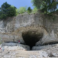
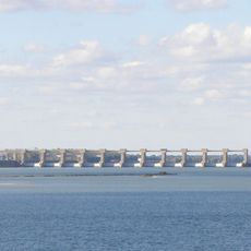
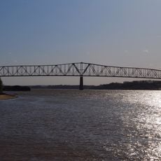
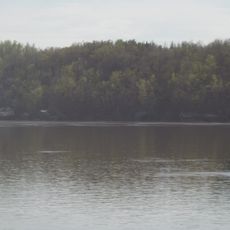
Crittenden County is located in western Kentucky, bounded by the Ohio River and the Tradewater River along its northern and western edges. The terrain includes river valleys and elevated plateaus that shape the county's natural geography.

History

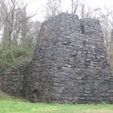
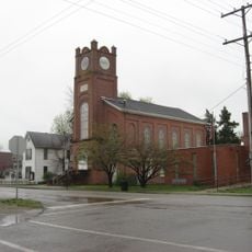
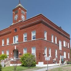
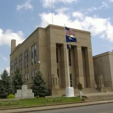
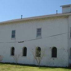
The county was established in January 1842 from portions of Livingston County and saw military conflict during the Civil War era. Confederate forces destroyed the county courthouse during that period of unrest.

Culture

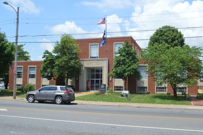
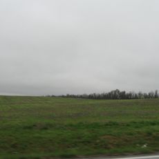
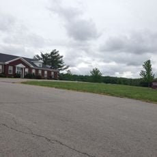
Marion, the county seat, serves as a gathering place for community events and farmers' markets where agricultural traditions remain central to local life. The region is shaped by farming families who have maintained rural practices across generations.

Practical

The area is accessible via US Route 60, US Route 641, and several Kentucky state routes that cross through the county. Visitors can explore the region by car, as these roads provide access to different parts of the area.

Did you know?

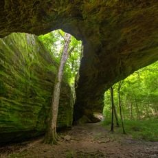
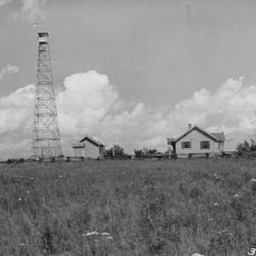
The area contains deposits of fluorspar, zinc, porcelain minerals, coal, limestone, and glass-making sand. These natural resources have driven mining and industrial operations throughout the county's history.

Location
Inception
January 26, 1842
Capital city
Marion
Shares border with
Hardin County, Union County, Webster County, Caldwell County, Lyon County, Livingston County
GPS coordinates
37.36000,-88.09000
Latest update
December 8, 2025 13:41

AroundUs brings together thousands of curated places, local tips, and hidden gems, enriched daily by 60,000 contributors worldwide. Discover all places nearby (Kentucky).

Around this place
Kentucky State Penitentiary
United States of America

Kentucky State Penitentiary

34.7 km
Lake Barkley
United States of America

Lake Barkley

39.5 km
Cave-in-Rock State Park
United States of America

Cave-in-Rock State Park

13.4 km
United States of America

Tolu Site

16.7 km
Adsmore
United States of America

Adsmore

33.4 km
Smithland Lock and Dam
United States of America

Smithland Lock and Dam

36.9 km
Illinois Iron Furnace
United States of America

Illinois Iron Furnace

26.2 km
Shawneetown Bridge
United States of America

Shawneetown Bridge

37 km
Battery Rock
United States of America

Battery Rock

18.9 km
Mantle Rock Archeological District
United States of America

Mantle Rock Archeological District

29.9 km
Orr-Herl Mound and Village Site
United States of America

Orr-Herl Mound and Village Site

22.6 km
University of Kentucky Research and Education Center Botanical Garden
United States of America

University of Kentucky Research and Education Center Botanical Garden

35.7 km
Golconda Historic District
United States of America

Golconda Historic District

35.1 km
United States of America

Lusk's Ferry, Illinois

34.8 km
Confederate Soldier Monument in Caldwell
United States of America

Confederate Soldier Monument in Caldwell

33.5 km
Old Eddyville Historic District
United States of America

Old Eddyville Historic District

34.8 km
Hardin County Courthouse
United States of America

Hardin County Courthouse

21.3 km
Fredonia Cumberland Presbyterian Church
United States of America

Fredonia Cumberland Presbyterian Church

16.9 km
Richard Olive House
United States of America

Richard Olive House

37.1 km
Beulah Lodge
United States of America

Beulah Lodge

36.8 km
Webster County Courthouse
United States of America

Webster County Courthouse

39.4 km
L.B. Overby House
United States of America

L.B. Overby House

33.7 km
The Darby House
United States of America

The Darby House

41.2 km
Providence Commercial Historic District
United States of America

Providence Commercial Historic District

29.2 km
Cave In Rock State Park
United States of America

Cave In Rock State Park

13.4 km
Capitol Cinemas
United States of America

Capitol Cinemas

33.4 km
Masonic Hall-Federal Commissary Building
United States of America

Masonic Hall-Federal Commissary Building

37.2 km
Peters Creek Lookout Tower
United States of America

Peters Creek Lookout Tower

21.5 km
Show the full map
« Crittenden County - County administrative division in Kentucky, United States » is provided by Around Us (aroundus.com). Images and texts are derived from Wikimedia project under a Creative Commons license. You are allowed to copy, distribute, and modify copies of this page, under the conditions set by the license, as long as this note is clearly visible.

Discover hidden gems everywhere you go!

From secret cafés to breathtaking viewpoints, skip the crowded tourist spots and find places that match your style. Our app makes it easy with voice search, smart filtering, route optimization, and insider tips from travelers worldwide. Download now for the complete mobile experience.

Around Us App Screenshot

A unique approach to discovering new places

Le Figaro

All the places worth exploring

France Info

A tailor-made excursion in just a few clicks

20 Minutes

Around Us
Travel Guide & Maps
Download

Send to your phone

QR Code
1

Open the camera app on your mobile.

2

Point at the QR code with your camera. A notification will appear.

3

Tap the notification to open the link.