Enable Location

We need your location to show you interesting places around you

Discover nearby places

Find interesting locations and hidden gems around you

Precise directions

Get accurate directions and distances to places

Your location is never shared with other users. It's only used when you tap the location button.

Elliott County

Log in to your account

Start exploring — it's free

Trusted by 61,692 travelers worldwide

Continue with Google
Continue with Apple
or

We will send you a code to connect

By continuing, you accept our Terms and Conditions and our Privacy Policy

Check your inbox

We've sent a pincode in your inbox. Please enter the code below.

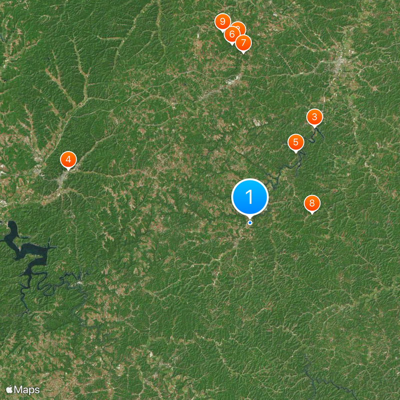
Elliott County, Administrative county in eastern Kentucky, US.

Description

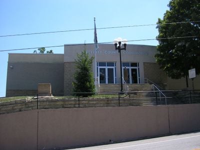
Elliott County is an administrative county in eastern Kentucky that spreads across valleys and hillsides throughout the region. Sandy Hook serves as its administrative center and sits along the Little Sandy River, where county government functions operate.

History

The Kentucky General Assembly created this county on January 26, 1869, by dividing portions of neighboring Morgan, Lawrence, and Carter counties. This establishment helped organize the region's government and administration more effectively.

Culture

Local residents keep Appalachian traditions alive through music and storytelling that pass between generations. These practices shape how people in the area connect with one another and celebrate their heritage.

Practical

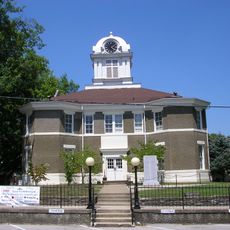
The courthouse in Sandy Hook handles day-to-day governmental services including vehicle registration and documentation for residents. This central location makes it easy to find administrative assistance when needed in the area.

Did you know?

Keith Whitley, born in Sandy Hook, became a notable country music figure whose early musical training came from the local traditions here. His career grew from the musical roots he developed in the area during his childhood.

Location
Inception
January 26, 1869
Capital city
Sandy Hook
Shares border with
Carter County, Lawrence County, Morgan County, Rowan County
GPS coordinates
38.11667,-83.10000
Latest update
December 20, 2025 11:57

AroundUs brings together thousands of curated places, local tips, and hidden gems, enriched daily by 60,000 contributors worldwide. Discover all places nearby (Kentucky).

Around this place
Carter Caves State Resort Park
United States of America

Carter Caves State Resort Park

28.7 km
Grayson Lake
United States of America

Grayson Lake

18.1 km
Jayne Stadium
United States of America

Jayne Stadium

29.7 km
Grayson Lake State Park
United States of America

Grayson Lake State Park

13.2 km
Shangra La Arch
United States of America

Shangra La Arch

28.1 km
Bat Cave and Cascade Caverns State Nature Preserves
United States of America

Bat Cave and Cascade Caverns State Nature Preserves

26.6 km
Elliott County Kimberlite
United States of America

Elliott County Kimberlite

9.9 km
United States of America

Tygarts State Forest

30.2 km
Saltpeter Cave
United States of America

Saltpeter Cave

29 km
United States of America

Van Kitchen House

16.4 km
Haldeman Voting House No. 8
United States of America

Haldeman Voting House No. 8

24.1 km
Judge John E. Cooper House
United States of America

Judge John E. Cooper House

25.6 km
United States of America

Jeff Bond House

24.8 km
Morgan County Courthouse
United States of America

Morgan County Courthouse

25.7 km
Sheltowee Falls Splash Pad
United States of America

Sheltowee Falls Splash Pad

29.7 km
United States of America

Olive Hill Reservoir

24.1 km
United States of America

Grayson Lake Wildlife Management Area

11.2 km
Natural Bridge
United States of America

Natural Bridge

29.2 km
Raven Bridge
United States of America

Raven Bridge

28 km
United States of America

Smoky Bridge

28.1 km
United States of America

Fern Bridge

28.4 km
United States of America

Cascade Bridge

26.3 km
United States of America

Old Homestead

28.4 km
United States of America

Old Homestead

27.8 km
United States of America

Pleasant Valley Country Club

28.4 km
United States of America

West Liberty Dough Boy

26 km
United States of America

War Mural

27.4 km
United States of America

Scenic viewpoint

29.2 km
Show the full map
« Elliott County - Administrative county in eastern Kentucky, US » is provided by Around Us (aroundus.com). Images and texts are derived from Wikimedia project under a Creative Commons license. You are allowed to copy, distribute, and modify copies of this page, under the conditions set by the license, as long as this note is clearly visible.

Discover hidden gems everywhere you go!

From secret cafés to breathtaking viewpoints, skip the crowded tourist spots and find places that match your style. Our app makes it easy with voice search, smart filtering, route optimization, and insider tips from travelers worldwide. Download now for the complete mobile experience.

Around Us App Screenshot

A unique approach to discovering new places

Le Figaro

All the places worth exploring

France Info

A tailor-made excursion in just a few clicks

20 Minutes

Around Us
Travel Guide & Maps
Download

Send to your phone

QR Code
1

Open the camera app on your mobile.

2

Point at the QR code with your camera. A notification will appear.

3

Tap the notification to open the link.