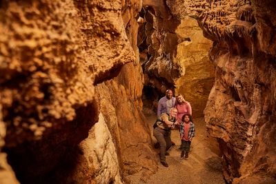
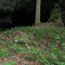
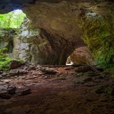
Enable Location

We need your location to show you interesting places around you

Discover nearby places

Find interesting locations and hidden gems around you

Precise directions

Get accurate directions and distances to places

Your location is never shared with other users. It's only used when you tap the location button.

Shangra La Arch

Log in to your account

Start exploring — it's free

Trusted by 64,530 travelers worldwide

Continue with Google
Continue with Apple
or

We will send you a code to connect

By continuing, you accept our Terms and Conditions and our Privacy Policy

Check your inbox

We've sent a pincode in your inbox. Please enter the code below.

Shangra La Arch
Discussion Reviews 1 Photos
2.8k Popularity

Shangra La Arch

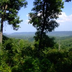
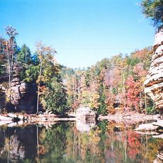
Shangra La Arch is a natural rock formation in Carter County that looks like a large stone archway surrounded by forests and open land. The structure displays layered rocks with a natural opening through which you can see the sky, while the surface shows lines and textures from years of wind and rain.

The formation was created over thousands of years as water and weather gradually wore away softer rocks, carving this distinctive arch shape. Local stories tell that the arch was once part of a larger rock formation that slowly separated over time.

The name "Shangra La" suggests a place of peace and beauty that draws visitors seeking calm surroundings. Couples often choose this spot for special moments like proposals, showing how the local community views it as meaningful for personal memories.

The arch sits on an easy-to-walk trail about a third of a mile (0.5 kilometers) round trip from the parking area and is suitable for most people. Wear comfortable shoes, bring water, and be aware of snakes and black bears in the area by making noise while walking.

A small waterfall flows right below the arch during and after rainy days, creating a scenic sight that draws photographers and nature lovers. This hidden feature is often overlooked but adds an extra element of natural beauty to the visit, making each trip after rain particularly memorable.

The community of curious travelers

AroundUs brings together thousands of curated places, local tips, and hidden gems, enriched daily by 60,000 contributors worldwide.

Start exploring
Location
Address
344 Caveland Dr, Olive Hill, KY 41164, USA
Phone
GPS coordinates
38.36767,-83.13202
Latest update
February 9, 2026 08:23
Around this place
Carter Caves State Resort Park
United States of America

Carter Caves State Resort Park

1.1 km
Grayson Lake
United States of America

Grayson Lake

18.3 km
Jayne Stadium
United States of America

Jayne Stadium

32.2 km
Shawnee State Forest
United States of America

Shawnee State Forest

36.2 km
Greenup Lock and Dam
United States of America

Greenup Lock and Dam

39.2 km
Grayson Lake State Park
United States of America

Grayson Lake State Park

19.6 km
Greenbo Lake
United States of America

Greenbo Lake

26.9 km
Bat Cave and Cascade Caverns State Nature Preserves
United States of America

Bat Cave and Cascade Caverns State Nature Preserves

2.2 km
Kentucky Folk Art Center
United States of America

Kentucky Folk Art Center

33.6 km
Union Monument in Vanceburg
United States of America

Union Monument in Vanceburg

30.5 km
Elliott County Kimberlite
United States of America

Elliott County Kimberlite

29.2 km
Jesse Stuart Memorial Bridge
United States of America

Jesse Stuart Memorial Bridge

39.1 km
Adams County Paleo-Indian District
United States of America

Adams County Paleo-Indian District

30.8 km
Saltpeter Cave
United States of America

Saltpeter Cave

1.2 km
Bennett's Mill Covered Bridge
United States of America

Bennett's Mill Covered Bridge

34.3 km
Oldtown Covered Bridge
United States of America

Oldtown Covered Bridge

21.9 km
Rowan County Courthouse
United States of America

Rowan County Courthouse

33.3 km
Downtown Morehead Historic District
United States of America

Downtown Morehead Historic District

33.8 km
Wurtland Union Church
United States of America

Wurtland Union Church

36.7 km
Haldeman Voting House No. 8
United States of America

Haldeman Voting House No. 8

21.7 km
Greenup Masonic Lodge
United States of America

Greenup Masonic Lodge

34.8 km
Methodist Episcopal Church South
United States of America

Methodist Episcopal Church South

34.8 km
United States of America

Brushy Voting House No. 6

35.4 km
Sheltowee Falls Splash Pad
United States of America

Sheltowee Falls Splash Pad

33.2 km
Morehead State University
United States of America

Morehead State University

33.2 km
Portsmouth Earthworks, Group A
United States of America

Portsmouth Earthworks, Group A

40.5 km
Hopewell Bridge
United States of America

Hopewell Bridge

20.3 km
Natural Bridge
United States of America

Natural Bridge

1.3 km
Show the full map
Reviews
Share your experience

No review yet

Discussions
Start a discussion...

No discussion yet

« Shangra La Arch » is provided by Around Us (aroundus.com). Images and texts are derived from Wikimedia project under a Creative Commons license. You are allowed to copy, distribute, and modify copies of this page, under the conditions set by the license, as long as this note is clearly visible.

Discover hidden gems everywhere you go!

From secret cafés to breathtaking viewpoints, skip the crowded tourist spots and find places that match your style. Our app makes it easy with voice search, smart filtering, route optimization, and insider tips from travelers worldwide. Download now for the complete mobile experience.

Around Us App Screenshot

A unique approach to discovering new places

Le Figaro

All the places worth exploring

France Info

A tailor-made excursion in just a few clicks

20 Minutes

Around Us
Travel Guide & Maps
Download

Send to your phone

QR Code
1

Open the camera app on your mobile.

2

Point at the QR code with your camera. A notification will appear.

3

Tap the notification to open the link.