Ste. Genevieve County

Log in to your account

AroundUs is a community-driven map of interesting places, built by curious explorers like you. It grows with every review, story, and photo you share.
Connect to save your favorite spots, contribute locations, and create personalized routes.
By continuing, you accept our Terms and Conditions and our Privacy Policy
Add to collection
Map
Suggest a change
Share

Ste. Genevieve County, Administrative county in eastern Missouri, United States

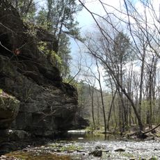
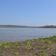
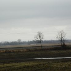
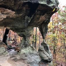
Ste. Genevieve County is an administrative division in eastern Missouri that stretches along the Mississippi River through rolling hills and fertile valleys. The landscape combines river bottomland with forested uplands and farmland, creating a varied terrain across the region.

The county received its formal establishment on October 1, 1812, following Missouri Territory's incorporation into the United States. Before this official date, the region attracted French settlers drawn to salt springs that fueled economic growth in one of the earliest European settlements west of the Mississippi.

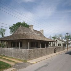
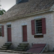
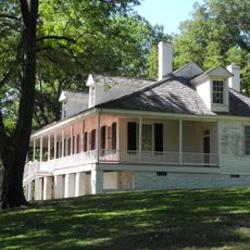
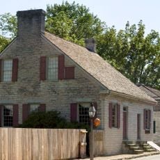
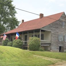
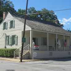
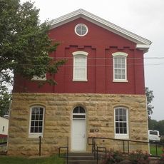
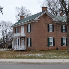
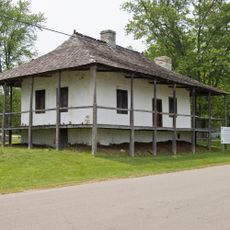
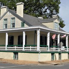
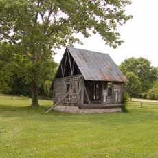
French colonial heritage shapes the local architecture, with numerous vertical post structures from the late 18th century still defining the visual character of communities throughout the region.

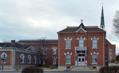
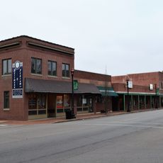
The county seat of Ste. Genevieve houses the main government offices, including circuit court, assessor services, and emergency management functions. Visitors navigating the region will find that essential services cluster in this central location, making it a logical reference point for orientation.

Salt springs scattered throughout the region drew early settlers and played a key role in establishing one of the first European communities west of the Mississippi. These natural resources shaped the initial economic success of local settlements more than farming or other goods.

Location: Missouri

Inception: 1812

Capital city: Ste. Genevieve

Shares border with: Monroe County, Randolph County, Perry County, St. Francois County, Jefferson County

Website: http://stegencounty.org

GPS coordinates: 37.89333,-90.20333

Latest update: December 7, 2025 20:47

Photos
Around this place
Show the full map
Fort de Chartres
United States of America

Fort de Chartres

21.6 km
Hawn State Park
United States of America

Hawn State Park

8.4 km
Louis Bolduc House
United States of America

Louis Bolduc House

17 km
Felix Vallé House State Historic Site
United States of America

Felix Vallé House State Historic Site

16.9 km
Modoc Rock Shelter
United States of America

Modoc Rock Shelter

22.5 km
Pierre Menard House
United States of America

Pierre Menard House

27 km
Ste. Genevieve Historic District
United States of America

Ste. Genevieve Historic District

17 km
Middle Mississippi River National Wildlife Refuge
United States of America

Middle Mississippi River National Wildlife Refuge

25.3 km
French Colonial Historic District
United States of America

French Colonial Historic District

21.8 km
Kaskaskia Bell State Memorial
United States of America

Kaskaskia Bell State Memorial

25.6 km
Amoureux House
United States of America

Amoureux House

16.9 km
Kolmer Site
United States of America

Kolmer Site

22.2 km
Creole House
United States of America

Creole House

23.3 km
Jacques Guibourd Historic House
United States of America

Jacques Guibourd Historic House

16.7 km
Sacred Heart Roman Catholic Church
United States of America

Sacred Heart Roman Catholic Church

15.2 km
St. Rose of Lima Mission, Roman Catholic Church
United States of America

St. Rose of Lima Mission, Roman Catholic Church

30 km
Le Grand Champ Bottom
United States of America

Le Grand Champ Bottom

19.1 km
Presbyterian Orphanage of Missouri
United States of America

Presbyterian Orphanage of Missouri

23.2 km
Pickle Springs
United States of America

Pickle Springs

13.4 km
St. Francois County Jail and Sheriff's Residence
United States of America

St. Francois County Jail and Sheriff's Residence

23 km
Courthouse Square Historic District
United States of America

Courthouse Square Historic District

22.8 km
East Columbia Historic District
United States of America

East Columbia Historic District

22.8 km
James Robinson McCormick House
United States of America

James Robinson McCormick House

23.2 km
Bequette-Ribault House
United States of America

Bequette-Ribault House

16.8 km
Ste. Geneviève National Historical Park
United States of America

Ste. Geneviève National Historical Park

17 km
Jean-Baptiste Vallé House
United States of America

Jean-Baptiste Vallé House

17 km
Lasource-Durand House
United States of America

Lasource-Durand House

16.8 km
Madison County Sheriff's House and Jail
United States of America

Madison County Sheriff's House and Jail

24.9 km
Show the full map
Reviews

Visited this place? Tap the stars to rate it and share your experience / photos with the community! Try now! You can cancel it anytime.

« Ste. Genevieve County - Administrative county in eastern Missouri, United States » is provided by Around Us (aroundus.com). Images and texts are derived from Wikimedia project under a Creative Commons license. You are allowed to copy, distribute, and modify copies of this page, under the conditions set by the license, as long as this note is clearly visible.

Discover hidden gems everywhere you go!

From secret cafés to breathtaking viewpoints, skip the crowded tourist spots and find places that match your style. Our app makes it easy with voice search, smart filtering, route optimization, and insider tips from travelers worldwide. Download now for the complete mobile experience.

Around Us App Screenshot

A unique approach to discovering new places

Le Figaro

All the places worth exploring

France Info

A tailor-made excursion in just a few clicks

20 Minutes