Enable Location

We need your location to show you interesting places around you

Discover nearby places

Find interesting locations and hidden gems around you

Precise directions

Get accurate directions and distances to places

Your location is never shared with other users. It's only used when you tap the location button.

French Colonial Historic District

Log in to your account

Start exploring — it's free

Trusted by 61,355 travelers worldwide

Continue with Google
Continue with Apple
or

We will send you a code to connect

By continuing, you accept our Terms and Conditions and our Privacy Policy

Check your inbox

We've sent a pincode in your inbox. Please enter the code below.

French Colonial Historic District, Historic district in Prairie du Rocher, United States.

Description

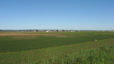
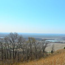
The French Colonial Historic District spans 14,080 acres between Fort Chartres and Kaskaskia Island, containing restored colonial buildings and archaeological remains from early settlements. The area includes residential structures, fortifications, and sites that show how French colonists and Native Americans lived in this region.

History

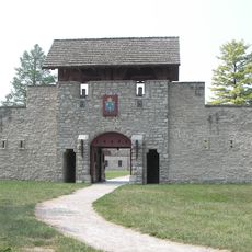
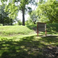
The district began as a French military stronghold in the 18th century, playing a key role in establishing French control over the region. Fort Chartres served as a strategic center for managing trade and defending territorial claims during colonial times.

Culture

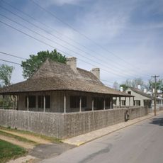
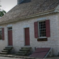
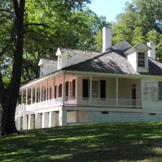
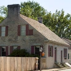
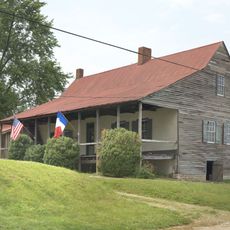
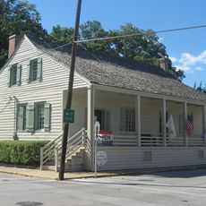
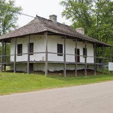
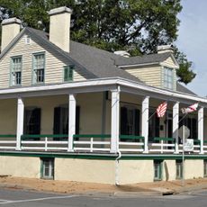
The district preserves French colonial houses in Prairie du Rocher and the Pierre Menard House, showing how settlers built their homes and organized their daily lives. These structures reflect the way families adapted to life in this frontier region.

Practical

Fort Chartres State Park offers guided visits and information centers to help you understand the sites and buildings. Plan to spend several hours exploring the different locations and examining the restored structures throughout the district.

Did you know?

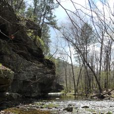
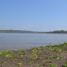
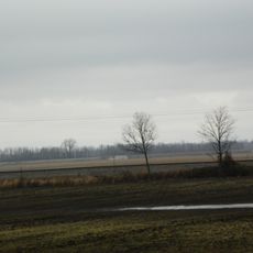
The Modoc Rock Shelter contains evidence of human occupation spanning thousands of years before European settlement arrived in the region. This site reveals how the same location was continuously important to people across vastly different time periods.

Location
Location
GPS coordinates
38.08000,-90.13000
Latest update
December 12, 2025 17:47

AroundUs brings together thousands of curated places, local tips, and hidden gems, enriched daily by 60,000 contributors worldwide. Discover all places nearby (Randolph County).

Around this place
Fort de Chartres
United States of America

Fort de Chartres

2.5 km
Illinois Caverns State Natural Area
United States of America

Illinois Caverns State Natural Area

17.3 km
Hawn State Park
United States of America

Hawn State Park

30.2 km
Fort Kaskaskia State Historic Site
United States of America

Fort Kaskaskia State Historic Site

22.9 km
Chester Bridge
United States of America

Chester Bridge

32.4 km
Louis Bolduc House
United States of America

Louis Bolduc House

13.6 km
Felix Vallé House State Historic Site
United States of America

Felix Vallé House State Historic Site

13.4 km
Modoc Rock Shelter
United States of America

Modoc Rock Shelter

6.1 km
Pierre Menard House
United States of America

Pierre Menard House

23.2 km
Ste. Genevieve Historic District
United States of America

Ste. Genevieve Historic District

13.5 km
Middle Mississippi River National Wildlife Refuge
United States of America

Middle Mississippi River National Wildlife Refuge

26.1 km
United States of America

Kaskaskia Bell State Memorial

25.8 km
Amoureux House
United States of America

Amoureux House

14.2 km
Kolmer Site
United States of America

Kolmer Site

4.6 km
Fults Hill Prairie State Natural Area
United States of America

Fults Hill Prairie State Natural Area

31.1 km
Creole House
United States of America

Creole House

2.9 km
Gov. Daniel Dunklin's Grave State Historic Site
United States of America

Gov. Daniel Dunklin's Grave State Historic Site

31.2 km
Jacques Guibourd Historic House
United States of America

Jacques Guibourd Historic House

13.3 km
Fountain Creek Bridge
United States of America

Fountain Creek Bridge

28 km
Sacred Heart Roman Catholic Church
United States of America

Sacred Heart Roman Catholic Church

25.4 km
Le Grand Champ Bottom
United States of America

Le Grand Champ Bottom

18.8 km
Waterloo Historic District
United States of America

Waterloo Historic District

28.5 km
Red Bud Historic District
United States of America

Red Bud Historic District

18.7 km
Bequette-Ribault House
United States of America

Bequette-Ribault House

14.3 km
Ste. Geneviève National Historical Park
United States of America

Ste. Geneviève National Historical Park

13.6 km
Jean-Baptiste Vallé House
United States of America

Jean-Baptiste Vallé House

13.6 km
Lasource-Durand House
United States of America

Lasource-Durand House

14.2 km
Kidd Lake State Natural Area
United States of America

Kidd Lake State Natural Area

10 km
Show the full map
« French Colonial Historic District - Historic district in Prairie du Rocher, United States » is provided by Around Us (aroundus.com). Images and texts are derived from Wikimedia project under a Creative Commons license. You are allowed to copy, distribute, and modify copies of this page, under the conditions set by the license, as long as this note is clearly visible.

Discover hidden gems everywhere you go!

From secret cafés to breathtaking viewpoints, skip the crowded tourist spots and find places that match your style. Our app makes it easy with voice search, smart filtering, route optimization, and insider tips from travelers worldwide. Download now for the complete mobile experience.

Around Us App Screenshot

A unique approach to discovering new places

Le Figaro

All the places worth exploring

France Info

A tailor-made excursion in just a few clicks

20 Minutes

Around Us
Travel Guide & Maps
Download

Send to your phone

QR Code
1

Open the camera app on your mobile.

2

Point at the QR code with your camera. A notification will appear.

3

Tap the notification to open the link.