Le Grand Champ Bottom

Log in to your account

AroundUs is a community-driven map of interesting places, built by curious explorers like you. It grows with every review, story, and photo you share.
Connect to save your favorite spots, contribute locations, and create personalized routes.
By continuing, you accept our Terms and Conditions and our Privacy Policy

Le Grand Champ Bottom

Add to collection
Map
Suggest a change
Share

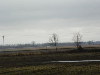
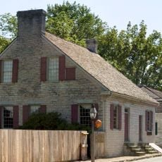
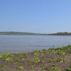
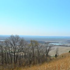
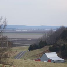
Le Grand Champ Bottom, Floodplain in Missouri, United States.

Le Grand Champ Bottom is a floodplain in Missouri that stretches across low-lying terrain shaped by seasonal water patterns and regional rainfall. The landscape shows natural drainage systems and vegetation adapted to periodic moisture changes.

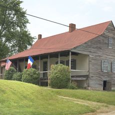
The area has been used for farming since early settlement times, with the nutrient-rich soil maintained by natural flooding cycles. These water patterns have shaped how communities developed their agricultural practices in the region.

Farming communities here have adapted their practices to work with the natural flooding, using the seasonal water cycles as part of their traditional approach to the land.

Check weather forecasts and water levels before visiting, especially during wetter months when conditions change frequently. Access can be difficult depending on the season, so plan ahead and wear appropriate footwear for muddy terrain.

The area functions as a natural water storage system that supports plant species specially adapted to periodic flooding. These water-loving plants are rarely found in drier regions and make this place ecologically important.

GPS coordinates: 37.94800,-89.99700

Latest update: December 14, 2025 18:11

Photos
Around this place
Fort de Chartres
United States of America

Fort de Chartres

20.7 km
Hawn State Park
United States of America

Hawn State Park

25.2 km
Fort Kaskaskia State Historic Site
United States of America

Fort Kaskaskia State Historic Site

7.9 km
Chester Bridge
United States of America

Chester Bridge

15 km
Louis Bolduc House
United States of America

Louis Bolduc House

5.3 km
Felix Vallé House State Historic Site
United States of America

Felix Vallé House State Historic Site

5.5 km
Modoc Rock Shelter
United States of America

Modoc Rock Shelter

14.1 km
Pierre Menard House
United States of America

Pierre Menard House

7.9 km
Ste. Genevieve Historic District
United States of America

Ste. Genevieve Historic District

5.4 km
Middle Mississippi River National Wildlife Refuge
United States of America

Middle Mississippi River National Wildlife Refuge

7.9 km
French Colonial Historic District
United States of America

French Colonial Historic District

18.8 km
Kaskaskia Bell State Memorial
United States of America

Kaskaskia Bell State Memorial

7.8 km
Amoureux House
United States of America

Amoureux House

4.8 km
Kolmer Site
United States of America

Kolmer Site

22.7 km
Fults Hill Prairie State Natural Area
United States of America

Fults Hill Prairie State Natural Area

17.5 km
Creole House
United States of America

Creole House

17.7 km
Bois Brule Bottom
United States of America

Bois Brule Bottom

21.8 km
Jacques Guibourd Historic House
United States of America

Jacques Guibourd Historic House

5.7 km
Sacred Heart Roman Catholic Church
United States of America

Sacred Heart Roman Catholic Church

9.9 km
Mary's River Covered Bridge
United States of America

Mary's River Covered Bridge

20.3 km
St. John the Evangelist Roman Catholic Church
United States of America

St. John the Evangelist Roman Catholic Church

16.3 km
Randolph County Courthouse
United States of America

Randolph County Courthouse

15.6 km
Frederick Weistar House
United States of America

Frederick Weistar House

15.5 km
Christian F. Weinrich House
United States of America

Christian F. Weinrich House

15.9 km
Bequette-Ribault House
United States of America

Bequette-Ribault House

4.7 km
Ste. Geneviève National Historical Park
United States of America

Ste. Geneviève National Historical Park

5.3 km
Jean-Baptiste Vallé House
United States of America

Jean-Baptiste Vallé House

5.3 km
Lasource-Durand House
United States of America

Lasource-Durand House

4.8 km
Show the full map
Reviews

Visited this place? Tap the stars to rate it and share your experience / photos with the community! Try now! You can cancel it anytime.

« Le Grand Champ Bottom - Floodplain in Missouri, United States » is provided by Around Us (aroundus.com). Images and texts are derived from Wikimedia project under a Creative Commons license. You are allowed to copy, distribute, and modify copies of this page, under the conditions set by the license, as long as this note is clearly visible.

Discover hidden gems everywhere you go!

From secret cafés to breathtaking viewpoints, skip the crowded tourist spots and find places that match your style. Our app makes it easy with voice search, smart filtering, route optimization, and insider tips from travelers worldwide. Download now for the complete mobile experience.

Around Us App Screenshot

A unique approach to discovering new places

Le Figaro

All the places worth exploring

France Info

A tailor-made excursion in just a few clicks

20 Minutes