Enable Location

We need your location to show you interesting places around you

Discover nearby places

Find interesting locations and hidden gems around you

Precise directions

Get accurate directions and distances to places

Your location is never shared with other users. It's only used when you tap the location button.

Middle Mississippi River National Wildlife Refuge

Log in to your account

Start exploring — it's free

Trusted by 61,985 travelers worldwide

Continue with Google
Continue with Apple
or

We will send you a code to connect

By continuing, you accept our Terms and Conditions and our Privacy Policy

Check your inbox

We've sent a pincode in your inbox. Please enter the code below.

Middle Mississippi River National Wildlife Refuge

Middle Mississippi River National Wildlife Refuge, National Wildlife Refuge along Mississippi River in Missouri and Illinois.

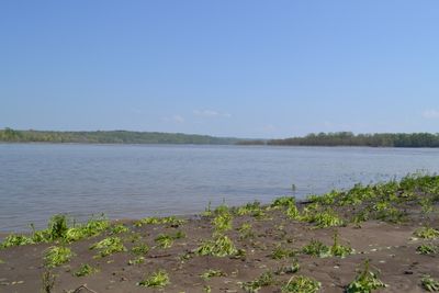
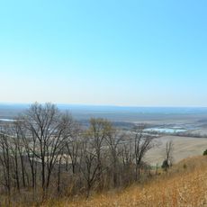
The Middle Mississippi River National Wildlife Refuge is a protected area with wetlands, forests, and river habitats stretching across Missouri and Illinois. It supports numerous migratory birds and aquatic animals that depend on these varied environments.

The refuge was established in 2000 to protect natural ecosystems along the Mississippi. This action reflects long-standing efforts to safeguard wildlife populations in this important migration corridor.

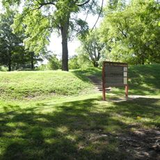
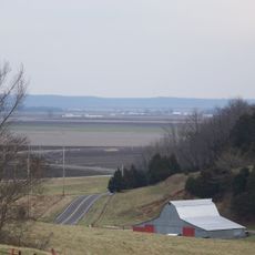
The refuge connects local communities through educational programs and seasonal outdoor activities that show how people relate to river landscapes. Visitors see directly how the valley has been shaped by work, river navigation, and traditional ways of life along the Mississippi.

Access to the refuge is available from several towns including Valmeyer, Festus, Chester, and St. Mary, each offering different viewing areas and trails. The land can be explored on foot, by bicycle, or by car depending on the type of paths available.

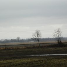
The refuge experiences regular flooding cycles from the river that constantly reshape its landscape. These flood events create dynamic habitats that shift with water levels throughout the year.

The community of curious travelers

AroundUs brings together thousands of curated places, local tips, and hidden gems, enriched daily by 60,000 contributors worldwide.

Start exploring
Location
Location
Inception
2000
GPS coordinates
37.91670,-89.91670
Latest update
December 12, 2025 17:48
Around this place
Fort Kaskaskia State Historic Site
United States of America

Fort Kaskaskia State Historic Site

5.8 km
Chester Bridge
United States of America

Chester Bridge

7.2 km
St. Mary's of the Barrens Catholic Church
United States of America

St. Mary's of the Barrens Catholic Church

21.3 km
Louis Bolduc House
United States of America

Louis Bolduc House

13.1 km
Felix Vallé House State Historic Site
United States of America

Felix Vallé House State Historic Site

13.3 km
Modoc Rock Shelter
United States of America

Modoc Rock Shelter

20.8 km
Pierre Menard House
United States of America

Pierre Menard House

5.4 km
Ste. Genevieve Historic District
United States of America

Ste. Genevieve Historic District

13.2 km
United States of America

Kaskaskia Bell State Memorial

691 m
St. Vincent de Paul Catholic Church
United States of America

St. Vincent de Paul Catholic Church

21.7 km
Amoureux House
United States of America

Amoureux House

12.6 km
Fults Hill Prairie State Natural Area
United States of America

Fults Hill Prairie State Natural Area

12.2 km
St. Boniface Roman Catholic Church
United States of America

St. Boniface Roman Catholic Church

21.6 km
Bois Brule Bottom
United States of America

Bois Brule Bottom

14 km
Jacques Guibourd Historic House
United States of America

Jacques Guibourd Historic House

13.5 km
Sacred Heart Roman Catholic Church
United States of America

Sacred Heart Roman Catholic Church

11.9 km
Mary's River Covered Bridge
United States of America

Mary's River Covered Bridge

13.7 km
Le Grand Champ Bottom
United States of America

Le Grand Champ Bottom

7.9 km
St. John the Evangelist Roman Catholic Church
United States of America

St. John the Evangelist Roman Catholic Church

9.8 km
Perry County Courthouse
United States of America

Perry County Courthouse

21.4 km
Randolph County Courthouse
United States of America

Randolph County Courthouse

7.9 km
Frederick Weistar House
United States of America

Frederick Weistar House

7.8 km
Christian F. Weinrich House
United States of America

Christian F. Weinrich House

8.4 km
Bequette-Ribault House
United States of America

Bequette-Ribault House

12.5 km
Ste. Geneviève National Historical Park
United States of America

Ste. Geneviève National Historical Park

13.1 km
Jean-Baptiste Vallé House
United States of America

Jean-Baptiste Vallé House

13.1 km
Lasource-Durand House
United States of America

Lasource-Durand House

12.6 km
St. Mary's of the Barrens Historic District
United States of America

St. Mary's of the Barrens Historic District

21.4 km
Show the full map
« Middle Mississippi River National Wildlife Refuge - National Wildlife Refuge along Mississippi River in Missouri and Illinois » is provided by Around Us (aroundus.com). Images and texts are derived from Wikimedia project under a Creative Commons license. You are allowed to copy, distribute, and modify copies of this page, under the conditions set by the license, as long as this note is clearly visible.

Discover hidden gems everywhere you go!

From secret cafés to breathtaking viewpoints, skip the crowded tourist spots and find places that match your style. Our app makes it easy with voice search, smart filtering, route optimization, and insider tips from travelers worldwide. Download now for the complete mobile experience.

Around Us App Screenshot

A unique approach to discovering new places

Le Figaro

All the places worth exploring

France Info

A tailor-made excursion in just a few clicks

20 Minutes

Around Us
Travel Guide & Maps
Download

Send to your phone

QR Code
1

Open the camera app on your mobile.

2

Point at the QR code with your camera. A notification will appear.

3

Tap the notification to open the link.